The National Geologic Map Database is migrating to a new infrastructure. We apologize for any service disruptions during this process.
|
|---|


- Usage in publication:
-
- Penn Yan tongue
- Modifications:
-
- Named
- Dominant lithology:
-
- Shale
- AAPG geologic province:
-
- Appalachian basin
Summary:
Proposed the name Penn Yan tongue for lower shales of West River shale. Lower part consists of interbedded black and blue-black shales, blue-gray shales and thin limy argillaceous beds; unfossiliferous flags interbedded in dark shales. In upper part, shales are generally lighter colored and more fossiliferous. Concretions are plentiful; marcasite nodules present. Unit is about 140 ft thick in type area but thins eastward. Contact with underlying Geneseo shale is difficult to place but is placed at base of sequence of dark limy shales and interbedded shaly limestone layers. Top of formation is placed arbitrarily at base of Crosby lentil of Starkey tongue, although Starkey-type flags begin lower.
Source: GNU records (USGS DDS-6; Reston GNULEX).

- Usage in publication:
-
- Penn Yan Shale Member*
- Modifications:
-
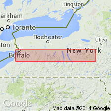
- Areal extent
- Age modified
- AAPG geologic province:
-
- Appalachian basin
Summary:
Penn Yan Shale Member of Genesee Formation extended from southwestern NY into western PA. West of Canandaigua Lake in western NY, the boundary between the Middle and the Upper Devonian lies within the lower part of the Penn Yan. Unit consists mainly of dark- to medium-gray shale or mudrock and some beds of black shale, abundant limestone nodules, and a few thin beds of dark-gray siltstone. The Penn Yan is overstepped to the southwest along the Middle Devonian unconformity by the West River Shale Member. To the east of Canandaigua Lake, the Penn Yan and the West River grad laterally into the Sherburne Flagstone and Ithaca Members.
Source: GNU records (USGS DDS-6; Reston GNULEX).
For more information, please contact Nancy Stamm, Geologic Names Committee Secretary.
Asterisk (*) indicates published by U.S. Geological Survey authors.
"No current usage" (†) implies that a name has been abandoned or has fallen into disuse. Former usage and, if known, replacement name given in parentheses ( ).
Slash (/) indicates name conflicts with nomenclatural guidelines (CSN, 1933; ACSN, 1961, 1970; NACSN, 1983, 2005, 2021). May be explained within brackets ([ ]).