- Usage in publication:
-
- Peedee [Pedee] group
- Modifications:
-
- Original reference
- AAPG geologic province:
-
- Forest City basin
Summary:
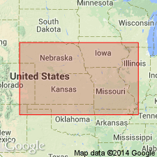
Pg. 93, 97. Peedee [Pedee] group. Shale and thin limestone up to 100 feet or more thick locally, that overlie Stanton limestone, and Weston shale. The Weston and Iatan are defined as previously. The shale overlying the Iatan and occurring beneath the unconformity is designated Hardesty shale, from a locality in Smithville quadrangle, Missouri. In some places, as along Kansas River, no representative of Peedee group remains, and basal sandstone and conglomerate of Virgil series rests directly on Stanton limestone.
Source: US geologic names lexicon (USGS Bull. 896, p. 1624); GNC KS-NE Pennsylvanian Corr. Chart, sheet 2, Oct. 1936.
- Usage in publication:
-
- Pedee group
- Modifications:
-
- Overview
- AAPG geologic province:
-
- Forest City basin
Summary:
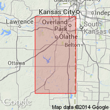
Pg. 79. Pedee group. For the dominantly shaly strata between Stanton limestone and base of overlying Virgil series Moore is introducing Pedee, from stream near Weston, opposite Leavenworth, on Missouri River. Age is Late Pennsylvanian (Missouri age). [In letter dated Sept. 3, 1935, Newell stated this creek is spelled Pedee (not Peedee).]
Source: US geologic names lexicon (USGS Bull. 896, p. 1624); GNC KS-NE Pennsylvanian Corr. Chart, sheet 2, Oct. 1936.

- Usage in publication:
-
- Pedee group
- Modifications:
-
- Revised
- AAPG geologic province:
-
- Forest City basin
Summary:
Pg. 137-138. Pedee group. The strata between top of Stanton limestone and disconformity that defines top of Missouri series are included in Pedee group. These beds were formerly included in Douglas group, but it is clear they should be separated from the rocks that disconformably overlie them. The Pedee beds are designated a separate group, rather than an addition to Lansing group, because latter beds are a well-characterized compact stratigraphic unit consisting mainly of limestone, and because the conformable upper boundary of Lansing group, as previously drawn and here accepted, is a more usable stratigraphic datum in mapping and in subsurface studies than the uneven surface of the post-Missouri disconformity. The Pedee group contains 2 formations, Weston shale below and Iatan limestone above. It is probable that in some places where Iatan limestone is present there is a certain thickness of shale above the Iatan that belongs below the post-Missouri disconformity and therefore should be included in Pedee group. Such conditions may exist along Missouri River in vicinity of Iatan and Weston, where part of the poorly bedded sandy and clayey beds between top of Iatan limestone and base of Sibley coal possibly belong to Missouri series. Evidence of exact position of boundary between Missouri and Virgil deposits is lacking here, but inasmuch as thickness of zone in which boundary belongs is only 5 to 20 feet, this uncertainty is not of great importance. In any case the boundary at top of Iatan limestone is practically the most useful, and accordingly Pedee group is regarded as including no beds above Iatan limestone. The term Hardesty shale is therefore abandoned. It was not properly defined. Thickness of Pedee group 100+/- feet southeast of St. Joseph, Missouri; it has been removed by erosion throughout much of Platte County, Missouri, and in Kansas River Valley; in southern Kansas it is 200 feet thick in places; is well represented in east-central and southeastern Kansas.
Source: US geologic names lexicon (USGS Bull. 896, p. 1624); GNC KS-NE Pennsylvanian Corr. Chart, sheet 2, Oct. 1936.
- Usage in publication:
-
- Pedee group
- Modifications:
-
- Areal extent
Summary:
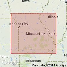
Pg. 28. Pedee group. Recognized in northwestern Missouri where it includes Weston shale and Iatan limestone members. Age is Late Pennsylvanian (Missouri age).
Source: US geologic names lexicon (USGS Bull. 1200, p. 2963-2964).
- Usage in publication:
-
- Pedee group
- Modifications:
-
- Not used
Summary:
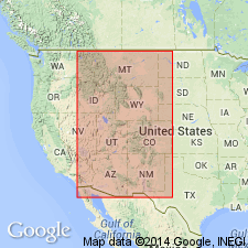
Pedee group. Dropped from Iowa nomenclature. Weston shale and Iatan limestone included in Lansing group. Later work may warrant reestablishment of Pedee as independent group.
Source: US geologic names lexicon (USGS Bull. 1200, p. 2963-2964).
- Usage in publication:
-
- Pedee group*
- Modifications:
-
- Areal extent
- AAPG geologic province:
-
- Anadarko basin
Summary:
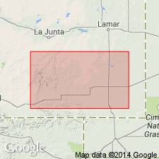
Extended as an undivided unit into the subsurface of Baca County, Colorado, in the Anadarko basin. Overlies Lansing group (undivided) and underlies Douglas group (undivided). Age is Late Pennsylvanian (Virgilian). Report includes correlation chart.
Source: Modified from GNU records (USGS DDS-6; Denver GNULEX).
- Usage in publication:
-
- Pedee group
- Modifications:
-
- Overview
Summary:
Pg. 78. Pedee group. Topmost division of Missourian rocks; includes Weston shale below and Iatan limestone above and possibly a few feet of sandy and clayey shale above the Iatan. Occurs between Stanton limestone of Lansing group and disconformity that defines top of Missourian series. Average thickness 90 feet.
Source: US geologic names lexicon (USGS Bull. 1200, p. 2963-2964).
For more information, please contact Nancy Stamm, Geologic Names Committee Secretary.
Asterisk (*) indicates published by U.S. Geological Survey authors.
"No current usage" (†) implies that a name has been abandoned or has fallen into disuse. Former usage and, if known, replacement name given in parentheses ( ).
Slash (/) indicates name conflicts with nomenclatural guidelines (CSN, 1933; ACSN, 1961, 1970; NACSN, 1983, 2005, 2021). May be explained within brackets ([ ]).

