- Usage in publication:
-
- "Pecatonica Formation"
- Modifications:
-
- Revised
- Overview
- AAPG geologic province:
-
- Illinois basin
Summary:
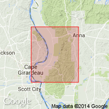
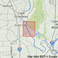
Ordovician (Mohawkian) Pecatonica Formation was not consistently mapped in southeaster MO. For this reason, used in quotes as "Pecatonica Formation" as was done by Thompson (1991) who stated that the "Pecatonica" is nearly identical in lithology to the Plattin Formation. Tentatively identified in Humble No. 1 Pickel well, Mill Creek 7.5-min quad, IL, as a 93-ft interval of dark-colored micritic limestone; overlies sandy dolomite of Joachim and underlies thin oolitic limestone thought to be Brickeys Member of Plattin Limestone (M.L. Sargent, written commun., 1992). Other wells in and close to study area lack logs sufficiently detailed to differentiate "Pecatonica" from Plattin.
Source: GNU records (USGS DDS-6; Reston GNULEX).

- Usage in publication:
-
- Pecatonica Formation
- Modifications:
-
- Revised
- Overview
- AAPG geologic province:
-
- Ozark uplift
- Illinois basin
Summary:
In southeastern MO, Ordovician (Champlainian) Pecatonica Formation is nearly identical to Plattin Formation and probably was not mapped consistently from one 7.5-min quad to another. Thompson (1991) states that Pecatonica can be identified with certainty only at a few sites in MO and regards use of the name tentative and questionable. Accordingly, Pecatonica is combined with Plattin Formation, along with the thin Decorah Formation, on map accompanying report. Pecatonica consists of intercalated dolomite and limestone and thin shale interbeds. Carbonate rocks are light to medium brownish gray and micritic to finely granular or crystalline. Fossils include brachiopods, ostracods, and algae. Portions are burrowed ("fucoidal") and, in lower part, beds of brown laminated dolomite and dark gray laminated limestone alternate. Upper part contains chert. Medium gray shale occurs as thin partings and thin interbeds throughout formation. Reported to be 80 to 150 ft thick in most of study area. Amos (1985) indicated a maximum thickness of 290 ft in Altenburg quad, southeastern Perry Co., MO. Thompson (1991) states that Pecatonica is absent north of Perry Co. and reaches a maximum of 140 ft in Cape Girardeau and Scott Cos., southeastern MO. Amos and Thompson evidently have different perceptions about Pecatonica; further study is needed.
Source: GNU records (USGS DDS-6; Reston GNULEX).

- Usage in publication:
-
- Pecatonica(?) Formation*
- Modifications:
-
- Revised
- AAPG geologic province:
-
- Ozark uplift
- Illinois basin
Summary:
Ordovician (Mohawkian) Pecatonica and Plattin Formations are lithologically similar units separable only in optimal exposures, such as roadcuts or quarry walls. Thompson (1991) stated that, for this reason, use of the name Pecatonica in Missouri had a "tentative and questionable future." Kolata and Noger (1991) reported Pecatonica and Plattin can be differentiated in subsurface by use of electric and gamma-ray logs. Some geologists who mapped 7.5-minute quadrangles in Missouri distinguished Pecatonica, but not consistently. For these reasons, used as Pecatonica(?) Formation and mapped undivided with Plattin Formation and Decorah Formation; Pecatonica(?) and Plattin are assigned to Platteville Group.
Source: GNU records (USGS DDS-6; Reston GNULEX).

- Usage in publication:
-
- Pecatonica Formation*
- Modifications:
-
- Overview
- AAPG geologic province:
-
- Illinois basin
- Upper Mississippi embayment
Summary:
Middle Ordovician (Mohawkian) Pecatonica Formation mapped undivided with Plattin and Decorah Groups in subsurface of IL and MO.
Source: GNU records (USGS DDS-6; Reston GNULEX).
For more information, please contact Nancy Stamm, Geologic Names Committee Secretary.
Asterisk (*) indicates published by U.S. Geological Survey authors.
"No current usage" (†) implies that a name has been abandoned or has fallen into disuse. Former usage and, if known, replacement name given in parentheses ( ).
Slash (/) indicates name conflicts with nomenclatural guidelines (CSN, 1933; ACSN, 1961, 1970; NACSN, 1983, 2005, 2021). May be explained within brackets ([ ]).

