

- Usage in publication:
-
- Pease River
- Modifications:
-
- Original reference
- AAPG geologic province:
-
- Palo Duro basin
- Permian basin
Summary:
[Title unknown, IN] AAPG Bull., v. 23, no. 5, p. 764, 1939. Pease River group. Name applied to the series of stratigraphic units from base of San Angelo up to base of Custer group. In tracing group northward to Mangum, Oklahoma, it was demonstrated that it contained a part if not all of the Duncan sandstone, all of the Flowerpot [Flower-pot] shale, Blaine, and Dog Creek shale up to base of Marlow or Custer group in Oklahoma and Kansas. Type exposure given. [Age is Permian (Leonard).]
Type exposure: along Pease River in Hardeman and Cottle Cos., western TX.
Source: US geologic names lexicon (USGS Bull. 1200, p. 2959).
- Usage in publication:
-
- Pease River group
- Modifications:
-
- First used
- Dominant lithology:
-
- Shale
- Sandstone
- Dolomite
- Anhydrite
- AAPG geologic province:
-
- Permian basin
Summary:
[First proposed in "At Home and Abroad" section of AAPG Bulletin, v. 23, no. 5, p. 764--several geologists, lead by H. C. Fountain, proposed name "Pease River group", described "type exposures" (along Pease River, Hardeman and Cottle Cos, TX, Permian basin), and stated that unit contained part or all of Duncan sandstone, all of Flowerpot [Flower-pot] shale, Blaine, and Dog Creek shales up to base of Marlow or Custer group in OK and KS [not on computer]. In present report, no type locality designated. Rocks of Leonard age that overlie Clear Fork group have been designated as San Andres, El Reno, and Pease River groups, and the "Blaine of Texas." Pease River is adopted here because its upper and lower limits are easily recognized over much of east side of Permian basin. Group includes beds from base of San Angelo sandstone up to base of Custer group (of Guadalupe age) which is 10-30 feet below base of Childress limestone. Disconformable at base and a regional unconformity occurs at top. Average thickness 870 ft. Surface exposures show many cycles of evaporites, now greatly condensed by solution. Except for area in Nolan Co, where redbed clastics are prominent, group is remarkably uniform in outcrop expression. Topography is rough with stair-like escarpments, and vegetation is different from over- and underlying beds. Section measured in Dickens Co, TX includes (ascending) San Angelo, Flower-pot, Blaine, and Dog Creek formations. Of Permian (Leonard) age.
Source: GNU records (USGS DDS-6; Denver GNULEX).
- Usage in publication:
-
- Pease River Group
- Modifications:
-
- Revised
- Overview
- Areal extent
- AAPG geologic province:
-
- Bend arch
Summary:
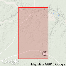
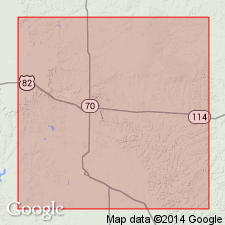
The Upper Permian Pease River Group, including San Angelo Formation (at base) and Blaine Formation (undivided, at top) is present in Jones Co, TX on Bend arch, where it is about 165 ft thick. Group overlies Permian Choza Formation of Clear Fork Group with a marked erosional unconformity; unconformably underlies the Pleistocene Seymour Formation (this is a revision of the upper contact). Because Flowerpot [Flower-pot] shale and Blaine Formation of northern TX and western OK cannot be easily separated in report area, "Blaine" for purposes of this report includes all Permian sediments above San Angelo Formation. The geologic record between the Permian System and the Quaternary System is not recorded in the rock sequence in this area. Prior to Pleistocene time, the Jones Co and surrounding area was eroded to a nearly flat plain which had a gentle slope to the east. During this time, all sediments younger than Permian age were removed. Following this and during Pleistocene time, streams were depositing sediments [Seymour Formation] over a large area of north-central TX; sediments were believed to have been derived and transported from the west. Deposition thought to have been controlled by repeated cycles of terrestrial alluviation and erosion caused principally by climatic changes associated with advance and retreat of glacial ice sheets located in the northern U.S. and farther north (Van Siclen, 1957). Geologic map. Chart of geologic units.
Source: GNU records (USGS DDS-6; Denver GNULEX).

- Usage in publication:
-
- Pease River Group
- Modifications:
-
- Age modified
- Overview
- AAPG geologic province:
-
- Permian basin
- Palo Duro basin
Summary:
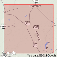
Area of report is north-central TX; in this area the Pease River Group of Guadalupe Series is present in Stonewall, King, and Knox Cos in Permian basin, and Foard and Hardeman Cos in Palo Duro basin. Pease River overlies Clear Fork Group (undivided) of Leonard Series; older than Trinity Group of Early Cretaceous age. Includes (ascending): San Angelo Formation, including its lower, Duncan Member (unmapped) and upper, Flowerpot [Flower-pot] Member (unmapped); and Blaine Formation, including its lower, unnamed dolomite beds, and Guthrie, Acme, and Mangum Dolomite [Members]. Thickness of San Angelo is 90-120 ft; thickness of Blaine is 250-400 ft. Pease River assigned to the Guadalupe Series [this is an age modification--previous reports assigned Pease River to the Leonard Series]. Geologic map.
Source: GNU records (USGS DDS-6; Denver GNULEX).
For more information, please contact Nancy Stamm, Geologic Names Committee Secretary.
Asterisk (*) indicates published by U.S. Geological Survey authors.
"No current usage" (†) implies that a name has been abandoned or has fallen into disuse. Former usage and, if known, replacement name given in parentheses ( ).
Slash (/) indicates name conflicts with nomenclatural guidelines (CSN, 1933; ACSN, 1961, 1970; NACSN, 1983, 2005, 2021). May be explained within brackets ([ ]).