The National Geologic Map Database is migrating to a new infrastructure. We apologize for any service disruptions during this process.
|
|---|


- Usage in publication:
-
- Peale formation*
- Modifications:
-
- Named
- Dominant lithology:
-
- Tuff
- Shale
- Sandstone
- Chert
- Conglomerate
- AAPG geologic province:
-
- Sierra Nevada province
Summary:
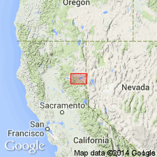
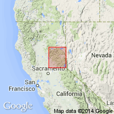
Named as youngest unit (of 3) in Calaveras Group. Name given to tuffaceous beds, well exposed and fossiliferous, on horse trail from Wards Creek to Peale diggings, also beyond Hosselkus and within about a mi of Lucky S road in Taylorsville region of northeastern CA. Consists of reddish to brown slaty shale, sometimes gray or greenish, passing into tuffaceous sandstone and fine conglomerate (which contains much volcanic material with occasional red lapilli and small lenses of calcareous matter). Thin beds of gray quartzite also occur and masses of black, gray or red chert form prominent ledges. Thickness is 1400 ft. Unconformably overlapped by Foreman formation. Overlain by Reeve meta-andesite. Overlies meta-andesite which separates it from Robinson formation on northeast, where rocks have been overturned. Contains fossils identified by Charles Schuchert and G.H. Girty [lists included]. Age is given as Carboniferous based on fossils and stratigraphic relations. Is older than Robinson formation and younger than Shoofly formation. [Note: "Calaverous Group" no longer used --see Ferguson and Gannet, 1932, USGS Professional Paper 172]
Source: GNU records (USGS DDS-6; Menlo GNULEX).
- Usage in publication:
-
- Peale Formation*
- Modifications:
-
- Areal extent
- Age modified
- AAPG geologic province:
-
- Sierra Nevada province
Summary:
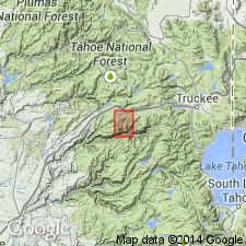
Geologic sketch map of Big Valley area (Cisco Grove and Duncan Peak 7.5' quads, CA) shows unit is recognized as far south as North Fork of American River. Chert member in upper part is shown separately in correlation chart. Overlies Taylor Formation; unconformably underlies Reeve Formation. Radiolarians were newly discovered 10 m below top surface of chert member (Holdsworth and Jones, 1980; D.L. Jones and B. Murchey, written commun., 1981). Age is Early Mississippian to Early Pennsylvanian(?) on basis of mega- and microfossils.
Source: GNU records (USGS DDS-6; Menlo GNULEX).
- Usage in publication:
-
- Peale Formation*
- Modifications:
-
- Age modified
- Biostratigraphic dating
- Reference
- Revised
- AAPG geologic province:
-
- Sierra Nevada province
Summary:
Principal reference locality designated as exposures on northeast-trending spur ridge and those in bed of an ephemeral creek just southeast of spur ridge on northeast slope of Peel Ridge (SW/4 sec.15 T25N R11E, Genessee Valley 7.5' quad, Plumas Co, CA). Volcaniclastic sandstone, conglomerate, chert breccia, and slate, included within Peale Formation by Diller (1908) are here stratigraphically restricted from chert member because they contain late Early Permian fossils and are reassigned to lower part of overlying Arlington Formation. Geographically restricted from area south of HWY 80 (see Harwood, 1983) where its strata are reassigned to overlying Reeve Formation. Age of lower part is Kinderhookian based on conodonts (A. Harris, 1984, written commun.; K. Denkler, 1985, written commun.). Age of upper chert member is Osagean to Desmoinesian based on radiolarian assemblages. Age of unit is Early Mississippian to Middle Pennsylvanian based on fossils.
Source: GNU records (USGS DDS-6; Menlo GNULEX).
For more information, please contact Nancy Stamm, Geologic Names Committee Secretary.
Asterisk (*) indicates published by U.S. Geological Survey authors.
"No current usage" (†) implies that a name has been abandoned or has fallen into disuse. Former usage and, if known, replacement name given in parentheses ( ).
Slash (/) indicates name conflicts with nomenclatural guidelines (CSN, 1933; ACSN, 1961, 1970; NACSN, 1983, 2005, 2021). May be explained within brackets ([ ]).