- Usage in publication:
-
- Pawpaw Formation
- Modifications:
-
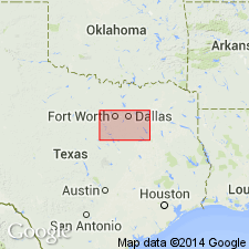
- Areal extent
- AAPG geologic province:
-
- Fort Worth syncline
- Ouachita folded belt
- Strawn basin
Summary:
Pawpaw Formation. Claystone, mudstone, and sandstone. Claystone and mudstone, massive, slightly selenitic. Sandstone, fine- to very fine-grained, platy, ripple cross-laminations, light olive gray to medium gray. Forms grass-covered slopes. Thickness 10 to 25 feet, thins southward. Lies above Weno Limestone and below Main Street Limestone. Marine megafossils. Age is Early Cretaceous.
Not separately mapped. [Pawpaw and upper limestone unit of Weno, undifferentiated, mapped south of Fort Worth area, in Hill, Johnson, and Tarrant Cos., northeastern TX; Pawpaw, Weno, and Denton Clay, undifferentiated, mapped in Fort Worth area and northward, in Denton and Tarrant Cos., northeastern TX.]
Source: Publication.

- Usage in publication:
-
- Pawpaw Formation
- Pawpaw Sandstone Member
- Modifications:
-
- Mapped 1:250k
- Dominant lithology:
-
- Sandstone
- Clay
- Limestone
- AAPG geologic province:
-
- Fort Worth syncline
- Ouachita folded belt
- South Oklahoma folded belt
Summary:
Pamphlet [p. 5]. Pawpaw Formation (Texas); Pawpaw Sandstone Member of Bokchito Formation (Oklahoma).
In Texas, sandstone, some sandy clay, ferruginous, ironstone concretions, loosely cemented, crossbedded; in Cooke and northern Denton Counties, alternates with red clay beds; at base 1- to 4-feet-thick "Quarry" limestone (=McNutt Limestone Member, unmapped, in Oklahoma), sandy, well-indurated, weathers to sandy ferruginous soil with abundant iron oxide concretions and rubble; thickness 25 to 60 feet, thins southward. Lies above Weno Limestone and below Main Street Limestone (not separately mapped). Age is Early Cretaceous.
In Oklahoma, sandstone, yellow to brownish-red, ferruginous, interbedded with gray to brown sandy clay; [thickness not stated]. Lies above Weno Clay Member of Bokchito Formation and below Bennington Limestone. Age is Early Cretaceous.
[Mapped in mostly continuous belts on both sides of Red River and southward to Lake Ray Roberts (btw. Sanger and Pilot Point); in Cooke, Denton, and Grayson Cos., northeastern TX, and Bryan, Love, and Marshall Cos., southeastern OK; northern and central part of map sheet. Pawpaw, Weno, and Denton mapped undifferentiated from Lake Ray Roberts area to southern edge of map sheet.]
Source: Publication.
For more information, please contact Nancy Stamm, Geologic Names Committee Secretary.
Asterisk (*) indicates published by U.S. Geological Survey authors.
"No current usage" (†) implies that a name has been abandoned or has fallen into disuse. Former usage and, if known, replacement name given in parentheses ( ).
Slash (/) indicates name conflicts with nomenclatural guidelines (CSN, 1933; ACSN, 1961, 1970; NACSN, 1983, 2005, 2021). May be explained within brackets ([ ]).

