- Usage in publication:
-
- Parks formation
- Modifications:
-
- Named
- Dominant lithology:
-
- Limestone
- Sandstone
- AAPG geologic province:
-
- Bend arch
Summary:
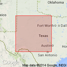
Named as upper of three mappable formations (all new) of the Smithwick group (revised--Smithwick beds are excluded from Morrow and Strawn series and assigned to the intervening newly named Lampasas series; classification of Smithwick as a group of Lampasas series is suggested). The formations are discernable in the subsurface of the Bend flexure area of TX. Named for the town of Parks and the Parks lease in central Stephens Co, TX. Well cuttings from the Anzac Oil Corp. et al, E. S. Graham No. 1, located in the Allen Hines Survey, Abstract 135, Young Co, TX on the Bend arch designated to serve as a type section for the formations of Smithwick group; Parks includes strata from depths of 3,820 to 3,626 ft. Overlies Caddo Poole formation (new) of Smithwick group; unconformably underlies Strawn series (term Strawn group not used). Basal member of Parks "is the productive sandstone known as the McLester 'pay' of south-central Young Co. Productive gray or brownish limestones of the Parks and James pools overlie this sandstone and near the top of the formation occurs the important gray limestone 'pay' of the Breckenridge, Eliasville, Ibex, and Pioneer pools." Eastern margin of the gray limestones follows a southeast course from central Young Co to few mi northwest of Caddo in Stephens Co, where it trends southwestward about 40 mi; south-southeast course here resumed for about 50 mi. Is Pennsylvanian age. Log sections. Stratigraphic chart.
Source: GNU records (USGS DDS-6; Denver GNULEX).
For more information, please contact Nancy Stamm, Geologic Names Committee Secretary.
Asterisk (*) indicates published by U.S. Geological Survey authors.
"No current usage" (†) implies that a name has been abandoned or has fallen into disuse. Former usage and, if known, replacement name given in parentheses ( ).
Slash (/) indicates name conflicts with nomenclatural guidelines (CSN, 1933; ACSN, 1961, 1970; NACSN, 1983, 2005, 2021). May be explained within brackets ([ ]).

