The National Geologic Map Database is migrating to a new infrastructure. We apologize for any service disruptions during this process.
|
|---|


- Usage in publication:
-
- Palomas formation
- Palomas gravel*
- Modifications:
-
- Original reference
- Dominant lithology:
-
- Gravel
- Sand
- AAPG geologic province:
-
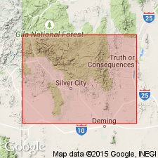
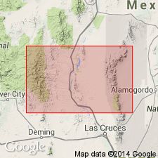
- Orogrande basin
Summary:
(Name credited to C.H. Gordon.) Pg. 91-92; Sci., n.s., v. 25, p. 824-825. Palomas formation. Stratified deposits of gravels and sands, 1,500 to 2,000 feet thick in Sierra and Grant Counties, southwestern New Mexico. In western Sierra County they are cemented into conglomerate comparable to Gila conglomerate of Arizona.
[Palomas gravel adopted by the USGS. Age is Pleistocene. Named from exposures on Palomas River, Sierra Co., southwestern NM.]
Source: US geologic names lexicon (USGS Bull. 896, p. 1593).
- Usage in publication:
-
- Palomas Formation
- Modifications:
-
- Principal reference
- Revised
- Redescribed
- Dominant lithology:
-
- Conglomerate
- Silt
- Sand
- Clay
- AAPG geologic province:
-
- Orogrande basin
Summary:
Name Palomas Gravel changed to Palomas Formation because of its varied lithology and assigned to the Santa Fe Group. A composite type section designated as the sections measured in NE1/4 SW1/4 sec 33, T14S, R4W; NW1/4 NW1/4 sec 30, T14S, R4W; and secs 3 and 4, T14S, R4W, Sierra Co, NM. Name Palomas applied to all "upper Santa Fe Group" deposits in the Palomas, Engle, and San Marcial basins in southern part of the Rio Grande rift between San Marcial and Derry, Sierra Co, NM in the Orogrande basin. Ranges in area from 100 to 131 m thick. Two facies mapped (geologic map)--1) piedmont facies with a proximal subfacies of brown, poorly sorted, lenticular to weakly stratified fanglomerates and fan gravels, distal subfacies of brown sandy silt, conglomerate, clay, and a medial subfacies between the two, and 2) axial-river facies of cross-stratified sandstone, sand, and pebble conglomerate, gravel, and clay lenses. Thickest section at type is brown to gray, poorly to moderately sorted, massive conglomerate of tuff, basalt, rhyolite, andesite clasts up to 40 cm long, brown silt and clay, brown, medium-grained, well-sorted, trough cross-bedded sand. Correlated with Sierra Ladrones Formation to north and Camp Rice Formation to south. Has a range about 5 Ma to 400,000 yrs.
Source: GNU records (USGS DDS-6; Denver GNULEX).
- Usage in publication:
-
- Palomas Formation*
- Modifications:
-
- Age modified
- Redescribed
- Paleomagnetics
- Dominant lithology:
-
- Sandstone
- Mudstone
- AAPG geologic province:
-
- Orogrande basin
Summary:
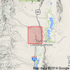
A collection of fossil mammals and four reptiles (turtle, lizard, snake, rabbit, rat, gopher, mastodon, horse, and deer) and a date of 4.05 and 4.20 m.y. from samples from the lower part of the Palomas place the time of the deposition of the lower part during the Nunivak Paleomagnetic Subchron of the Gilbert Chron. The interval sampled was a greenish-gray to moderate-red mudstone lens within a medium- to coarse-grained sandstone of the axial facies of Palomas. Term "Formation" used rather than "Gravel" because gravel is not representative of Palomas at the sampled locality. Sample site is near Truth or Consequences, Sierra Co, NM in the Orogrande basin. Age changed from Pleistocene only to include Pliocene.
Source: GNU records (USGS DDS-6; Denver GNULEX).
- Usage in publication:
-
- Palomas Formation*
- Modifications:
-
- Age modified
- AAPG geologic province:
-
- Orogrande basin
Summary:
Name assigned gray lenticular gravel and sandy gravel that are interbedded with pink, tan, and gray silt, sand, and conglomeratic sand, white sand, and red and green mudstone mapped on both sides of the Mud Springs Mountains, Sierra Co, NM in the Orogrande basin. Thought to correlate with the Pliocene and Pleistocene Sierra Ladrones Formation, upper formation of the Santa Fe Group to north, and with the Pliocene and Pleistocene Camp Rice Formation of the Santa Fe Group to the south. Is not included as part of Santa Fe. Overlies Santa Fe Formation with angular unconformity. Pliocene age assignment of Palomas in this quad determined from 4.05 and 4.20 m.y. age reported earlier by Repenning and May from the lower part of the Palomas Formation, and from 2.1 and 2.2 m.y. age reported from basalt flows on Cuchillo surface, a surface that is well developed on the top of Palomas. A fanglomerate facies separately mapped. Truncates some Miocene? basalt dikes.
Source: GNU records (USGS DDS-6; Denver GNULEX).
For more information, please contact Nancy Stamm, Geologic Names Committee Secretary.
Asterisk (*) indicates published by U.S. Geological Survey authors.
"No current usage" (†) implies that a name has been abandoned or has fallen into disuse. Former usage and, if known, replacement name given in parentheses ( ).
Slash (/) indicates name conflicts with nomenclatural guidelines (CSN, 1933; ACSN, 1961, 1970; NACSN, 1983, 2005, 2021). May be explained within brackets ([ ]).