The National Geologic Map Database is migrating to a new infrastructure. We apologize for any service disruptions during this process.
|
|---|


- Usage in publication:
-
- Paine member
- Modifications:
-
- Revised
- AAPG geologic province:
-
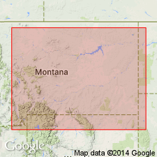
- Central Montana uplift
- Montana folded belt
- Yellowstone province
- Sweetgrass arch
- Williston basin
Summary:
Rank revised to member of Lodgepole limestone. Described in sections in the Little Belt, Big Snowy, and Little Rocky Mountains, MT; at Logan, MT; in the Bridger Range, MT; and at Quadrant Mountain, MT on Sweetgrass arch, Central Montana uplift, Williston basin, Montana folded belt province, and Yellowstone province. Overlain conformably by Woodhurst member; underlain conformably by Three Forks formation. Describes characteristics of insoluble residues. Mississippian in age.
Source: GNU records (USGS DDS-6; Denver GNULEX).
- Usage in publication:
-
- Paine Member*
- Modifications:
-
- Biostratigraphic dating
- Dominant lithology:
-
- Limestone
- Chert
- AAPG geologic province:
-
- Williston basin
- Montana folded belt
- Sweetgrass arch
Summary:
A member of the Lodgepole Limestone. Type section established above the road along the Dry Fork of Belt Creek at the intersection of Currie Coulee, SE1/4, SE1/4 sec 35, T16N, R7E, Cascade Co, MT on the Sweetgrass arch. Consists mostly of fine-grained, silty and argillaceous cherty limestone; bed 6 ft thick of medium-grained crinoidal limestone at base. Thickness 201 ft. Overlain conformably by Woodhurst Member; underlain conformably by Cottonwood Canyon Member. Describes other detailed sections at Logan, SE1/4, SW1/4 sec 25, T2N, R2E, Gallatin Co, MT in the Montana folded belt province, and in Little Chief Canyon, a tributary of Lodgepole Creek, NW1/4 sec 30 and SE1/4 sec 19, T26N, R25E, Blaine Co, MT. IS overlain conformably by Woodhurst Member at these localities; underlain conformably by Cottonwood Canyon Member at Logan, and by Bakken Formation at Little Chief Canyon. Shows stratigraphic positions of fossil collections, and boundaries of faunal zones based on corals, brachiopods, and Foraminifera. Early Mississippian (late Kinderhookian) in age.
Source: GNU records (USGS DDS-6; Denver GNULEX).
- Usage in publication:
-
- Paine Limestone*
- Modifications:
-
- Revised
- AAPG geologic province:
-
- Montana folded belt
Summary:
Raised in stratigraphic rank from Paine Member of Lodgepole Limestone of Madison Group to Paine Limestone and assigned as basal formation to Tendoy Group (new) in the northern Tendoy Mountains, Beaverhead Co, MT in the Montana folded belt province. Overlies Sappington Member of Three Forks Formation; underlies Middle Canyon Formation (extended into MT) of Tendoy. Consists of 228 m of dark-gray, thin-bedded, silty micrite and crinoidal micrite. Has Kinderhookian conodonts at base and Osagean conodonts in the upper 20 m. Assigned to the Early Mississippian. Correlation chart. Composite section. Geologic map.
Source: GNU records (USGS DDS-6; Denver GNULEX).
For more information, please contact Nancy Stamm, Geologic Names Committee Secretary.
Asterisk (*) indicates published by U.S. Geological Survey authors.
"No current usage" (†) implies that a name has been abandoned or has fallen into disuse. Former usage and, if known, replacement name given in parentheses ( ).
Slash (/) indicates name conflicts with nomenclatural guidelines (CSN, 1933; ACSN, 1961, 1970; NACSN, 1983, 2005, 2021). May be explained within brackets ([ ]).