

- Usage in publication:
-
- Paguate Sandstone Tongue*
- Modifications:
-
- Named
- Dominant lithology:
-
- Sandstone
- Siltstone
- AAPG geologic province:
-
- San Juan basin
Summary:
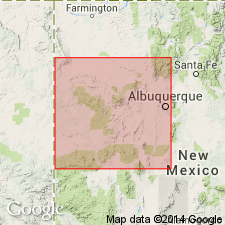
Named as one of four formal named units of Dakota Sandstone for town of Paguate, 7 mi north of Laguna, Valencia Co, NM in San Juan basin. Type section designated at NE1/4 SE1/4 sec 20 and SW1/4 NW1/4 sec 21, T10N, R5W, Laguna quad. Is composed of very fine and fine-grained, gray sandstone, silty in part, interbedded gray to brown siltstone, and minor amount of medium-grained sandstone. Some sandstone beds are limy and weather to dark-brown concretionary masses. Is 61 ft thick at type where it overlies Clay Mesa Shale Tongue of Mancos Shale and underlies Whitewater Arroyo Shale Tongue of Mancos. Recognized from Laguna to La Ventana. Pinches out about 15 mi west-southwest of Laguna. Has a fauna of Lincoln age or of Late Cretaceous age. Is a mix of open-marine shelf and nearshore marine deposits.
Source: GNU records (USGS DDS-6; Denver GNULEX).
- Usage in publication:
-
- Paguate Tongue*
- Modifications:
-
- Biostratigraphic dating
- AAPG geologic province:
-
- San Juan basin
Summary:
Is tongue of Dakota Sandstone. Is assigned a late middle Cenomanian (Late Cretaceous) age based on identification of the ammonite TARRANTOCERAS SELLARDSI in sandy concretions from USGS Mesozoic localities D5372 and D7084 in Sandoval and Valencia Cos, respectively, NM in San Juan basin. Fauna places unit in CUNNINGTONICERAS AMPHIBOLUM AMPHIBOLUM subzone of C. AMPHIBOLUM zone. [Term "sandstone" considered redundant, and dropped from formal name.]
Source: GNU records (USGS DDS-6; Denver GNULEX).
- Usage in publication:
-
- Paguate Tongue*
- Modifications:
-
- Biostratigraphic dating
- Overview
- AAPG geologic province:
-
- San Juan basin
Summary:
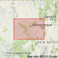
Is member of Dakota Sandstone in the San Juan basin in west-central NM. Overlies lower part of Mancos Shale in Moreno Hill area; overlies Clay Mesa Tongue of Mancos Shale in Laguna area. Underlies Whitewater Arroyo Tongue of Mancos in both aforementioned areas. Molluscan fossils are abundant in the Paguate; 25 bivalve species, 27 gastropod species, and 10 cephalopod species are known from the area. Upper part of unit becomes younger in a northeastern direction. Fauna in Moreno Hill area places unit in the ammonite zone of ACANTHOCERAS AMPHIBOLUM of middle Cenomanian age while fauna in Laguna area reveals both the zone of A. AMPHIBOLUM and the overlying zone of PLESIACANTHOCERAS WYOMINGENSE of later middle Cenomanian age (Late Cretaceous). Figure 2 is stratigraphic nomenclature and correlation chart of middle Cenomanian to lower Coniacian rocks in west-central NM, spanning 20 ammonite zones.
Source: GNU records (USGS DDS-6; Denver GNULEX).
- Usage in publication:
-
- Paguate Tongue*
- Modifications:
-
- Areal extent
- AAPG geologic province:
-
- San Juan basin
Summary:
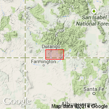
Intertongues with the lower part of the Upper Cretaceous Graneros Member of the Mancos Shale. Mapped as a tongue of Upper Cretaceous Dakota Sandstone in a very limited area on two cross sections in the subsurface at three localities --one in northern San Juan Co, NM, one in southern La Plata Co, CO, and one in southeastern Archuletta Co, CO in the San Juan basin. Of Late Cretaceous age.
Source: GNU records (USGS DDS-6; Denver GNULEX).
For more information, please contact Nancy Stamm, Geologic Names Committee Secretary.
Asterisk (*) indicates published by U.S. Geological Survey authors.
"No current usage" (†) implies that a name has been abandoned or has fallen into disuse. Former usage and, if known, replacement name given in parentheses ( ).
Slash (/) indicates name conflicts with nomenclatural guidelines (CSN, 1933; ACSN, 1961, 1970; NACSN, 1983, 2005, 2021). May be explained within brackets ([ ]).