The National Geologic Map Database is migrating to a new infrastructure. We apologize for any service disruptions during this process.
|
|---|


- Usage in publication:
-
- Packsaddle Mountain granodiorite*
- Modifications:
-
- Named
- Dominant lithology:
-
- Granodiorite
- AAPG geologic province:
-
- Idaho Mountains province
Summary:
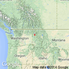
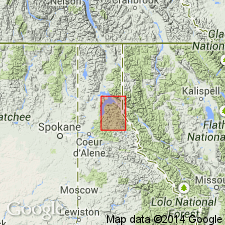
Named as 1 of 3 granodiorite masses in the Pend Oreille district of northern Idaho in the Idaho Mountains province. No type locality designated; named for Packsaddle Mountain in Bonner Co. Consists of a granodiorite of uniform darker gray color (than Bayview granodiorite) with a distinctly porphyritic texture. A feature common to all three granodiorites is a type of alteration that had clouded the feldspar and formed abundant chlorite and epidote in all the rocks. The three granodiorites described together since they differ only in detail in their petrography and mineralogy. Intrudes Algonkian and Cambrian sedimentary rocks. Is coarse grained up to contact with sedimentary rocks. Geologic maps. Mapped in two large and two small bodies on east-central side of Pend Oreille Lake and at Packsaddle Mountain. Mineral composition table. Age is "between latest Cretaceous and earliest Eocene."
Source: GNU records (USGS DDS-6; Denver GNULEX).
- Usage in publication:
-
- Packsaddle Mountain Granodiorite*
- Modifications:
-
- Overview
- Age modified
- AAPG geologic province:
-
- Idaho Mountains province
Summary:
Mapped as part of a unit designated "granitic to dioritic intrusive rocks" of Cretaceous and Tertiary age exposed along Pend Oreille Lake, Bonner Co, ID, Idaho Mountains province. [This mapped unit includes rocks named and mapped as Granite Creek, Bayview, and Packsaddle Mountain Granodiorites by Gillson (1927).] Is the most prominent of the positive anomalies of the granodiorite bodies exposed along Pend Oreille Lake, Bonner Co, ID, Idaho Mountains province. Positive aeromagnetic anomalies reflect the exposed and buried Cretaceous granodiorite cupolas and stocks. These granodiorite bodies--of which the Packsaddle Mountain Granodiorite has a narrow shape--are associated with the Kaniksu batholith. The early Tertiary event is represented by granodiorite and dacite porphyry dikes that followed the faults. The Tertiary event was the final phase of the Kaniksu batholith. The Cretaceous bodies caused extensive metamorphism of Belt Supergroup and of Cambrian rocks.
Source: GNU records (USGS DDS-6; Denver GNULEX).
For more information, please contact Nancy Stamm, Geologic Names Committee Secretary.
Asterisk (*) indicates published by U.S. Geological Survey authors.
"No current usage" (†) implies that a name has been abandoned or has fallen into disuse. Former usage and, if known, replacement name given in parentheses ( ).
Slash (/) indicates name conflicts with nomenclatural guidelines (CSN, 1933; ACSN, 1961, 1970; NACSN, 1983, 2005, 2021). May be explained within brackets ([ ]).