

- Usage in publication:
-
- Oxyoke Canyon sandstone member*
- Modifications:
-
- Named
- Dominant lithology:
-
- Sandstone
- AAPG geologic province:
-
- Great Basin province
Summary:
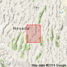
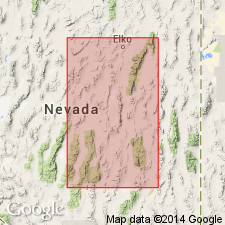
Named for exposures at Oxyoke Canyon. Type section in Oxyoke Canyon on southwestern slope of Beacon Peak [sec 16, T18N, R54E, Pinto Summit 15' quad, White Pine Co, NV]. Is next to lowest member of Nevada formation (Merriam, 1940). Exposed in southern end of Diamond Mountains (Hornitos Cone, Silvarado, Alhambra Hills), also in linear band from Black Point to beyond Phillipsburg mine, and small exposure at eastern base of Newark Mountain near Gimme mine. Composed of light-olive-gray thick-bedded sandstone or quartzite that commonly weathers to shades of brown. Beds are commonly several feet thick and exhibit cross-bedding. Thickness 400 to 450 ft. In mapping highest sandstone bed or lowest dolomite bed has been taken as boundary. Gradational contacts with underlying Beacon Peak dolomite member (new) and overlying Sentinel Mountain dolomite member (new). Age is Early and Middle Devonian.
Source: GNU records (USGS DDS-6; Menlo GNULEX).
- Usage in publication:
-
- Oxyoke Canyon Sandstone*
- Modifications:
-
- Revised
- AAPG geologic province:
-
- Great Basin province
Summary:
Oxyoke Canyon Sandstone Member (Nolan and others, 1956) raised to formation rank as Oxyoke Canyon Sandstone (Nevada Formation abandoned, its members being everywhere raised to formation rank).
Source: GNU records (USGS DDS-6; Menlo GNULEX).
- Usage in publication:
-
- Oxyoke Canyon Sandstone*
- Modifications:
-
- Areal extent
Summary:
Recognized in Fish Creek Range where unit is mainly in fault blocks and consists of medium-grained well-indurated light-yellowish-brown quartz sandstone. Overlies Beacon Peak Dolomite. Underlies Sentinel Mountain(?) Dolomite. Assigned Early and Middle Devonian age.
Source: GNU records (USGS DDS-6; Menlo GNULEX).
- Usage in publication:
-
- Oxyoke Canyon Formation
- Modifications:
-
- Areal extent
- Redescribed
- Revised
Summary:
Western tongue of Oxyoke Canyon Formation recognized in Sulphur Spring Range where it conformably overlies Sadler Ranch Formation (new) and underlies Sentinel Mountain Dolomite. In "transitional area" which includes Modoc Peak, Sulphur Spring Range and Pinyon Range, unit is informally divided into upper coarse crystalline member and lower quartzose member. The lower quartzose member intertongues with the Sadler Ranch Formation.
Source: GNU records (USGS DDS-6; Menlo GNULEX).
For more information, please contact Nancy Stamm, Geologic Names Committee Secretary.
Asterisk (*) indicates published by U.S. Geological Survey authors.
"No current usage" (†) implies that a name has been abandoned or has fallen into disuse. Former usage and, if known, replacement name given in parentheses ( ).
Slash (/) indicates name conflicts with nomenclatural guidelines (CSN, 1933; ACSN, 1961, 1970; NACSN, 1983, 2005, 2021). May be explained within brackets ([ ]).