

- Usage in publication:
-
- Owiyukuts Complex
- Modifications:
-
- Named
- Dominant lithology:
-
- Gneiss
- Amphibolite
- AAPG geologic province:
-
- Southern Rocky Mountain region
Summary:
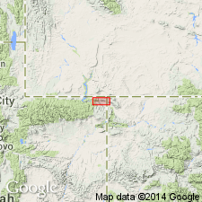
Named for O-Wi-Yu-Kuts Mountain, Moffat Co, CO in Southern Rocky Mountain region. The mountain is in Beaver Creek block. Complex also occurs in the Mountain Home, Dutch John, and Bender Mountain blocks to the west along the north flank of the Uinta Mountains in the Southern Rocky Mountain region. No type locality designated. Rocks of the complex were included in the Red Creek Quartzite by Hansen (1965). Underlies an area of less than 3 sq km. Is dominated by medium- to fine-grained potassium-feldspar-rich granitic gneiss interfaced with quartzo-feldspathic gneiss, garnet gneiss, migmatitic gneiss, fine-grained biotite gneiss, and garnet amphibolite. Unconformably underlies Red Creek Quartzite. Has an Rb-Sr whole-rock isochron age of 2.7 b.y. from gneisses from Beaver Creek.
Source: GNU records (USGS DDS-6; Denver GNULEX).
- Usage in publication:
-
- Owiyukuts Complex*
- Modifications:
-
- Overview
- AAPG geologic province:
-
- Southern Rocky Mountain region
Summary:
Used for pre-Red Creek granitic gneisses of 2,700 +/-50 m.y. by Rb-Sr method (sample from secs 11 and 13, T11N, R104W, Moffat Co in the Southern Rocky Mountain region) or of Archean age and similar in age to the Archean WY province.
Source: GNU records (USGS DDS-6; Denver GNULEX).
For more information, please contact Nancy Stamm, Geologic Names Committee Secretary.
Asterisk (*) indicates published by U.S. Geological Survey authors.
"No current usage" (†) implies that a name has been abandoned or has fallen into disuse. Former usage and, if known, replacement name given in parentheses ( ).
Slash (/) indicates name conflicts with nomenclatural guidelines (CSN, 1933; ACSN, 1961, 1970; NACSN, 1983, 2005, 2021). May be explained within brackets ([ ]).