

- Usage in publication:
-
- Ouray limestone*
- Modifications:
-
- Incidental mention
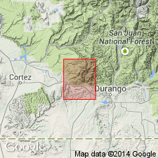
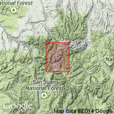
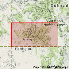
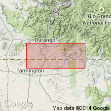
- Areal extent
- AAPG geologic province:
-
- San Juan basin
Summary:
Pg. 8. From section displayed in Animas Valley and at Rico we can assume presence of other sedimentary formations below Dolores formation (oldest exposed) in La Plata dome. These embrace Rico and Hermosa (Carboniferous), the Ouray (Devonian), and the Ignacio (Cambrian), all in apparent structural conformity.
Source: US geologic names lexicon (USGS Bull. 896, Hermosa entry p. 945).
- Usage in publication:
-
- Ouray limestone*
- Modifications:
-
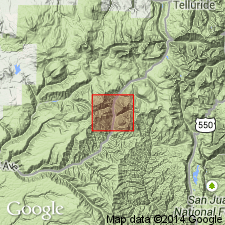
- Areal extent
- AAPG geologic province:
-
- San Juan basin
Summary:
Pg. 37-78. Ouray limestone (Devonian) is overlain by Hermosa formation (Pennsylvanian). The shale on which Ouray limestone rests may be pre-Devonian.
Source: US geologic names lexicon (USGS Bull. 896, p. 1577-1578).
- Usage in publication:
-
- Ouray limestone*
- Modifications:
-
- Principal reference
- Dominant lithology:
-
- Limestone
- AAPG geologic province:
-
- San Juan basin
- San Juan Mountains province
Summary:
Pg. 125-129. Ouray limestone is name proposed for only member of pre-Carboniferous section of San Juan region, southwestern Colorado, which is definitely shown by its fossils to be of Devonian age. Named from prominent occurrence in vicinity of Ouray at junction of Canon Creek with Uncompahgre River, [Ouray County], southwestern Colorado. The formation consists of 100 to 300 feet of massive limestone. In places it is one massive layer; in other places it consists of 2 or 3 heavy bands separated by greenish crumbling marls. The limestone is usually white, but sometimes is stained red or pink. Certain strata are somewhat coarsely crystalline, but as a rule the limestone is fine-grained. The Devonian fossils (identified by G.H. Girty) were found a short distance below top. Neither extreme upper nor lower layers have yielded fossils. Rests on 0 to 100 feet of Devonian shale, and, in places, on Algonkian; and underlies, apparently conformably, rocks containing a few feet above Ouray limestone, Upper Carboniferous fossils. The Lower Carboniferous appears to be absent, but possibly a few feet of unfossiliferous limestone above the true Devonian and not differentiated from it may be of Lower Carboniferous age.
Source: US geologic names lexicon (USGS Bull. 896, p. 1577-1578).
- Usage in publication:
-
- Ouray limestone*
- Modifications:
-
- Revised
- AAPG geologic province:
-
- San Juan basin
Summary:
Pg. 245-252. Ouray limestone of San Juan region is a lithologic unit, and contains Mississippian fossils in upper part and Devonian fossils in lower part. It overlies Elbert formation (Devonian shale).
Source: US geologic names lexicon (USGS Bull. 896, p. 1577-1578).
- Usage in publication:
-
- Ouray limestone*
- Modifications:
-
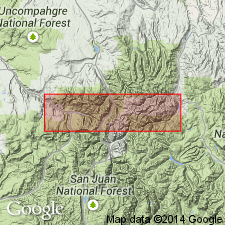
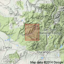
- Areal extent
- AAPG geologic province:
-
- San Juan Mountains province
Summary:
[and GSA Bull. v. 16, p. 470-496.] Ouray limestone of southwestern Colorado is unconformably overlain by Molas formation (Pennsylvanian).
[GNC remark (ca. 1936, US geologic names lexicon, USGS Bull. 896, Molas entry p. 1397): The Mississippian part of Ouray limestone as first defined is now called Leadville limestone, and Ouray limestone is restricted to the Upper Devonian part. (See entry under Kirk, 1931).]
Source: US geologic names lexicon (USGS Bull. 896, p. 1577-1578).
- Usage in publication:
-
- Ouray limestone*
- Modifications:
-
- Age modified
- AAPG geologic province:
-
- San Juan basin
- San Juan Mountains province
Summary:
[Credits Whitman Cross, A.C. Spencer, and F.L. Ransome.] Ouray limestone, 100 to 300 feet thick, is of Mississippian and Devonian age. When defined by Spencer it was supposed to be all Devonian. Is a lithologic unit and the Mississippian and Devonian can not be separated. The Mississippian fauna is found also in Leadville limestone.
Source: US geologic names lexicon (USGS Bull. 896, p. 1577-1578).
- Usage in publication:
-
- Ouray limestone*
- Modifications:
-
- Revised
- AAPG geologic province:
-
- San Juan basin
- San Juan Mountains province
Summary:
The Ouray limestone is chiefly of Mississippian age, the Devonian part being 65 to 70 feet thick, and the Mississippian part 180 to 235 feet thick. Fossils 15 to 20 feet above base are pronounced by Kirk to be Upper Devonian. No other fossils found in Devonian part of the limestone. The Devonian part is chiefly gray, buff, or white limestones of medium grain; the Mississippian part is largely gray or brownish-gray crystalline limestone alternating with beds of limestone breccia containing red shaly seams. The top of Devonian part in Ouray district is drawn at base of a blue-gray thin-bedded limestone that commonly contains nodules of black chert. An inconspicuous limestone breccia occurs at places in overlying beds. At Box Canyon the dark-colored chert-bearing beds and the breccia are both absent, but base of Mississippian limestone seems to be marked by sandstone layers containing calcareous cement.
Source: US geologic names lexicon (USGS Bull. 896, p. 1577-1578).
- Usage in publication:
-
- Ouray limestone*
- Modifications:
-
- Revised
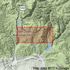
- Areal extent
- AAPG geologic province:
-
- San Juan Mountains province
Summary:
Pg. 224. Ouray limestone here restricted to Devonian part of the Ouray limestone as previously used, the Mississippian part to hereafter be called Leadville limestone. It is understood that Ouray will not be applied outside of southwestern Colorado. [See under Chaffee formation.]
Source: US geologic names lexicon (USGS Bull. 896, p. 1577-1578).
- Usage in publication:
-
- Ouray Limestone*
- Modifications:
-
- Age modified
- AAPG geologic province:
-
- San Juan Mountains province
Summary:
Ouray Limestone.
Considered to be Famennian age in San Juan Mountains, San Juan Co, CO in the San Juan Mountain province. Younger than Elbert Formation and older than Leadville Limestone. Ouray-Leadville contact placed top of a 2 m-thick bed of crinoid-bryozoan-brachiopod packstone that has a Late Devonian, mid-Famennian brachiopod fauna. The overlying basal Leadville can be vugular, brecciated, have irregular bedding and algal mats. The Ouray is usually a fine-grained dolomite with sedimentary structures that suggest subtidal-intertidal deposition. Ouray is brown gray whereas Leadville is light gray to gray, has less argillaceous material, has intraformational conglomerates and strongly developed stromatolites. Stratigraphic sections.
Source: GNU records (USGS DDS-6; Denver GNULEX).
- Usage in publication:
-
- Ouray Limestone*
- Modifications:
-
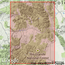
- Areal extent
- AAPG geologic province:
-
- Black Mesa basin
- Paradox basin
- San Juan basin
Summary:
Pg. A5 (fig. 3), A18, A19 (fig. 8, isopach map). Ouray Limestone. Dark-brown to light-gray, dense, argillaceous limestone, locally with green clay partings. In many places basal bed is a tan dolomite and uppermost bed is a green clay. Thickness up to 100 feet west of Reservation. [Not mapped (pl. 1, geol. map).] Unconformably(?) underlies Lower Mississippian (Kinderhookian) Leadville Limestone; conformably overlies Upper Devonian Elbert Formation. Fossils. Age is Late Devonian (citing Sandberg and others, 1989, CSPG Mem., no. 14, v. 1, p. 206).
Recognized in the Four Corners region of southwestern Colorado, northwestern New Mexico, northeastern Arizona, and southeastern Utah.
Source: Publication.
For more information, please contact Nancy Stamm, Geologic Names Committee Secretary.
Asterisk (*) indicates published by U.S. Geological Survey authors.
"No current usage" (†) implies that a name has been abandoned or has fallen into disuse. Former usage and, if known, replacement name given in parentheses ( ).
Slash (/) indicates name conflicts with nomenclatural guidelines (CSN, 1933; ACSN, 1961, 1970; NACSN, 1983, 2005, 2021). May be explained within brackets ([ ]).