

- Usage in publication:
-
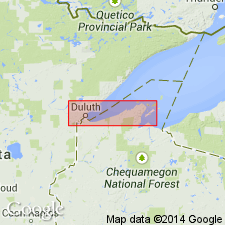
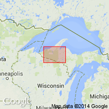
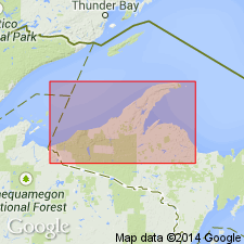
- Oronto group
- Modifications:
-
- Named
- Dominant lithology:
-
- Sandstone
- Conglomerate
- Shale
- AAPG geologic province:
-
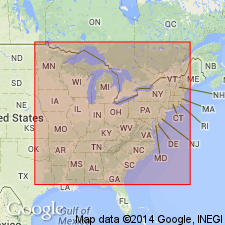
- Wisconsin arch
Summary:
Named for exposures on Oronto Bay, Iron Co., northwestern WI. Occurs in Bayfield, Douglas, and Iron Cos. Divided into (descending) Amnicon formation, Eileen sandstone, Freda sandstone, Nonesuch formation, and Outer conglomerate. Consists of mostly nonmarine arkosic sandstones, conglomerates, and red shales. Thickness is about 21,500 ft. Top fixed at highest thick beds of red shales and well-marked arkosic sandstones. Conformably underlies Bayfield sandstone group; overlies middle and lower Keweenawan traps. No fossils present. Age is Precambrian (upper Keweenawan).
Source: GNU records (USGS DDS-6; Reston GNULEX).
- Usage in publication:
-
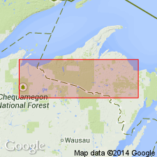
- Oronto group
- Modifications:
-
- Revised
- AAPG geologic province:
-
- Wisconsin arch
Summary:
Group revised to include (ascending) Outer conglomerate, Nonesuch shale, and Freda sandstone. Revision made on basis of lithological and heavy mineral evidence which suggests that Eileen sandstone belongs above Amnicon and includes beds on Middle River and Fish Creek sections which Thwaites (1912) classified as lower Orienta (Bayfield group). Eileen sandstone, which resembles Bayfield group of sandstones, is probably basal Orienta and Amnicon arkose is upper Freda. Thickness of Amnicon given by Thwaites (5,000 ft) is included in his estimate of thickness of Freda, and the 2,000 ft assigned to the Eileen is included in Orienta. Thwaites' estimated thickness of Oronto group was 21,500; about 7,000 ft is here eliminated from his section, bringing it to about 13,550 ft.
Source: GNU records (USGS DDS-6; Reston GNULEX).
- Usage in publication:
-
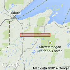
- Oronto Group*
- Modifications:
-
- Revised
- AAPG geologic province:
-
- Lake Superior region
- Wisconsin arch
Summary:
Pg. D121 (table 2). Oronto Group. Includes (descending) Freda Sandstone, Nonesuch Shale, and Copper Harbor Conglomerate. Upper Keweenawan.
See also P.M. DuBois, 1962, Canada Geol. Survey Bull. 71, 75 p.
Source: GNC index card files (USGS-Reston).
- Usage in publication:
-
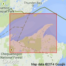
- Oronto Group*
- Modifications:
-
- Revised
- AAPG geologic province:
-
- Wisconsin arch
Summary:
Oronto Group revised to consist of Freda Sandstone and underlying Nonesuch Shale. Copper Harbor Conglomerate is excluded. Top of Copper Harbor is adopted as base of upper Keweenawan and of the Oronto Group. Copper Harbor is a better boundary between upper and middle Keweenawan than other stratigraphic horizons that have been used inconsistently from place to place. Irving's (1883) boundary cannot be traced farther away from Keweenaw Peninsula. Top of Copper Harbor comes closer to marking end of Keweenawan volcanism than other boundaries. In addition, no other major stratigraphic boundary in the Keweenawan province is so precisely located over so large a fraction of its total outcrop trace. Author notes that upper Keweenawan time is part of Precambrian Y, an interim subdivision of Precambrian time. Precambrian Y spans the period between 1,600 and 800 m.y.
Source: GNU records (USGS DDS-6; Reston GNULEX).
- Usage in publication:
-
- Oronto Group*
- Modifications:
-
- Revised
- AAPG geologic province:
-
- Wisconsin arch
Summary:
Oronto Group terminology follows usage of White (1972) and includes Nonesuch Shale and Freda Sandstone. Copper Harbor Conglomerate underlies Oronto Group and is assigned to the middle Keweenawan [middle part of Keweenawan Supergroup].
Source: GNU records (USGS DDS-6; Reston GNULEX).
- Usage in publication:
-
- Oronto Group*
- Modifications:
-
- Revised
- AAPG geologic province:
-
- Wisconsin arch
Summary:
Copper Harbor Conglomerate assigned to Oronto Group, reverting to pre-1972 usage. White (1972) removed Copper Harbor from Oronto Group because the basal contact of the Copper Harbor was ambiguous and did not provide a good lower contact for the Oronto Group. Although this usage was adopted by the USGS, other workers have continued to include the Copper Harbor in the Oronto Group. In addition, mapping since 1972 has not revealed the difficulties in correlating the group boundary that White (1972) predicted as a major problem. The Copper Harbor rocks are more akin to the Freda Sandstone and Nonesuch Shale in its mostly sedimentary nature, although its lower part records the transition from a dominantly volcanic regime to a dominantly sedimentary regime. Age is Middle Proterozoic. Report includes geologic map and correlation chart.
Source: GNU records (USGS DDS-6; Reston GNULEX).
- Usage in publication:
-
- Oronto Group*
- Modifications:
-
- Overview
- AAPG geologic province:
-
- Wisconsin arch
Summary:
On the correlation chart of Precambrian rocks of the conterminous United States, the Oronto Group is shown in the Lake Superior region (MN, WI, MI) as Middle Proterozoic (approximately 1100 Ma).
Source: GNU records (USGS DDS-6; Reston GNULEX).
For more information, please contact Nancy Stamm, Geologic Names Committee Secretary.
Asterisk (*) indicates published by U.S. Geological Survey authors.
"No current usage" (†) implies that a name has been abandoned or has fallen into disuse. Former usage and, if known, replacement name given in parentheses ( ).
Slash (/) indicates name conflicts with nomenclatural guidelines (CSN, 1933; ACSN, 1961, 1970; NACSN, 1983, 2005, 2021). May be explained within brackets ([ ]).