

- Usage in publication:
-
- Orangeburg formation*
- Modifications:
-
- Original reference
- Dominant lithology:
-
- Sand
- Clay
- AAPG geologic province:
-
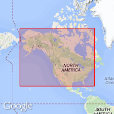
- Atlantic Coast basin
Summary:
Pg. 344, and chart opp. p. 334; also published in 1897 as House Doc. 5, 55th Cong., 2nd sess. Tallahatta or Orangeburg formation. Hitherto known as the Buhrstone, a local term used for the rough siliceous rocks belonging to lower Eocene of the Carolinas, Georgia, Alabama, etc., adopted by Lyell in 1845 (Quart. Jour. Geol. Soc. London, v. 1, p. 435) for a formation which he regarded as newer than the white limestone [Vicksburg group]. Buhrstone had been used by Finch and others as early as 1823 (Amer. Jour. Sci., 1st ser., v. 7, p. 38), but the term is of a colloquial rather than a distinctive character. Owing to very great objections to these qualitative mineralogical terms as names for formations, and loose way in which present one has been used in the literature, it has been thought best to propose a geographical name for the original group. The name selected is that of Orangeburg district of South Carolina, the typical locality of the Buhrstone, as defined by Tuomey (Geology of South Carolina, 1848, p. 149), in correcting Lyell's stratigraphy. It was in Orangeburg district that Tuomey found the fossils which fixed the horizon, and also the thickest and finest exposures. For the exposures of nearly same age, but of different fauna and lithologic character, in Alabama, E.A. Smith suggests Tallahatta, from the local name of the hills containing them. [Age is middle Eocene.]
Source: US geologic names lexicon (USGS Bull. 896, p. 1556, Tallahatta entry p. 2111).
- Usage in publication:
-
- Orangeburg Group
- Modifications:
-
- Revised
- AAPG geologic province:
-
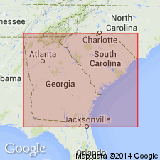
- Atlantic Coast basin
Summary:
Authors follow Colquhoun and others (1983) and Nystrom and others (this volume) and herein assign all middle Eocene sediments of the outer Coastal Plain of SC to the Orangeburg Group. Therefore, in the outer Coastal Plain, the group includes the Congaree Formation, the Santee Limestone, and the lower part of the Cross Formation. [This last assignment is in conflict with the 1983 Code, Art. 28(b). The Cross Formation was determined to be one depositional sequence of middle and late Eocene age by Zullo and Harris (1987).]
Source: GNU records (USGS DDS-6; Reston GNULEX).
- Usage in publication:
-
- Orangeburg Group
- Modifications:
-
- Overview
- Areal extent
- AAPG geologic province:
-
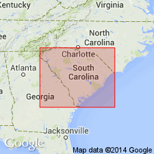
- Atlantic Coast basin
Summary:
Authors include the Huber, Congaree, Warley Hill and McBean Formations in the Orangeburg Group. The Huber and the Congaree are age equivalent (early middle Eocene) facies and correlate with the Tallahatta Formation of AL. The middle middle Eocene Warley Hill Formation correlates with the lower part of the Lisbon Formation in AL. The upper middle Eocene McBean Formation correlates with the upper part of the Lisbon Formation and the Cook Mountain Formation of the Claiborne Group in the Gulf Coast. Unit crops out extensively above the Orangeburg scarp and only occasionally below. Consists primarily of quartz sand and clays of terrigenous origin, but also includes marine, glauconitic sands found in the Warley Hill and McBean. Group unconformably overlies the Paleocene Black Mingo Group and unconformably underlies the upper Eocene Barnwell Group.
Source: GNU records (USGS DDS-6; Reston GNULEX).
For more information, please contact Nancy Stamm, Geologic Names Committee Secretary.
Asterisk (*) indicates published by U.S. Geological Survey authors.
"No current usage" (†) implies that a name has been abandoned or has fallen into disuse. Former usage and, if known, replacement name given in parentheses ( ).
Slash (/) indicates name conflicts with nomenclatural guidelines (CSN, 1933; ACSN, 1961, 1970; NACSN, 1983, 2005, 2021). May be explained within brackets ([ ]).