The National Geologic Map Database is migrating to a new infrastructure. We apologize for any service disruptions during this process.
|
|---|


- Usage in publication:
-
- Open Door limestone
- Modifications:
-
- Named
- Dominant lithology:
-
- Shale
- Limestone
- AAPG geologic province:
-
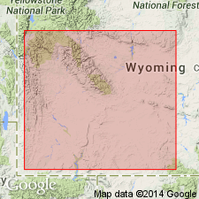
- Yellowstone province
- Wind River basin
- Green River basin
Summary:
Named as the upper formation of the Gallatin group. Name replaces prior use of names such as upper Gallatin limestone, Grove Creek and Snowy Range formations, Sage pebble conglomerates, etc. Type section is on east wall of Granite Canyon in the Gros Ventre Mountains, just below a feature known as the Open Door in secs 5 and 6, T39N, R113W and secs 30 and 31, T40N, R113W, Teton Co, WY in the Yellowstone province. Overlies Du Noir limestone of Gallatin group. Underlies Bighorn dolomite. The Du Noir-Dry Creek contact is marked by a change from cliff-forming limestone to shale. Basal shale called Dry Creek shale member. Overlying part of formation shown on two cross sections as a limestone and cherty limestone. Open Door and its Dry Creek member identified on cross sections in Sublette Co, WY in the Greater Green River basin, and in Fremont Co, WY in the Wind River basin. Only the lower beds are fossiliferous. Lower part lies in the ELVINIA zone, a representative Upper Cambrian zone. Of late Dresbachian and Franconian, Cambrian age.
Source: GNU records (USGS DDS-6; Denver GNULEX).
- Usage in publication:
-
- Open Door limestone
- Modifications:
-
- Overview
- AAPG geologic province:
-
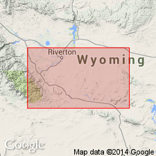
- Wind River basin
Summary:
Is the upper formation of Gallatin group. Overlies Dunoir limestone (spelled Du Noir in author's 1955 report), basal formation of Gallatin group. The closest equivalent stratigraphically is the Sage pebble conglomerate of Lochman (1950). Name Sage not applied to these rocks in the southwest Wind River basin because flat limestone pebble conglomerate is not the dominant rock type. Consists of a basal shale called Dry Creek member and an overlying unnamed part of thick-bedded, medium gray, fine- to medium-grained limestone. Fine to extremely fine quartz sand present in many beds. Dolomite not common except near top, where it may be secondary. Glauconite is rare to common in unit. Flat pebble conglomerate beds distinctive in unit, but they are not common. Fossils in lower part. Thickness not stated. Upper contact is an erosion surface. On surface, contact represented by red staining. Overlain by Lander sandstone. Late Cambrian age.
Source: GNU records (USGS DDS-6; Denver GNULEX).
- Usage in publication:
-
- Open Door Limestone Member*
- Modifications:
-
- Revised
- Overview
- AAPG geologic province:
-
- Wind River basin
Summary:
Gallatin Limestone divided into Du Noir Limestone Member (base) and Open Door Limestone Member (top). Usage in this paper represents a change in stratigraphic rank used by Shaw (1955) for Gallatin (from group), and Du Noir and Open Door (from formation). Gallatin forms cliffs above shale slopes of Gros Ventre Formation and is separated from the overlying Bighorn Dolomite by an erosional unconformity. The formation is 265 to 365 ft thick in the Wind River Range, 235 to 455 ft thick in the Washakie Range, Owl Creek, and southern Bighorn Mountains, 209 ft thick along south edge of Wind River basin. The Du Noir described as a cliff-forming, thin-bedded, glauconitic and oolitic limestone with some flat-pebble conglomerate. The Open Door has a lower soft, green-gray shale with minor thin-bedded, gray limestone, and an upper gray, thin-bedded to massive limestone and a few flat-pebble conglomerates. The members can be traced in the Washakie Range, along the south side of the Owl Creek Mountains, and into the southern Bighorn Mountains of WY in the Wind River basin. The boundary between the APHELASPIS and ELVINIA zones nearly corresponds to the Du Noir-Open Door contact. Is a marine deposit of Late Cambrian age. Cross sections.
Source: GNU records (USGS DDS-6; Denver GNULEX).
For more information, please contact Nancy Stamm, Geologic Names Committee Secretary.
Asterisk (*) indicates published by U.S. Geological Survey authors.
"No current usage" (†) implies that a name has been abandoned or has fallen into disuse. Former usage and, if known, replacement name given in parentheses ( ).
Slash (/) indicates name conflicts with nomenclatural guidelines (CSN, 1933; ACSN, 1961, 1970; NACSN, 1983, 2005, 2021). May be explained within brackets ([ ]).