

- Usage in publication:
-
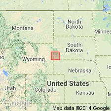
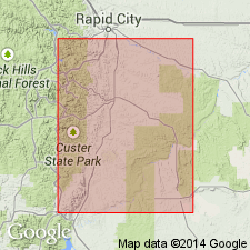
- Opeche formation*
- Modifications:
-
- Named
- Dominant lithology:
-
- Sandstone
- Shale
- Gypsum
- AAPG geologic province:
-
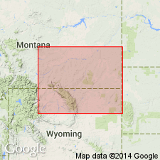
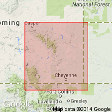
- Powder River basin
- Williston basin
- Chadron arch
Summary:
Soft red sandstone, mainly thin-bedded, containing variable amounts of clay admixture. At the top are shales which are invariably a deep purple. A few thin beds of gypsum are sometimes observed in the formation. Thickness averages slightly less than 100 ft. Name is the Indian name for Battle Creek, Custer Co, SD on Chadron arch where the formation is typically developed. Overlain by Minnekahta limestone (new); underlain by Minnelusa formation. Assigned to the Permian because it underlies rocks of Permian age, and there are extensive red beds in the upper part of the Permian in KS and eastern NE.
Source: GNU records (USGS DDS-6; Denver GNULEX).
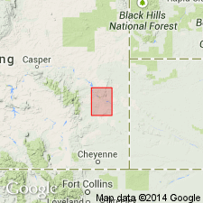
- Usage in publication:
-
- Opeche formation*
- Modifications:
-
- Areal extent
- Revised
- Overview
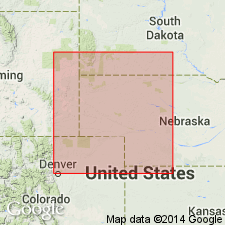
- AAPG geologic province:
-
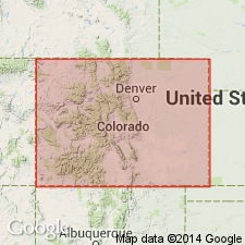
- Denver basin
Summary:
Extended from the Black Hills, SD into the Hartville area, Platte Co, WY in the Denver basin. Occurs in a narrow strip in northwest corner of map (geologic map) conformably above the Carboniferous Hartville formation (first used). Is about 60 ft thick and consists of bright-red, thin-bedded, fine-grained sandstone and a minor portion of red, flaky shale. Conformably underlies Permian? Minnekahta limestone; also extended into Hartville area from the Black Hills. Columnar section. Of Permian? age.
Source: GNU records (USGS DDS-6; Denver GNULEX).
- Usage in publication:
-
- Opeche formation*
- Modifications:
-
- Overview
- AAPG geologic province:
-
- Williston basin
Summary:
The basal red shales of Chugwater formation (a new name) in the Bighorn Mountains, WY, Bighorn and Powder River basins, are thought to correlate with Permian Opeche formation of the Black Hills, SD, Williston basin. Correlation diagram.
Source: GNU records (USGS DDS-6; Denver GNULEX).
- Usage in publication:
-
- Opeche shale
- Modifications:
-
- Areal extent
- AAPG geologic province:
-
- Chadron arch
Summary:
Name extended southward in the subsurface into northeastern NE on the Chadron arch. Identified in the Duthie well, sec 33, T35N, R47W, Dawes Co, NE for red shale at depths 1850-1955 ft. Overlain by Minnekahta limestone; underlain by Minnelusa group. Permian in age.
Source: GNU records (USGS DDS-6; Denver GNULEX).
- Usage in publication:
-
- Opeche formation
- Modifications:
-
- Areal extent
- AAPG geologic province:
-
- Williston basin
Summary:
Used name in southeast MT, Williston basin, in the Montana-Dakota Utilities Co. No. 1 Northern Pacific Railroad Co. well, sec. 17, T4N, R62E, Fallon Co, MT in the Williston basin for red shale with traces of anhydrite in the interval 5,490 to 5,631 ft. Overlain by Minnekahta limestone; underlain by Minnelusa formation. Permian in age.
Source: GNU records (USGS DDS-6; Denver GNULEX).
- Usage in publication:
-
- Opeche shale
- Modifications:
-
- Areal extent
- Overview
- AAPG geologic province:
-
- Denver basin
- Powder River basin
Summary:
Opeche shale, basal formation of the Phosphoria group [intent to designate as a group not stated], recognized from Owl Canyon, Larimer County, Colorado, north to the Laramie Range, Wyoming (Denver basin), and as far north as La Bonte Post Office [sec. 5, T. 29 N., R. 72 W.] Converse County, Wyoming (Powder River basin). Age is Permian. Report includes measured sections.
Source: Modified from GNU records (USGS DDS-6; Denver GNULEX).
- Usage in publication:
-
- Opeche shale
- Modifications:
-
- Areal extent
- AAPG geologic province:
-
- Williston basin
Summary:
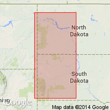
Extends Opeche shale into Nesson anticline, central part of Williston basin, Williams County, North Dakota. Underlies Minnekahta limestone; overlies Minnelusa formation. Age is Permian.
Source: Modified from GNU records (USGS DDS-6; Denver GNULEX).
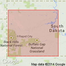
- Usage in publication:
-
- Opeche shale
- Modifications:
-
- Areal extent
- AAPG geologic province:
-
- Williston basin
- Chadron arch
Summary:
Identified and described in the subsurface in western SD in southern part of Williston basin and on the Chadron arch. Permian in age.
Source: GNU records (USGS DDS-6; Denver GNULEX).
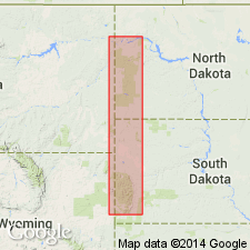
- Usage in publication:
-
- Opeche formation
- Modifications:
-
- Overview
- AAPG geologic province:
-
- Williston basin
Summary:
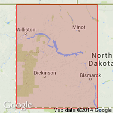
Name used in western ND in the Williston basin for shale, orange-red, slightly dolomitic, locally silty, streaks of anhydrite and gypsum, locally containing salt, 0-280 ft thick. Conformable with overlying Minnekahta limestone; unconformable with underlying Minnelusa formation. Permian in age.
Source: GNU records (USGS DDS-6; Denver GNULEX).
- Usage in publication:
-
- Opeche shale
- Modifications:
-
- Revised
- AAPG geologic province:
-
- Williston basin
Summary:
Restricted the Opeche shale to a few feet (20 to 60 feet) of relatively close shales that directly underlie the Minnekahta limestone. Described as red to pink, generally waxy to subwaxy, and appear to be of marine origin. Underlying beds of red, pink, and orange-red silty shale containing anhydrite and salt, that were previously assigned to Opeche by the North Dakota Geological Society (1954, Stratigraphy of the Williston basin), are thought to be a time equivalent of the Cassa group [of the Hartville uplift, Wyoming] and are excluded from Opeche shale [in the Williston basin]. Age is Permian.
Source: Modified from GNU records (USGS DDS-6; Denver GNULEX).
- Usage in publication:
-
- Opeche formation*
- Modifications:
-
- Revised
- AAPG geologic province:
-
- Williston basin
Summary:
A reddish sandstone, siltstone, and red shale sequence, which in ND contains a sequence of salt referred to in this report as the Permian "A" salt. The salt is as much as 181 ft thick a few miles north of Dickinson, Dunn Co, ND. A second, less extensive salt, the Permian "B" salt, underlies the Permian "A" salt in a few wells. Isopach map shows thickness and distribution of the Permian "A" salt in ND. Is Permian in age.
Source: GNU records (USGS DDS-6; Denver GNULEX).
- Usage in publication:
-
- Opeche shale member
- Modifications:
-
- Overview
- AAPG geologic province:
-
- Powder River basin
- Wind River basin
Summary:
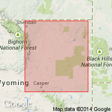
Considered a member of Goose Egg formation in the subsurface of the Powder River basin, WY [except in the northwestern part in Sheridan, and adjacent parts of Johnson and Campbell Cos, WY where it pinches out beneath overlying Minnekahta limestone member]. Discusses local features, and shows correlation in 10 wells in the basin, and in two wells in Natrona Co, WY in the adjacent eastern part of the Wind River basin. Unconformably underlies Minnekahta limestone member; overlies unconformably Minnelusa formation. Is Permian in age.
Source: GNU records (USGS DDS-6; Denver GNULEX).
- Usage in publication:
-
- Opeche Shale Member*
- Modifications:
-
- Revised
- Overview
- AAPG geologic province:
-
- Green River basin
Summary:
Reduced in stratigraphic rank to basal member, one of eight members, of Goose Egg Formation in Albany and Carbon Cos, WY of the Greater Green River basin. Is a thin widespread unit present throughout most of eastern WY. Is 70 ft thick at type Goose Egg; thins south or is absent in CO. Ranges from 20 to 70 ft thick. Overlies Casper, Hartville, or Owl Canyon Formation, depending on location. Grades into overlying Minnekahta Limestone Member, newly assigned to the Goose Egg. Is mostly reddish-orange claystone whose bedding ranges from parallel thin laminae to thin-bedded. Dolomite and gypsum occurs in lower part. Nomenclature chart; cross section. Of Early Permian age.
Source: GNU records (USGS DDS-6; Denver GNULEX).
- Usage in publication:
-
- Opeche Shale*
- Modifications:
-
- Overview
- AAPG geologic province:
-
- Williston basin
- Denver basin
- Chadron arch
- Green River basin
- Wind River basin
- Bighorn basin
Summary:
Discusses correlation and extent. Used in formational sense (Opeche Shale) in western SD, western ND, southeastern MT, and northeastern WY (in Williston, Powder River, and Denver basins, and on Chadron arch). Known as a member of Satanka Shale in southeastern and south-central WY (in Greater Green River basin) as Opeche Shale Member. Is a member of Goose Egg Formation in central WY (in Wind River and Bighorn basins). Shows correlations with units in nearby areas. Is middle Permian (Leonardian) in age.
Source: GNU records (USGS DDS-6; Denver GNULEX).
- Usage in publication:
-
- Opeche Shale*
- Modifications:
-
- Areal extent
- AAPG geologic province:
-
- Denver basin
Summary:
Recognized as a unit of Leonardian, or Roadian, Early Permian age in north-central CO Front Range, Denver basin. Overlies Owl Canyon Formation. Underlies Minnekahta Limestone. Correlation chart.
Source: GNU records (USGS DDS-6; Denver GNULEX).

- Usage in publication:
-
- Opeche Shale Member*
- Modifications:
-
- Areal extent
- AAPG geologic province:
-
- Powder River basin
Summary:
Goose Egg Formation identified in the subsurface of the Powder River basin in WY and MT where it unconformably overlies Minnelusa Formation and underlies Chugwater Formation. Goose Egg divided into (descending) an unnamed upper part, Minnekahta Limestone Member, and Opeche Shale Member. Of Permian age. [This nomenclature shown on 22 cross sections in this OC series.]
Source: GNU records (USGS DDS-6; Denver GNULEX).
For more information, please contact Nancy Stamm, Geologic Names Committee Secretary.
Asterisk (*) indicates published by U.S. Geological Survey authors.
"No current usage" (†) implies that a name has been abandoned or has fallen into disuse. Former usage and, if known, replacement name given in parentheses ( ).
Slash (/) indicates name conflicts with nomenclatural guidelines (CSN, 1933; ACSN, 1961, 1970; NACSN, 1983, 2005, 2021). May be explained within brackets ([ ]).