

- Usage in publication:
-
- Okpikruak formation*
- Modifications:
-
- Named
- Biostratigraphic dating
- Dominant lithology:
-
- Clay
- Shale
- AAPG geologic province:
-
- Alaska Northern region
Summary:
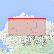
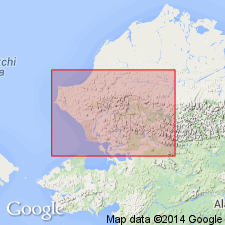
Named for Okpikruak River. Type section designated in middle of major syncline on small tributary of Okpikruak River, 64 deg 34'30"N, 153 deg 38'W, northern AK. Crops out in southern part of Arctic Foothills from Itkillik River west to Kukpowruk River. Predominantly is fine-grained greenish-gray sandstone of graywacke type, dark clay, and silt shale, with minor amounts of conglomerate near base. On Siksikpuk River unit characterized by rhythmic alternation of fine-grained sandstone, silt shale and clay shale. Alternation not well developed along Okpikruak River. Is about 2400 ft thick at type, 1850 ft thick at Siksikpuk River. Unconformably underlies Torok Formation (new); overlies Jurassic or Triassic rocks with little or no angular discordance. Age is Early Cretaceous based on pelecypods (Neocomian) identified by R.W. Imlay.
Source: GNU records (USGS DDS-6; Menlo GNULEX).
- Usage in publication:
-
- Okpikruak Formation*
- Modifications:
-
- Areal extent
- Revised
- AAPG geologic province:
-
- Alaska Northern region
Summary:
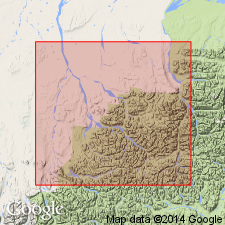
Okpikruak formation is recognized in foothills from Canning River to Sagavanirktok River. Okpikruak is differentiated from underlying Kingak shale by presence of fossils and rhythmic alternation of shale and siltstone. From Echooka River to Kavik River basal 220-ft-thick sandstone of Early Cretaceous age here named Kemik sandstone member and is tentatively assigned to Okpikruak formation. Measured section, fossils with localities, and geologic map of Shaviovik and Sagavanirktok Rivers region included in report.
Source: GNU records (USGS DDS-6; Menlo GNULEX).
- Usage in publication:
-
- Okpikruak Formation*
- Modifications:
-
- Reference
- Biostratigraphic dating
- AAPG geologic province:
-
- Alaska Northern region
Summary:
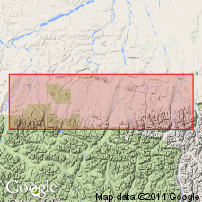
Measured type section location corrected is 68 deg 35'N, 153 deg 30'W on east side of Okpikruak River; thickness is 1800 ft. Reference section designated in cutbanks on east side of Tiglukpuk Creek at 68 deg 19'N, 151 deg 50'W; thickness here is 1850 ft. Another measured section is on Aucella Creek. BUCHIA (collected from lowest to highest beds) restudied by D.L. Jones (oral commun., 1964) indicate age is Early Cretaceous (probably Berriasian).
Source: GNU records (USGS DDS-6; Menlo GNULEX).
- Usage in publication:
-
- Okpikruak Formation*
- Modifications:
-
- Areal extent
- Revised
- AAPG geologic province:
-
- Alaska Northern region
Summary:
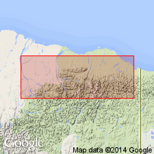
Okpikruak formation geographically restricted from northeastern AK to which Keller and others (1961) extended unit. These rocks which are dissimilar to Okpikruak in its type area are named Kongakut Formation to which Kemik Sandstone Member is reassigned. Okpikruak Formation is presently valid only in central and western parts of AK.
Source: GNU records (USGS DDS-6; Menlo GNULEX).
- Usage in publication:
-
- Okpikruak Formation*
- Modifications:
-
- Age modified
- AAPG geologic province:
-
- Alaska Northern region
Summary:
Lowermost part of Okpikruak Formation, as dated by sparse pelecypod fossils, is at least as old as Late Jurassic in Ipnavik River and Nuka Ridge allochthons. In most sequences Okpikruak Formation is assigned to Late Cretaceous. Overall age is Late Jurassic (locally) and Early Cretaceous.
Source: GNU records (USGS DDS-6; Menlo GNULEX).
For more information, please contact Nancy Stamm, Geologic Names Committee Secretary.
Asterisk (*) indicates published by U.S. Geological Survey authors.
"No current usage" (†) implies that a name has been abandoned or has fallen into disuse. Former usage and, if known, replacement name given in parentheses ( ).
Slash (/) indicates name conflicts with nomenclatural guidelines (CSN, 1933; ACSN, 1961, 1970; NACSN, 1983, 2005, 2021). May be explained within brackets ([ ]).