

- Usage in publication:
-
- Ojo Alamo beds
- Modifications:
-
- Named
- Dominant lithology:
-
- Shale
- AAPG geologic province:
-
- San Juan basin
Summary:
Pg. 267-274. Ojo Alamo beds. Less than a mile south of the store at Ojo Alamo the Puerco formation rests unconformably on a conglomerate composed of red, gray, yellow, and white pebbles. Below the conglomerate is a series of shales and sandstones evenly stratified and usually horizontal. The shales below the conglomerate that contain numerous dinosaur and turtle remains I shale designate as Ojo Alamo beds. They were estimated to be abut 200 feet thick, but owing to lack of time I was unable to determine their relation to underlying formations. Age is Cretaceous.
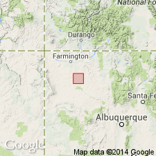
Named from Ojo Alamo trading post in Chaco Canyon about 95 miles northwest of Gallup and 25 miles west of the Bonito Indian Pueblo, San Juan Co, NM in the San Juan basin.
Source: US geologic names lexicon (USGS Bull. 896, p. 1536-1537); supplemental information from GNU records (USGS DDS-6; Denver GNULEX).
- Usage in publication:
-
- Ojo Alamo beds
- Modifications:
-
- Overview
- AAPG geologic province:
-
- San Juan basin
Summary:
Pg. 300-304. Puerco formation [of Ojo Alamo and Barrel Spring Arroyos] rests with marked erosional unconformity on a coarse cross-bedded conglomeratic yellow-brown sandstone 28 to 66 feet thick, which rests disconformably on rusty-yellow, bluish, greenish, and wine-red banded clays with lenses of yellow channel sandstone having maximum measured thickness of 58 feet and containing abundant but badly crushed dinosaur bones, ceratopsian, trachodont, and carnivorous, also turtles, crocodiles, and garpikes. This lies conformably on a lower conglomerate, 6 to 8 feet thick, which varies from a pebbly sandstone to a coarse conglomerate, with waterworn, chatter-marked quartzite, jasper, andesite, and porphyritic pebbles, the source of which has not been traced. This lower conglomerate lies disconformably on a series of bluish shales, or rather clay, containing dinosaur remains. [All these beds were included in Ojo Alamo beds of Brown according to table at end of paper.]
Source: US geologic names lexicon (USGS Bull. 896, p. 1536-1537).
- Usage in publication:
-
- Ojo Alamo sandstone*
- Modifications:
-
- Revised
- Dominant lithology:
-
- Sandstone
- Shale
- Conglomerate
- AAPG geologic province:
-
- San Juan basin
Summary:
Ojo Alamo sandstone. Revised in Ojo Alamo Arroyo area, San Juan County, New Mexico (San Juan basin). Overlying Kirtland shale with apparent conformity is a thin formation of conglomeratic sandstone and shale. These beds were first described by Barnum Brown [1910, Amer. Mus. Nat. Hist. Bull., v. 28, art. 24, p. 267-274] who named them Ojo Alamo, from locality in which they were examined, but assigned no base and indicated no relation between them and underlying beds. On Ojo Alamo Arroyo Brown found dinosaur-bearing shale below a conglomerate, which is overlain unconformably by Puerco formation. Later Sinclair and Granger [1914, Amer. Mus. Nat. Hist. Bull., v. 33, p. 300-304] examined Ojo Alamo locality and found that the dinosaur-bearing shale on Ojo Alamo and Barrel Spring Arroyos is split by a thin conglomerate, referred to by them as "lower conglomerate." The discrepancies in these descriptions and failure of these investigators to assign a stratigraphic or paleontologic lower limit to Ojo Alamo beds call for a more accurate definition. Writer made careful study of the beds in type locality. On Ojo Alamo and Barrel Spring Arroyos, the succession of shale and conglomerate described by Sinclair and Granger was noted. Section measured by writer on Ojo Alamo Arroyo shows (descending): (1) "upper conglomerate," 25 feet; (2) wine-red and bluish-gray banded shales interbedded with lenses of gray-white, easily eroded sandstone, 34 feet; (3) poorly consolidated conglomerate, 9 feet. Has irregular base, the irregularities amounting to 2 or 3 feet in a horizontal distance of 50 feet; (4) bluish-gray to greenish-gray shale, banded here and there with purplish beds and gray-white sandstone lenses. Both shales mentioned above contain dinosaur and turtle remains. However, the lower conglomerate has been traced laterally to points where the shale between it and the upper conglomerate is absent and only a single lithologic unit is present. The lower shale is lithologically like and conformable with underlying beds and is clearly a part of Kirtland shale. Brown placed upper limit of his Ojo Alamo beds at base of "upper conglomerate," and Sinclair and Granger placed it at top of "upper conglomerate," and neither of them assigned a lower limit to formation. As writer found the formation to be essentially a sandstone including lenses of shale and conglomerate, it seems desirable to call it Ojo Alamo sandstone and to define it as consisting, on Ojo Alamo Arroyo, of 2 conglomeratic beds and shale lenses which they include. Its thickness where overlain by Puerco formation ranges from 63 to 110 feet. The Ojo Alamo sandstone is highly cross-bedded, and pebbles of sandstone, andesite, felsite, porphyrite, gneiss, and schist are fairly common at different horizons or are scattered through it irregularly. In some places lower 20 or 30 feet is almost lacking in pebbles. Age is Cretaceous. Report includes cross section, geologic map, correlation chart.
[Misprint (US geologic names lexicon, USGS Bull. 896, p. 1537): should be C.M. Bauer, 1916, USGS Prof. Paper 98-[P].]
Source: US geologic names lexicon (USGS Bull. 896, p. 1536-1537).
- Usage in publication:
-
- Ojo Alamo sandstone*
- Modifications:
-
- Areal extent
- AAPG geologic province:
-
- San Juan basin
Summary:
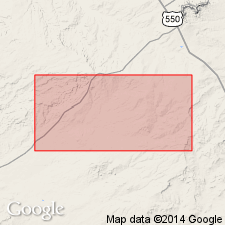
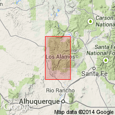
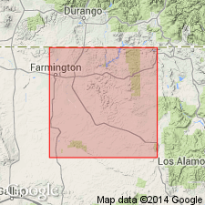
Mapped in a small area in the west-central part of map, Sandoval County, New Mexico (San Juan basin), as a unit of Late Cretaceous age younger than the Kirtland shale and older than the Puerco and Torrejon formations undivided. Report includes geologic map, cross sections.
Source: GNU records (USGS DDS-6; Denver GNULEX).
- Usage in publication:
-
- Ojo Alamo Sandstone*
- Modifications:
-
- Revised
- Overview
- Reference
- Age modified
- Dominant lithology:
-
- Sandstone
- AAPG geologic province:
-
- San Juan basin
Summary:
Bauer's (1916) Ojo Alamo Sandstone is restricted to the upper conglomerate. The unconformably underlying (medial) shale and soft sandstone, and the lower conglomerate are reassigned to the Naashoibito Member (new) of Kirtland Shale. Ojo Alamo (restricted) is a cuesta-forming, soft to well-consolidated, coarse-grained, conglomeratic, arkosic, buff, cross-bedded sandstone that has numerous silicified fossil logs and thin shale lenses. At type section is tan to gray, coarse-grained, arkosic sandstone, 35.5 feet thick; at reference section is conglomeratic, fine- to coarse-grained, 22 feet thick. Thickest section (200 feet) is south of Farmington on the San Juan River. Intertongues with overlying Nacimiento Formation. The restricted Ojo Alamo probably was formed as a series of coalescing stream deposits and dune? sand. Age is considered early Paleocene because of unconformable relationship with Kirtland and intertonguing relationship with Nacimiento. Report includes nomenclature chart, geologic map, cross section.
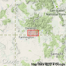
Type section of restricted Ojo Alamo designated and measured in sec. 6, T. 24 N., R. 11 W.
Reference section: in sec. 9, T. 24 N., R. 11 W.
Source: Modified from GNU records (USGS DDS-6; Denver GNULEX).
- Usage in publication:
-
- Ojo Alamo Sandstone*
- Modifications:
-
- Overview
- AAPG geologic province:
-
- San Juan basin
Summary:
Follows definition of Bauer (1916, USGS Prof. Paper 98-P). Three units distinguished at Ojo Alamo Wash, in T. 24 N., R. 11 and 12 W., San Juan County, New Mexico, San Juan basin (considered type locality in this report); these are: (1) lower massive conglomeratic sandstone; (2) medial silty shale and soft conglomeratic sandstone; and (3) upper massive conglomeratic sandstone. The three units are 6 to 122+ m thick. Authors believe Bauer's definition should be retained rather than restrict Ojo Alamo to upper sandstone (citing Baltz and others, 1966). Authors also believe Naashoibito Member should be used only in Ojo Alamo Wash and that it should be reassigned from the Kirtland Shale to the Ojo Alamo. At type locality, a right femur of a hadrosaurian dinosaur was found in lower sandstone. Age is Late Cretaceous and Paleocene (= Ojo Alamo of Bauer). Ojo Alamo at Hunter Wash, South Mesa, Barrel Spring, Pot Mesa, Portales, and Gasbuggy sites described. Report includes geologic map, stratigraphic diagrams, nomenclature history (Bauer to present).
Source: Modified from GNU records (USGS DDS-6; Denver GNULEX).
- Usage in publication:
-
- Ojo Alamo Sandstone
- Modifications:
-
- Age modified
- Biostratigraphic dating
- AAPG geologic province:
-
- San Juan basin
Summary:
Pollen (PROTEACIDITES, BALMEISPORITES, INTERPOLLIS, GUNNERA, KURTZIPITES, ULMOIDEIPITES) collected near Farmington, New Mexico (San Juan basin), from mudstone above the base of a conglomeratic sandstone that has been assigned by some to the Naashoibito Member of the Kirtland Shale and by others to the lower part of the Ojo Alamo, are of early or of late Maastrichtian age. The upper part of the Ojo Alamo intertongues with the Nacimiento Formation and has yielded palynomorphs (MOMIPITES, ULMOIDEIPITES) of early Paleocene age. The Naashoibito or lower Ojo Alamo is separated from the upper Ojo Alamo by an unconformity. If the Naashoibito or lower Ojo Alamo is early Maastrichtian, at least half of the Maastrichtian is missing in the southwestern San Juan basin. Report includes correlation diagram.
Source: GNU records (USGS DDS-6; Denver GNULEX).
- Usage in publication:
-
- Ojo Alamo Sandstone*
- Modifications:
-
- Areal extent
- AAPG geologic province:
-
- San Juan basin
Summary:
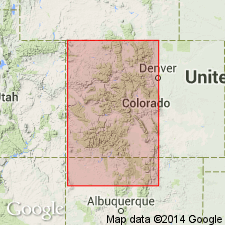
Tentatively extended into the subsurface of southern La Plata County, Colorado, from northern San Juan County, New Mexico (San Juan basin), where it can be recognized as far north as sec. 33, T. 33 N., R. 7 W. Identified on four cross sections. Unconformably overlies Upper Cretaceous Kirtland Shale. Age is Tertiary.
Source: GNU records (USGS DDS-6; Denver GNULEX).
For more information, please contact Nancy Stamm, Geologic Names Committee Secretary.
Asterisk (*) indicates published by U.S. Geological Survey authors.
"No current usage" (†) implies that a name has been abandoned or has fallen into disuse. Former usage and, if known, replacement name given in parentheses ( ).
Slash (/) indicates name conflicts with nomenclatural guidelines (CSN, 1933; ACSN, 1961, 1970; NACSN, 1983, 2005, 2021). May be explained within brackets ([ ]).