

- Usage in publication:
-
- Ocmulgee Formation
- Modifications:
-
- Named
- Dominant lithology:
-
- Limestone
- AAPG geologic province:
-
- South GA-North FL sedimentary province
Summary:
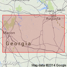
The Ocmulgee Formation of the Ocala Group is here named in the GA Coastal Plain from Houston and Pulaski Cos., in the west, to as far east as the Savannah River. It was previously mapped as the Cooper Marl, but it is shown that the units are not laterally equivalent. It consists of a basal sandy, glauconitic, indurated limestone overlain by tough, massive, glauconitic, granular, even-textured, slightly argillaceous, calcarenitic limestone. Conformably overlies the Twiggs Clay Member of the Dry Branch Formation; paraconformably underlies the Marianna Limestone. Thickness at type locality is 35 ft (11 m). Age is late Eocene.
Source: GNU records (USGS DDS-6; Reston GNULEX).
For more information, please contact Nancy Stamm, Geologic Names Committee Secretary.
Asterisk (*) indicates published by U.S. Geological Survey authors.
"No current usage" (†) implies that a name has been abandoned or has fallen into disuse. Former usage and, if known, replacement name given in parentheses ( ).
Slash (/) indicates name conflicts with nomenclatural guidelines (CSN, 1933; ACSN, 1961, 1970; NACSN, 1983, 2005, 2021). May be explained within brackets ([ ]).