

- Usage in publication:
-
- Nuttall sandstone lentil*
- Modifications:
-
- Named
- Dominant lithology:
-
- Sandstone
- AAPG geologic province:
-
- Appalachian basin
Summary:
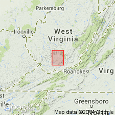
Named as a lentil of Sewell formation. Named for Nuttallburg, Fayette Co., southern WV. Forms cliffs from Gauley Bridge to Nuttallburg. Consists of massive conglomerate, 150 to 200 ft thick, forming top bed of Sewell formation along New River, from Caperton to Deepwater.
Source: GNU records (USGS DDS-6; Reston GNULEX).

- Usage in publication:
-
- Nuttall Sandstone Member*
- Modifications:
-
- Areal extent
- AAPG geologic province:
-
- Appalachian basin
Summary:
Nuttall Sandstone Member, uppermost member of New River Formation, is present only in WV.
Source: GNU records (USGS DDS-6; Reston GNULEX).
For more information, please contact Nancy Stamm, Geologic Names Committee Secretary.
Asterisk (*) indicates published by U.S. Geological Survey authors.
"No current usage" (†) implies that a name has been abandoned or has fallen into disuse. Former usage and, if known, replacement name given in parentheses ( ).
Slash (/) indicates name conflicts with nomenclatural guidelines (CSN, 1933; ACSN, 1961, 1970; NACSN, 1983, 2005, 2021). May be explained within brackets ([ ]).