

- Usage in publication:
-
- Nugget formation*
- Modifications:
-
- Original reference
- Dominant lithology:
-
- Sandstone
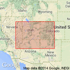
- AAPG geologic province:
-
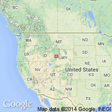
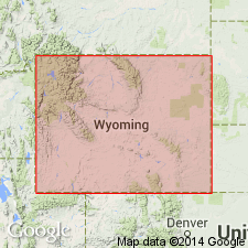
- Green River basin
Summary:
Pg. 56, chart opp. p. 50, map, etc. Nugget formation. The gorup of yellow, pink, and red sandstones bounded below by the gray fossiliferous limestones of Thaynes formation and above by the dark-colored fossiliferous shales and limestones of Twin Creek formation. Along Twin Creek in vicinity of Nugget Station the formation is 1,900+/- feet thick and shows two distinct members, a lower brightly colored red-bed member 600 feet thick and an upper light-colored sandstone member. The upper member is a thin-bedded sandstone the layers of which are perforated with holes at right angles to the bedding planes, but are otherwise without a suggestion of organic life. This sandstone is light yellow on fresh exposures and weathers dark brown. In Absaroka Ridge, Wyoming, these two divisions are not distinct. [Age is Middle(?) Jurassic.]
[The Nugget formation of Veatch corresponds essentially to Ankareh shale as originally defined by Boutwell in Park City district, Utah, according to studies of G.R. Mansfield (USGS Bulls. 713, 716, and Prof. Paper 152).]
Named from Nugget Station, on Oregon Short Line, [a few mi west of Fossil, in SW/4 sec. 4, T. 21 N., R. 118 W., Nugget 7.5-min quadrangle, Lincoln Co.], southwestern Wyoming, at and near which the beds are well exposed.
Source: US geologic names lexicon (USGS Bull. 896, p. 1519-1520).
- Usage in publication:
-
- Nugget sandstone*
- Modifications:
-
- Revised
Gale, H.S., and Richards, R.W., 1910, Preliminary report on the phosphate deposits in southeastern Idaho and adjacent parts of Wyoming and Utah: U.S. Geological Survey Bulletin, 430, p. 457-553.
Summary:
In attempting to reconcile the definitions of Boutwell in northeastern Utah and of Veatch in southwestern Wyoming, subdivided the rocks of southeastern Idaho and adjacent parts of Utah and Wyoming into following formations (descending):
Twin Creek limestone 3,500 [feet].
Nugget sandstone 1,900 (massive red and white sandstone and red sandy shale; greater part dark red or brown, although in places an upper zone is distinct as a clear white sandstone; includes intervals of sandy shale).
Ankareh shale 670 (red shale, mottled red and greenish clay and shale, some sandstone and limestone).
Thaynes limestone 2,000 or less (main body dark-blue limestone, in many places fossiliferous; weathers brown muddy color; includes sandy and calcareous shale).
Source: US geologic names lexicon (USGS Bull. 896, p. 1519-1520).
- Usage in publication:
-
- Nugget sandstone*
- Modifications:
-
- Revised
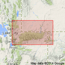
- AAPG geologic province:
-
- Central Western Overthrust
- Uinta basin
- Wasatch uplift
Summary:
Pg. 59. Nugget sandstone. About 500 feet of white sandstone with some intercalated reddish shales complete the section in Park City district, Utah. These were originally grouped with Ankareh shale, but subsequent work in adjoining areas, in which overlying beds are well represented, makes it apparent they represent lower part of upper portion of Nugget sandstone of Veatch (USGS Prof. Paper 56, 1907), and further described and mapped by Gale and Richards in USGS Bull. 430, 1910. Veatch's Nugget included at base 600+/- feet of reddish strata which properly belong to Ankareh shale, and in all later reports Nugget has been restricted to upper heavy white sandstones, which also include some shale beds. The beds in Park City district that are correlated with Nugget sandstone outcrop in ridges east and west of Iron Hollow, in extreme northwest corner of district. The overlie Ankareh shale [as here restricted]. [Boutwell in above report reduced thickness of Ankareh shale from 1,500+ feet, as given in his original definition, to 1,150+ feet.] [Age is Middle(?) Jurassic.]
Source: US geologic names lexicon (USGS Bull. 896, p. 1519-1520).
- Usage in publication:
-
- Nugget sandstone*
- Modifications:
-
- Revised
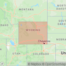
- AAPG geologic province:
-
- Snake River basin
Summary:
Pg. 31-42. Nugget sandstone. Divided rocks of Fort Hall Indian Reservation, southeastern Idaho, as follows (descending):
Twin Creek limestone.
Nugget sandstone (descending, main sandstone member 1,500 [feet], red and light-colored sandstones; Wood shale member 250, red; Deadman limestone member 150+/-; Higham grit member 500+/-).
Ankareh sandstone 800.
Thaynes group 3,650 (chiefly limestones, some sandstone and shale).
Woodside shale 900.
Source: US geologic names lexicon (USGS Bull. 896, p. 1519-1520).
- Usage in publication:
-
- Nugget sandstone*
- Modifications:
-
- Revised
- AAPG geologic province:
-
- Snake River basin
Summary:
Nugget sandstone. Restricted to the upper or "main sandstone member" of earlier reports, elevated Wood, Deadman, Higham to rank of formations, and replaced Ankareh sandstone of that area with Timothy sandstone. According to his 1927 report (USGS Prof. Paper 152) the Nugget sandstone as now recognized in southeastern Idaho, is = upper part of Veatch's typical Nugget of southwestern Wyoming, and of Gale and Richard's Nugget of southeastern Idaho, but includes more than Boutwell's Nugget of northeastern Utah; and Ankareh appears not to be applicable to any specific unit in southeastern Idaho. [Age is Middle(?) Jurassic.]
Source: US geologic names lexicon (USGS Bull. 896, p. 1519-1520).
- Usage in publication:
-
- Nugget sandstone*
- Modifications:
-
- Areal extent
Summary:
Pg. 3. It is believed that typical Nugget sandstone of southwestern Wyoming and Wasatch Mountains is direct equivalent of Navajo sandstone. [For further details see pages listed in index to volume cited.]
Source: US geologic names lexicon (USGS Bull. 896, p. 1519-1520).
- Usage in publication:
-
- Nugget sandstone*
- Modifications:
-
- Areal extent
- AAPG geologic province:
-
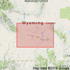
- Big Horn basin
- Green River basin
- Wind River basin
- Yellowstone province
Summary:
Nugget sandstone. Sandstone. In outcrop is buff, red or gray with color not always following bedding, fine- to medium-grained, typically containing abundant rounded frosted to polished grains, massive to thin-bedded with some highly cross-bedded zones, moderately soft but forms cliffs. Thin red shales occur in lower part, and a thin cherty limestone is present locally in upper 75 feet. Absent in northeastern part of Wind River basin. Except in southwestern corner, the base is sharply defined and hence is a good contouring horizon. In subsurface is salmon-red in color except where reduced to gray by oil staining, fine- to medium-grained, characterized by abundant frosted to polished grains. Base is easily picked in samples and electric logs. Overlies Popo Agie member of Chugwater formation. Underlies Middle Jurassic sequence of gypsum, red shale, and dolomite beds [Gypsum Spring formation] throughout most of Wind River basin except in southeastern part. There the gypsiferous rocks are absent and the Nugget is overlain by Upper Jurassic fine-grained gray marine sandstones and green shales. Thickness 500 feet at southwest margin of Wind River basin, thins to north and east, and is absent in most places north of Owl Creek Mountains and along eastern margin of basin. Age is Early Jurassic. Nugget sandstone has been included in Chugwater formation by some geologists; in Lost Soldier district and in Steamboat Butte field where oil was found in it [Nugget], it is called lower Sundance sand. This sandstone is called Wyopo formation by some geologists.
[Recognized in subsurface of Fremont, Hot Springs, Washakie, Natrona, Sweetwater, Sublette, and Teton Cos., central WY.]
Source: Publication; US geologic names lexicon (USGS Bull. 1200, p. 2781-2782).
- Usage in publication:
-
- Nugget sandstone
- Modifications:
-
- Areal extent
- AAPG geologic province:
-
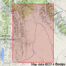
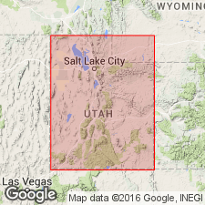
- Wasatch uplift
- Uinta uplift
Summary:
Pg. 1273, 1275, strat. sections. Nugget sandstone. In western Uinta and central Wasatch Mountains, overlies Stanaker formation (new) which includes some strata classed as Nugget by Boutwell (USGS Prof. Paper 77, 1912). Underlies Twin Creek limestone. Thickness 1,183 to 1,293 feet. Nugget persists eastward but is called Navajo beyond Whiterocks Canyon. [Age is Early Jurassic.]
Source: US geologic names lexicon (USGS Bull. 1200, p. 2781-2782).
- Usage in publication:
-
- Nugget sandstone*
- Modifications:
-
- Areal extent
Love, J.D., Tourtelot, H.A., Johnson, C.O., Thompson, R.M., Sharkey, H.H.R., and Zapp, A.D., 1947, Stratigraphic sections of Mesozoic rocks in central Wyoming: Wyoming Geological Survey Bulletin, no. 38, 30 p.
Summary:
Pg. 23, 33, 34, 43-44, 50-51, 59. Nugget sandstone. Stratigraphic sections in central Wyoming show Nugget underlying Gypsum Spring formation and overlying Popo Agie member of Chugwater. [Age is Early Jurassic.]
Source: US geologic names lexicon (USGS Bull. 1200, p. 2781-2782).
- Usage in publication:
-
- Nugget sandstone*
- Modifications:
-
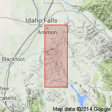
- Areal extent
- AAPG geologic province:
-
- Snake River basin
- Wasatch uplift
Summary:
Pg. 35-36, pl. 1. Nugget sandstone. Described in Ammon and Paradise Valley quadrangles, Idaho, where it is estimated to be 1,000 to 1,500 feet thick. Overlies Wood shale; underlies Twin Creek limestone. Age is Early Jurassic.
Source: US geologic names lexicon (USGS Bull. 1200, p. 2781-2782).
- Usage in publication:
-
- Nugget sandstone*
- Modifications:
-
- Revised
- AAPG geologic province:
-
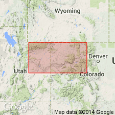
- Denver basin
- Green River basin
Pipiringos, G.N., 1953, Correlation of marine Jurassic and related rocks in the Laramie basin, Wyoming: Wyoming Geological Association Field Conference Guidebook, no. 8, p. 34-39., Prepared in conjunction with University of Wyoming
Summary:
p. 36 (chart), 37, correlation chart. Nugget sandstone. Expanded at base to include 50 feet of strata formerly included in Jelm Formation as originally defined. Age is Early Jurassic.
[Study area in Albany and Carbon Cos., southeastern WY, and Larimer Co., central northern CO.]
Footnote, p. 34, This is a condensed revised vers. of MS thesis, Univ. Wyoming, to appear as Wyoming Geol. Survey Bull. 47, in press [1957].
Source: Publication; US geologic names lexicon (USGS Bull. 1200, p. 2781-2782).
- Usage in publication:
-
- Nugget sandstone
- Modifications:
-
- Areal extent
Summary:
Pg. 47-48. In northwestern Wyoming, overlies Deadman limestone or upper Popo Agie beds; unconformably underlies Gypsum Spring formation. Thickness 54 to 354 feet. [Age is Early Jurassic.]
Source: US geologic names lexicon (USGS Bull. 1200, p. 2781-2782).
- Usage in publication:
-
- Nugget sandstone
- Modifications:
-
- Areal extent
- AAPG geologic province:
-
- Green River basin
- Denver basin
Summary:
Pg. 8-10, 12 (table 2), 13, 17-19, pl. 5. Type Nugget, 1,900 feet thick, overlies the Thaynes and underlies the Twin Creek. It is divided into two members which Veatch (1907) separately mapped. Boutwell (1907) applied name Ankareh to a 1,300-foot sequence in Park City mining district, Utah, whose stratigraphic position is identical to that of original Nugget (resting on Thaynes and overlain by Twin Creek). Subsequent workers [see bibliography this report] in adjacent and intervening areas have tried to retain both names, not as equivalents, but by restricting name Ankareh to basal redbed unit of original Ankareh and Nugget formations, and by restricting name Nugget to the overlying thick sandstone unit. These workers did not agree as to where Nugget-Ankareh boundary should be drawn; hence, there is little agreement as to what names to use for subdivisions in sequence overlying the Thaynes and underlying the Twin Creek. Presumably Nugget sandstone (upper member of Nugget formation of Veatch) is similar to Nugget of central Wyoming as described by Love and others (1945, 1947). Term Nugget sandstone is here applied [Laramie basin] to those rocks overlying Jelm formation and underlying Sundance formation. Sandstone grades, within a few feet, downward into upper conglomeratic member of Jelm and is overlain by Canyon Springs member of Sundance. The Nugget of this paper constitutes upper part of original Jelm formation and is here correlated with upper part of Nugget sandstone of central Wyoming and with so-called Entrada of northern part of Colorado Front Range. Thickness 40 to 110 feet. [Age is Early Jurassic.]
Source: US geologic names lexicon (USGS Bull. 1200, p. 2781-2782).
- Usage in publication:
-
- Nugget sandstone
- Modifications:
-
- Revised
- AAPG geologic province:
-
- Green River basin
Summary:
Pg. 129-130. Nugget sandstone. Stratigraphically restricted above to exclude unit here named Kendall sandstone member of Gypsum Spring formation.
Source: US geologic names lexicon (USGS Bull. 1200, p. 2781-2782).
- Usage in publication:
-
- Nugget Sandstone
- Modifications:
-
- Not used
- AAPG geologic province:
-
- Green River basin
- Uinta uplift
Summary:
Name Glen Canyon Sandstone applied to the thick sandstones overlying Chinle Formation in Uinta Mountains, northeastern Utah, and Dinosaur National Monument area, northwestern Colorado. Previously called Nugget or Navajo.
Source: Publication.
- Usage in publication:
-
- Nugget Sandstone*
- Modifications:
-
- Revised
- Age modified
- AAPG geologic province:
-
- Green River basin
- Wind River basin
Summary:
Pg. D3 (fig. 2), D5 (fig. 4), D10-D11 (fig. 7), D16-D18. Nugget Sandstone. The Nugget of south-central Wyoming, revised to include basal Bell Springs Member (new) of Triassic(?) age. Age of formation is tentatively changed from Early Jurassic --to-- Triassic(?) and Jurassic(?), based on stratigraphic relations. Lies below Gypsum Spring Formation and above Popo Agie Formation; bounded by unconformities.
Source: Publication; Changes in stratigraphic nomenclature, 1968 (USGS Bull. p. A13).
- Usage in publication:
-
- Nugget Sandstone*
- Modifications:
-
- Overview
For more information, please contact Nancy Stamm, Geologic Names Committee Secretary.
Asterisk (*) indicates published by U.S. Geological Survey authors.
"No current usage" (†) implies that a name has been abandoned or has fallen into disuse. Former usage and, if known, replacement name given in parentheses ( ).
Slash (/) indicates name conflicts with nomenclatural guidelines (CSN, 1933; ACSN, 1961, 1970; NACSN, 1983, 2005, 2021). May be explained within brackets ([ ]).