

- Usage in publication:
-
- Notch Peak formation*
- Modifications:
-
- Original reference
- Dominant lithology:
-
- Limestone
- AAPG geologic province:
-
- Great Basin province
Summary:
Pg. 9. Notch Peak formation. Gray arenaceous limestone in more or less massive layers. Thickness 1,890 feet. Overlies Orr formation. [Age is Late Cambrian.]
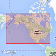
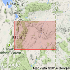
Type locality: upper part of main mass of Notch Peak, House Range, western UT.
Source: US geologic names lexicon (USGS Bull. 896, p. 1518).
- Usage in publication:
-
- Notch Peak Formation*
- Modifications:
-
- Revised
- AAPG geologic province:
-
- Great Basin province
Summary:
Overlies Sneakover Limestone Member (new) of Orr Formation in the Deep Creek Range, House Range, and Wah Wah Mountains, UT in the Great Basin province. Is of Late Cambrian age.
Source: GNU records (USGS DDS-6; Denver GNULEX).
- Usage in publication:
-
- Notch Peak Formation*
- Modifications:
-
- Principal reference
- Revised
- Reference
- Dominant lithology:
-
- Limestone
- Dolomite
- Mudstone
- AAPG geologic province:
-
- Great Basin province
Summary:
Name applied to sequence above Sneakover Limestone Member of Orr Formation and below House Limestone. Basal contact easy to select. Sneakover is a silty, medium-bedded, ledge-forming lime-mudstone with phosphatic brachiopods and trilobites. Basal Notch Peak forms massive cliffs and is barren of shelly fossils. Composed of medium-brown-gray to dark gray lime mudstone and medium gray massive limestone with algal stromatolites and gray, medium- to coarse-crystalline medium- to thick-bedded dolomite. Some mudstone beds are thin to thick bedded. Forms resistant cliffs. Divisible in many localities where a bioclastic, thinly bedded, bench, slope and low ledge-forming, brown-weathering lime grainstone named Red Tops Member present. Underlying part named Hellnmaria Member. Overlying part named Lava Dam Member. Principal reference section 1,707 ft thick designated and measured in Ts19 and 20S, R13W. Reference section 1,827 ft thick designated and measured in SW1/4 sec 30, T24S, R14W to E1/2 sec 4, T25S, R15W. Sections measured in Juab Co, UT, Great Basin province. Reference section (undivided) 1,207 ft thick designated and measured in sec 3, T13S, R14W. Correlates with part of Chokecherry Dolomite, Dugway Ridge Dolomite, and upper member Ajax Dolomite. Ranges from late Franconian, through Trempealeauan into early Canadian. Late Cambrian and Early Ordovician age. Correlation chart.
Source: GNU records (USGS DDS-6; Denver GNULEX).
- Usage in publication:
-
- Notch Peak Formation*
- Modifications:
-
- Revised
Miller, J.F., Evans, K.R., Loch, J.D., Ethington, R.L., and Stitt, J.H., 2001, New lithostratigraphic units in the Notch Peak and House Formations (Cambrian-Ordovician), Ibex area, western Millard County, Utah: Brigham Young University Geology Studies, v. 46, p. 35-69.
Summary:
Contact between Notch Peak Formation and House Limestone is placed above a widespread thin trilobite coquina bed with abundant SYMPHYSURINA at top of the Notch Peak Formation and below a distinctive interval of limestone that has 30 to 50 percent white to brown to black chert. Contact is conformable in Wah Wah Mountains and House Range, but is unconformable in Drum Mountains and northward.
Source: Publication.
For more information, please contact Nancy Stamm, Geologic Names Committee Secretary.
Asterisk (*) indicates published by U.S. Geological Survey authors.
"No current usage" (†) implies that a name has been abandoned or has fallen into disuse. Former usage and, if known, replacement name given in parentheses ( ).
Slash (/) indicates name conflicts with nomenclatural guidelines (CSN, 1933; ACSN, 1961, 1970; NACSN, 1983, 2005, 2021). May be explained within brackets ([ ]).