

- Usage in publication:
-
- North Boulder Group†
- Modifications:
-
- Abandoned
Summary:
Name North Boulder Group as applied to coarse facies of Belt Series in the Northern Rocky Mountain region in Jefferson Co, MT is unsatisfactory and should be abandoned. It was not described, no type was designated, exposures adjacent to the North Boulder River are folded and faulted, and geographic name North Boulder River has been changed to Boulder River. Rocks formerly assigned to it are reassigned to the LaHood Formation (new).
Source: GNU records (USGS DDS-6; Denver GNULEX).
- Usage in publication:
-
- North Boulder formation*
- Modifications:
-
- Overview
- AAPG geologic province:
-
- Northern Rocky Mountain region
Summary:
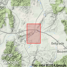
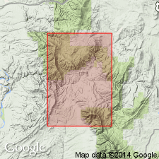
Assigned to a sequence less than 4,000 ft thick that underlies a 3 sq mi area, west-central part of quad in Gallatin Co, MT, Northern Rocky Mountain region, as a formation of Belt series. Belt has not been divided here or nearby. Assignment to Belt--probably upper Belt--though not typical of Belt. [Compare with Peale, 1893 and 1896.] Composed of brown, coarse, thick-bedded, micaceous, feldspathic sandstone. Many layers show graded bedding; some contain numerous flat pebbles parallel to bedding. Poor sorting and poor rounding are characteristic. Micaceous olive-gray siltstone separates many sandstone beds, especially in upper part. Lenses of subround cobble (of quartz, quartzite, granite pegmatite, diorite, gneiss, amphibolite, diabase) conglomerate abundant near base. Same rocks called LaHood formation by Alexander, 1955. Can be dated only by the fact that Flathead sandstone or Wolsey shale disconformably overlie it. Is a marine geosynclinal or unstable shelf type of deposit. Considered upper Precambrian. Geologic map.
Source: GNU records (USGS DDS-6; Denver GNULEX).
- Usage in publication:
-
- North Boulder Group*†
- Modifications:
-
- Abandoned
Summary:
Designation North Boulder Group of Belt Supergroup abandoned and replaced in Northern Rocky Mountain region by LaHood Formation (adopted).
Source: GNU records (USGS DDS-6; Denver GNULEX).
For more information, please contact Nancy Stamm, Geologic Names Committee Secretary.
Asterisk (*) indicates published by U.S. Geological Survey authors.
"No current usage" (†) implies that a name has been abandoned or has fallen into disuse. Former usage and, if known, replacement name given in parentheses ( ).
Slash (/) indicates name conflicts with nomenclatural guidelines (CSN, 1933; ACSN, 1961, 1970; NACSN, 1983, 2005, 2021). May be explained within brackets ([ ]).