- Usage in publication:
-
- Nomlaki tuff member
- Modifications:
-
- Original reference
- Dominant lithology:
-
- Tuff
- AAPG geologic province:
-
- Sacramento basin
Summary:
Pg. 12-15. Nomlaki tuff member of Tehama formation; Nomlaki tuff member of Tuscan formation. A massive coarse-grained pumice tuff member that occurs near base of Tehama formation and also near base of Tuscan formation. Is of dacitic composition and consists of white pumice fragments embedded in a medium- to light-gray matrix of glass and crystal shards. Most of pumice fragments are less than 3 inches maximum diameter, but they occasionally exceed 1 foot. Upper 6 feet of the tuff has a salmon-pink color, in marked contrast to the predominant gray below. Thickness variable; in Tehama County, northern California, the maximum is 50 feet. A separate designation for this tuff member seems advisable because of its highly distinctive appearance, dacitic composition in contrast to the andesitic Tuscan, much wider distribution, and value as a horizon marker. The Tehama formation with exception of this tuff member contains only a very subordinate amount of volcanic debris. The tuff member is therefore named for its good exposures on old Nomlaki Indian Reservation, in Tehama County, northern California. [Age is Pliocene.]
Source: US geologic names lexicon (USGS Bull. 896, p. 1506).

- Usage in publication:
-
- Nomlaki tuff
- Nomlaki tuff member
- Modifications:
-
- Principal reference
- Revised
- Dominant lithology:
-
- Tuff
- AAPG geologic province:
-
- Sacramento basin
Summary:
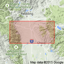
Pg. 243-247, pl. 3. Referred to as both Nomlaki tuff and Nomlaki tuff member of Tehama formation. Interbedded with both Tuscan and Tehama formations. Exposed for a distance of 40 miles along west side of Sacramento Valley; southerly exposure is in Stone Valley, northeastern corner of T. 20 N., R. 5 W., [Glenn County], where it is 15 feet thick. Thickness 42 feet at type locality, base not exposed; as much as 300 feet thick in Redding quadrangle where it unconformably overlies Chico formation. Age is late Pliocene. Type locality noted.
Type locality: at former headquarters of old Nomlaki Indian Reservation about 6 mi northeast of Paskenta, Tehama Co., northwestern CA.
Source: US geologic names lexicon (USGS Bull. 1200, p. 2757).
For more information, please contact Nancy Stamm, Geologic Names Committee Secretary.
Asterisk (*) indicates published by U.S. Geological Survey authors.
"No current usage" (†) implies that a name has been abandoned or has fallen into disuse. Former usage and, if known, replacement name given in parentheses ( ).
Slash (/) indicates name conflicts with nomenclatural guidelines (CSN, 1933; ACSN, 1961, 1970; NACSN, 1983, 2005, 2021). May be explained within brackets ([ ]).

