The National Geologic Map Database is migrating to a new infrastructure. We apologize for any service disruptions during this process.
|
|---|


- Usage in publication:
-
- Nolichucky shale*
- Modifications:
-
- Original reference
- Dominant lithology:
-
- Shale
- Limestone
- AAPG geologic province:
-
- Appalachian basin
Summary:
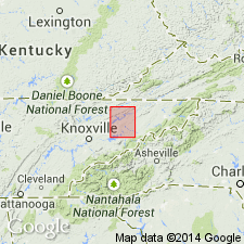
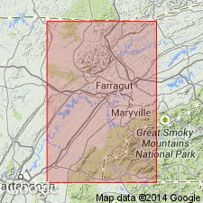
Pg. 2. Nolichucky shale. Calcareous shales and shaly limestones, with beds of massive blue limestone in upper portion. When fresh the shales and shaly limestones are bluish gray and gray, but they weather readily to various shales of yellow and greenish-yellow shale. Passing northeast to north of Holston River the limestone beds become more prominent and the shales more highly colored and calcareous. Thickness 400 to 750 feet. Very fossiliferous. Overlies Maryville limestone and underlies Knox dolomite. [Age is Late Cambrian.]
[Named from exposures along Nolichucky River, Greene Co., eastern TN. See also USGS Greeneville folio, no. 118, 1905.]
Source: US geologic names lexicon (USGS Bull. 896, p. 1505-1506).

- Usage in publication:
-
- Nolichucky shale*
- Modifications:
-
- Overview
- AAPG geologic province:
-
- Appalachian basin
Summary:
Foregoing [see Keith 1896 USGS Morristown folio (no. 27) entry] is original definition in type region. The name, however, first appeared in print in 1894, in USGS Estillville folio (no. 12), by M.R. Campbell, who accepted Keith's name, correlating the rocks of Estillville quadrangle with those of Nolichucky type locality. He described the formation as consisting of 500 to 730 feet of calcareous shale carrying lentils of blue limestone, the center of formation in Carter Valley consisting of a lentil of massive blue limestone 400 to 500 feet thick. Underlain by Maryville limestone and overlain by Knox dolomite.
Nolichucky shale. Named from exposures along Nolichucky River, Greene Co., eastern TN. Recognized in eastern Tennessee, western North Carolina, and southwestern Virginia. Age is Late Cambrian.
[See also USGS Greeneville folio, no. 118, 1905.]
Source: US geologic names lexicon (USGS Bull. 896, p. 1505-1506).
- Usage in publication:
-
- Nolichucky Shale
- Modifications:
-
- Revised
- AAPG geologic province:
-
- Appalachian basin
Summary:
The middle limestone member of the Nolichucky Shale in eastern TN was informally named the Bradley Creek Limestone Member by Helton (1967: Univ. of TN Ph.D. thesis). Because it is wide spread and easily recognized, lying between upper and lower unnamed shale members, the authors here formalize the unit as the Bradley Creek Member. In southwest VA, the name is applied only where the lower shale member of the Nolichucky pinches out and the limestone becomes the basal unit.
Source: GNU records (USGS DDS-6; Reston GNULEX).

- Usage in publication:
-
- Nolichucky Shale*
- Modifications:
-
- Areal extent
- AAPG geologic province:
-
- Appalachian basin
Summary:
The Nolichucky Shale of the Conasauga Group is used in the Rome thrust sheet in GA and AL. It overlies the Maryville Limestone and underlies the Maynardville Limestone. Age is Late Cambrian.
Source: GNU records (USGS DDS-6; Reston GNULEX).
- Usage in publication:
-
- Nolichucky Shale*
- Modifications:
-
- Areal extent
- AAPG geologic province:
-
- Appalachian basin
Summary:
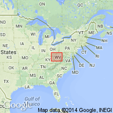
Geographically extended the Nolichucky Shale of the Conasauga Group into the subsurface of WV in the Rome trough of section F-F'. Overlies the Maryville Limestone and underlies the Maynardville Limestone, both of the Conasauga Group. Unit also extends into the OH-WV hinge zone in WV where is overlies the unnamed dolomite member of the Maryville and underlies the lower sandy member of the Gatesburg Formation. The Nolichucky is of Late Cambrian (Franconian) age.
Source: GNU records (USGS DDS-6; Reston GNULEX).
- Usage in publication:
-
- Nolichucky Shale*
- Modifications:
-
- Areal extent
- AAPG geologic province:
-
- Appalachian basin
Summary:
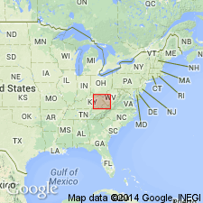
Geographically extended the Nolichucky Shale of the Conasauga Group into the subsurface of KY in the Rome trough as shown in section G-G'. Overlies the Maryville Limestone and underlies the Maynardville Limestone, both of the Conasauga Group. Unit extends eastward into the Valley and Ridge province of WV and VA. The Nolichucky is of Late Cambrian age.
Source: GNU records (USGS DDS-6; Reston GNULEX).
For more information, please contact Nancy Stamm, Geologic Names Committee Secretary.
Asterisk (*) indicates published by U.S. Geological Survey authors.
"No current usage" (†) implies that a name has been abandoned or has fallen into disuse. Former usage and, if known, replacement name given in parentheses ( ).
Slash (/) indicates name conflicts with nomenclatural guidelines (CSN, 1933; ACSN, 1961, 1970; NACSN, 1983, 2005, 2021). May be explained within brackets ([ ]).