The National Geologic Map Database is migrating to a new infrastructure. We apologize for any service disruptions during this process.
|
|---|


- Usage in publication:
-
- Nipper formation
- Modifications:
-
- Original reference
- Dominant lithology:
-
- Volcanics
- AAPG geologic province:
-
- Pedregosa basin
Summary:
Pg. 1323, 1325, pl. 1. Nipper formation. Lower half of formation is thick conglomerate of mafic volcanic rocks. The poorly sorted well-rounded cobbles and boulders range up to several feet in diameter, and are tightly cemented in matrix of graywacke sandstone. Very dark purple and green dominant colors. South of Nippers, a 20-foot bed of Paleozoic limestone conglomerate is interstratified with this sequence. Light-weathering aphanitic andesite flows comprise much of upper part of formation. Underlies Faraway Ranch formation; overlies Bisbee group at some localities and unconformably overlies upper Paleozoic strata at others. Age is Late Cretaceous to Tertiary.
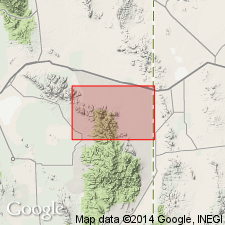
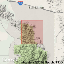
Type locality: at The Nippers and other hills south of Blue Mountains in southwest corner of Vanar quadrangle, Cochise Co., southeastern AZ. Also forms ridge between Whitetail and Indian Creeks, in sec. 20, T. 18 S., R. 30 E., and occurs southwest of Cochise Head, Cochise Co. Named from The Nippers [in secs. 25 and 30, T. 26 S., R. 30 and 31 E., Lat. 32 deg. 00 min. 44 sec. N., Long. 109 deg. 13 min. 13 sec. W., Blue Mountain 7.5-min quadrangle, Cochise Co., southeastern AZ].
[Additional locality information from USGS GNIS database and ACME Mapper 2.0, accessed June 28, 2009.]
Source: US geologic names lexicon (USGS Bull. 1200, p. 2750).

- Usage in publication:
-
- Nipper Formation*
- Modifications:
-
- Age modified
- AAPG geologic province:
-
- Basin-and-Range province
Summary:
Is formation of Sabins (1957) in northern Chiricahua Mountains, Cochise Co, AZ in Basin-and-Range province. Overlies Lower Cretaceous and Paleozoic rocks with angular unconformity. Underlies Faraway Ranch Formation (tentatively mid-Tertiary) of Enlows (1951). Is correlated with andesitic rocks in lower part of Salero Formation (Campanian and Maestrichtian, Upper Cretaceous). Age refined to probable Campanian age on basis of correlation. [See fig. 5 for regional correlation.]
Source: GNU records (USGS DDS-6; Denver GNULEX).
- Usage in publication:
-
- Nipper Formation*
- Modifications:
-
- Age modified
- AAPG geologic province:
-
- Pedregosa basin
Summary:
Nipper Formation of Sabins (1957). Andesitic or dacitic lava flows, epiclastic rocks, and small masses of intrusive rocks. Commonly greenish-gray and strongly propylitized. Contains about 10 percent phenocrysts (plagioclase, clinopyroxene, and magnetite). Includes conglomerate marker bed near base. Thickness as much as 200 m. Possible correlative of "dacite of Davis Mountain"; sample from a few 100 m south of map area yielded a fission-track age (zircon) of 28.6 +/-1.2 Ma (C.W. Naeser, written commun., 1979; Drewes, 1980). Age is Oligocene.
Source: Publication.
For more information, please contact Nancy Stamm, Geologic Names Committee Secretary.
Asterisk (*) indicates published by U.S. Geological Survey authors.
"No current usage" (†) implies that a name has been abandoned or has fallen into disuse. Former usage and, if known, replacement name given in parentheses ( ).
Slash (/) indicates name conflicts with nomenclatural guidelines (CSN, 1933; ACSN, 1961, 1970; NACSN, 1983, 2005, 2021). May be explained within brackets ([ ]).