The National Geologic Map Database is migrating to a new infrastructure. We apologize for any service disruptions during this process.
|
|---|


- Usage in publication:
-
- Newman limestone*
- Modifications:
-
- Named
- Dominant lithology:
-
- Limestone
- Shale
- Sandstone
- AAPG geologic province:
-
- Appalachian basin
Summary:
According to Wilmarth (1938, US geologic names lexicon, USGS Bull. 896), Newman limestone first used in this report. Total thickness 829 ft. Lower 600 ft is heavy blue limestone becoming cherty towards base. Succeeding 150 ft is limestone and interbedded shale. Upper 75 ft is shale and interbedded sandstone. Underlain by Grainger shale; overlain by Pennington shale.
Source: GNU records (USGS DDS-6; Reston GNULEX).
- Usage in publication:
-
- Newman Limestone
- Modifications:
-
- Areal extent
- AAPG geologic province:
-
- Appalachian basin
Summary:
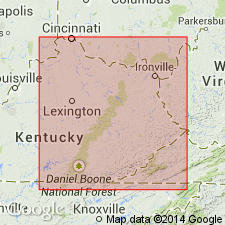
The name Newman Limestone restricted from the Cumberland Escarpment in eastern Kentucky, from the northern border to the southern border. Rock renamed Slade Formation. Name changed because Newman has not been used consistently, and because it has been used differently from original definition. Underlain by Borden Formation; overlain by Paragon Formation (new).
Source: GNU records (USGS DDS-6; Reston GNULEX).
- Usage in publication:
-
- Newman Limestone
- Modifications:
-
- Overview
- AAPG geologic province:
-
- Appalachian basin
Summary:
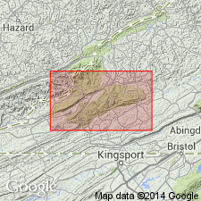
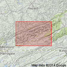
Mississippian Newman Limestone of southeastern KY is here divided into informal lower and upper lithologic members. Lower member is composed principally of limestone with lesser dolomite and shale, and minor amounts of siltstone and sandstone. Upper member consists of shale with varied amounts of interbedded limestone, dolomite, siltstone, and sandstone. Complete section exposed in the Harlan quarry and adjacent roadcuts on Pine Mountain, along south side of U.S. Hwy 421, 7.2 mi north of Harlan County Court House in town of Harlan. Thickness of lower member is 407 ft and upper member, 124.5 ft. Lower member further divided into subunits A-D. Subunit C, 15 ft thick, equivalent to Taggard Red Member of Wilpolt and Marden (1959). Newman underlies Pennington Formation and overlies Grainger Formation.
Source: GNU records (USGS DDS-6; Reston GNULEX).

- Usage in publication:
-
- Newman Limestone
- Modifications:
-
- Overview
- AAPG geologic province:
-
- Appalachian basin
Summary:
Newman Limestone mapped in Roane Co., eastern TN. Consists of light- to medium-gray, very fine to medium-grained, generally thick-bedded, locally oolitic limestone. Newman is equivalent to all Mississippian limestone formations extending from the Bangor down through the Warsaw. No complete section of this unit occurs in Harriman quad. because of faulting. Upper 160 ft is equivalent to the Bangor Limestone and is medium- to dark-gray, medium-grained with zones of medium-gray to light olive-gray shale. Hartselle Formation equivalent is composed of light-gray to light olive-gray, very fine grained, calcareous sandstone and calcareous shale approximately 70 ft thick. Monteagle Limestone equivalent, 330 ft thick, is light- to medium-gray and light olive gray, fine to medium-grained with some scattered oolitic and shaly zones. St. Louis Limestone equivalent, 80 ft thick, is medium-gray, some light gray, very fine to fine-grained and dolomitic, with medium- to dark-gray chert. Warsaw Limestone equivalent, 40 ft thick, is light to medium-gray, fine- to medium-grained, sandy with crinoidal chert. Individual formations are not mappable in this area because of scarcity of exposures due to heavy colluvial cover. Total thickness of Newman approximately 570 ft. Underlies Pennington Formation and overlies Lower Mississippian Fort Payne Formation. Age is Late Mississippian.
Source: GNU records (USGS DDS-6; Reston GNULEX).
- Usage in publication:
-
- Newman Limestone*
- Modifications:
-
- Revised
- Overview
- AAPG geologic province:
-
- Appalachian basin
Summary:
Report corrects identification of units in pilot bore section by Vanover and others (1989, Itinerary, Day 2-Pilot bore traverse, IN Dean, C.S., and Moshier, S.O., eds., Cumberland Mountain: the inside story: Geological Survey of Kentucky Field Trip Guidebook, p. 24-30) and by Vanover (1989, Pilot tunnel stratigraphy, IN Dean, C.S., and Moshier, S.O., eds., Cumberland Mountain: the inside story: Geological Survey of Kentucky Field Trip Guidebook, p. 39-43). Rocks identified as lower member of Pennington Formation are here re-identified as upper part of upper unnamed member of Newman Limestone. Although Newman-Pennington contact is gradational and therefore may not always be placed at same position everywhere, lower unnamed member of Pennington, as well as that of equivalent Hinton Formation, is resistant, quartzose ripple-bedded Stony Gap Member [of Hinton Formation]. It was misidentified as Pinnacle Overlook Member of Lee Formation by Vanover and others (1989), Vanover (1989), and Watson and Ettensohn (1991, Nature and origin of the Mississippian-Pennsylvanian unconformity in the Cumberland Gap area [abs.]: Geological Society of America Abstracts with Programs, [no volume given], p. 146). Lowest unnamed member of Newman Limestone is also known as Greenbrier Limestone elsewhere in the Appalachian basin. Upper unnamed member of Newman is also known as Bluefield Formation northeast of Cumberland Gap. Upper member is lithically similar to Newman of original description by Campbell (1893) as well as to Bluefield Formation of current usage. Gradational contact between lower and upper members of Newman corresponds to Greenbrier-Bluefield contact and separates dominantly limestone rocks from overlying nonresistant shaly sequence.
Source: GNU records (USGS DDS-6; Reston GNULEX).
For more information, please contact Nancy Stamm, Geologic Names Committee Secretary.
Asterisk (*) indicates published by U.S. Geological Survey authors.
"No current usage" (†) implies that a name has been abandoned or has fallen into disuse. Former usage and, if known, replacement name given in parentheses ( ).
Slash (/) indicates name conflicts with nomenclatural guidelines (CSN, 1933; ACSN, 1961, 1970; NACSN, 1983, 2005, 2021). May be explained within brackets ([ ]).