

- Usage in publication:
-
- Newcastle sandstone member*
- Modifications:
-
- Named
- Dominant lithology:
-
- Sandstone
- Shale
- AAPG geologic province:
-
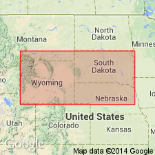
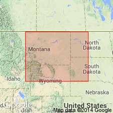
- Powder River basin
Summary:
Named as a member of Graneros shale of Colorado group for the town of Newcastle, Weston Co, WY in Powder River basin, where member is conspicuously developed. Consists of reddish to light-yellow sandstone associated with black, carbonaceous shale. About 35 ft thick in vicinity of Newcastle. Type section not given. Gives incomplete section northwest of Wright's camp, near the north end of Old Woman anticline, Niobrara Co, WY in which the member is 36+ ft thick. Underlain by unnamed black shale member; overlain by unnamed dark, sandy shale member, both of Graneros. Doubtless widely distributed throughout WY. Recognized on south slope of Como Ridge, about 6 mi east of Medicine Bow, WY and is in all probability equivalent to the sand that occurs near middle of Thermopolis shale at different localities in Bighorn basin, and is commonly known to drillers as Muddy sand. Late Cretaceous in age. Geologic map. Stratigraphic table.
Source: GNU records (USGS DDS-6; Denver GNULEX).
- Usage in publication:
-
- Newcastle sandstone*
- Modifications:
-
- Revised
- Age modified
- Areal extent
- AAPG geologic province:
-
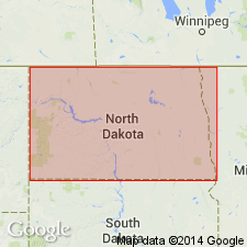
- Williston basin
Summary:
Given formational rank in chart showing representative Cretaceous sequence in the northern Great Plains in Williston and Powder River basins and on Chadron arch. Removed from Colorado group. Separated from underlying Skull Creek shale by an unconformity representing late Albian time. Overlain conformably by Mowry shale. Late Cretaceous (Cenomanian) in age.
Source: GNU records (USGS DDS-6; Denver GNULEX).
- Usage in publication:
-
- Newcastle sandstone member
- Modifications:
-
- Revised
- Biostratigraphic dating
- AAPG geologic province:
-
- Chadron arch
- Williston basin
- Powder River basin
Summary:
Pg. 83, 84 (fig. 1), 85, 88, 90. Newcastle sandstone, formerly regarded as a member of Graneros shale by Hancock (1920, USGS Bull. 716, p. 39, 42, 96), is herein assigned to Lower Cretaceous. Area of report, Black Hills of Wyoming and South Dakota. Table 1 (p. 85) shows Newcastle sandstone member in Skull Creek group, above Skull Creek shale and below Mowry shale. Thickness 0 to 100 feet. Consists of discontinuous beds of ripple-marked, cross-bedded sandstone with clay and carbonaceous shale interbeds. Some impure lignite and thin bentonites. Some shaly beds contain marine fossils. Dinosaur remains in some beds (citing Dobbin and Horn, 1949, USGS Oil and Gas Inv. Prelim. Map 103). Foraminifera identified (e.g., VERNEUILINA, AMMOBACULITES, AMMOBACULOIDES, HAPLOPHRAGMOIDES, AMMOMARGINULINA(?), HAPLOSITCHE(?), SPIROPLECTAMMINA, TEXTULARIA, QUINQUELOCULINA, ROBULUS, RZEHAKINA, CORNUSPIRA); assemblage is present in both the Newcastle sandstone and the Skull Creek shale, but is absent from the Mowry (Graneros) shale indicating the Newcastle is more closely related to the Skull Creek than to the Mowry (Graneros). Cites evidence for deposition in nearshore environment. Age is Early Cretaceous. Report includes map showing outcrop areas, generalized stratigraphic section, table of spectrometric analyses comparing sample of gold from well core with samples from 3 mines in area.
[Remark (ca. 2007): the "Newcastle sandstone member of Skull Creek group" does not follow the graduated sequence of terms (member, formation, group) described in nomenclature guidelines (CSN, 1933). When employing Cowley's classification, please use the following format: Newcastle Sandstone Member of Skull Creek Group (usage of Cowley, 1951).
Misprint: GNU staff (USGS DDS-6; Denver GNULEX) inferred a formation rank for the Newcastle which was clearly not the author's intention.]
Source: Publication; US geologic names lexicon (USGS Bull. 1200, p. 2718-2719).
- Usage in publication:
-
- Newcastle sandstone*
- Modifications:
-
- Overview
- AAPG geologic province:
-
- Williston basin
- Powder River basin
- Chadron arch
Summary:
Classed as a formation on the western rim of the Black Hills, WY in Powder River basin; as a member of Graneros shale in Lance Creek region, Niobrara Co, WY in Powder River basin; and on the southern, eastern, and northern rim of the Black Hills in western SD, in Williston basin and on Chadron arch. Early Cretaceous (Albian) in age.
Source: GNU records (USGS DDS-6; Denver GNULEX).
- Usage in publication:
-
- Newcastle formation
- Modifications:
-
- Revised
- Overview
- AAPG geologic province:
-
- Chadron arch
- Williston basin
- Powder River basin
Summary:
Redefined as a formation. Shows lithologic details in 27 sections measured on west, north, and east sides of the Black Hills in Williston and Powder River basins and on the Chadron arch. Discriminates two phases: a carbonaceous phase on the west and northwest flanks of the Black Hills, and a non-carbonaceous phase on the east flank of the Black Hills. Thickens into lenses in seven separate areas along the outcrop. The lenses are named, clockwise, Newcastle, Osage, New Haven, and Little Missouri lenses, all in SD. Was deposited near the shore of a small island in the western part of the present Black Hills uplift. Early Cretaceous in age.
Source: GNU records (USGS DDS-6; Denver GNULEX).
- Usage in publication:
-
- Newcastle formation
- Modifications:
-
- Areal extent
- AAPG geologic province:
-
- Williston basin
Summary:
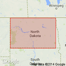
Extends name into the subsurface of the Williston basin in North Dakota in a series of correlation diagrams. A formation in Dakota group. Overlain by Mowry formation; underlain by Skull Creek formation. Early Cretaceous in age.
Source: GNU records (USGS DDS-6; Denver GNULEX).
- Usage in publication:
-
- Newcastle sandstone*
- Modifications:
-
- Overview
- Dominant lithology:
-
- Bentonite
- AAPG geologic province:
-
- Williston basin
- Powder River basin
Summary:
Describes bentonite bed--referred to as bed A, or the Newcastle bentonite bed--in upper part of formation on north side of the Black Hills, MT, WY, and SD, in Powder River and Williston basins. Is generally 3-5 ft thick but locally 30 ft thick in sec 6, T56N, R62W, Crook Co, WY. Shows distribution of bentonite and gives results of tests for use as sand bonding clay and drilling mud. Early Cretaceous in age.
Source: GNU records (USGS DDS-6; Denver GNULEX).
- Usage in publication:
-
- Newcastle sandstone*
- Modifications:
-
- Overview
Summary:
Correlation with other Cretaceous units in Powder River basin northeast WY, Wind River basin central WY, and Denver basin southeast WY, northeast and south-central CO shown on fig. 19.
Source: GNU records (USGS DDS-6; Denver GNULEX).
- Usage in publication:
-
- Newcastle sandstone member
- Modifications:
-
- Overview
- Dominant lithology:
-
- Sandstone
- Shale
- Bentonite
- Coal
- AAPG geologic province:
-
- Williston basin
- Powder River basin
- Chadron arch
Summary:
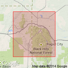
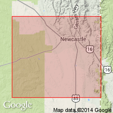
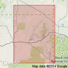
Designated a member of Skull Creek formation. Establishes type section in NW1/4 NW1/4 sec 28, T45N, R61W, on northwest side of cut on U.S. Hwy 85, 0.4 mi northeast of its junction with U.S. Hwy 16, 1 mi east of Newcastle, Weston Co, WY in Powder River basin. Consists of sandstone interbedded with shale, sandy shale, bentonite, and minor impure coal. Thickness 93 ft. Conformable with overlying Mowry shale and with underlying Skull Creek shale. Gives detailed sections at 14 other places on flanks of Black Hills in Crook and Weston Cos, WY, and in Butte, Meade, Pennington, and Custer Cos, SD, in Powder River and Williston basins and on Chadron arch. Lists arenaceous Foraminifera from Skull Creek shale, basal shale of Newcastle sandstone, and lower part of Mowry shale. Deposited as a chain of lenticular offshore bars rimming a low, forested landmass of smaller area than the present Black Hills. Early Cretaceous (Albian) in age.
Source: GNU records (USGS DDS-6; Denver GNULEX).
- Usage in publication:
-
- Newcastle Formation
- Modifications:
-
- Overview
- Dominant lithology:
-
- Sandstone
- Coal
- Bentonite
- Siltstone
- Shale
- AAPG geologic province:
-
- Powder River basin
Summary:
Detailed stratigraphic study in vicinity of Newcastle, Weston Co, WY in Powder River basin. Relocates type section to SW1/4 SW1/4 SW1/4 sec 21, T45N, R61W, Weston Co, WY, along U.S. Hwy 85, northern outskirts of Newcastle. Detailed section at type locality shown graphically with abbreviated description of lithologic units. Consists of sandstone interbedded with siltstone, shale, bentonitic shale, bentonite, and carbonaceous shale. Bentonite bed near top is 8.0 ft thick, and bentonite bed near middle is 3.3 ft thick. Total thickness 86.6 ft. Shows local variations in thickness and composition in a stratigraphic cross section extending from vicinity of Pedro southeastward for about 25 mi to vicinity of Clifton, Weston Co, WY. Unconformably overlies Skull Creek Shale; conformably overlain by Nefsy Shale. With exception of its uppermost part, is interpreted as a nonmarine alluvial plain deposit. Uppermost bed is a sheet sandstone interpreted as a transgressive marine sandstone. Early Cretaceous in age.
Source: GNU records (USGS DDS-6; Denver GNULEX).
- Usage in publication:
-
- Newcastle Sandstone Member
- Modifications:
-
- Areal extent
- Overview
- AAPG geologic province:
-
- Williston basin
- Powder River basin
- Chadron arch
Summary:
1388-1389 (fig. 8), 1390-1392, 1393 (fig. 9), 1394. Newcastle Sandstone Member of Skull Creek Shale. Occurs in an area extending about 150 miles east-west and about 200 miles north-south with an approx. center in [Black Hills area of Wyoming and South Dakota (Williston and Powder River basins, and Chadron arch)]. Is typically light-gray or tan, but is also white in some localities; weathers somewhat darker. Exhibits planar and trough cross-bedding, oscillation ripple marks, rib and furrow; numerous channels infilled with sandstone, shale, and siltstone found in exposures around the Black Hills. Sandstones are 95 percent quartz, fine-grained, generally well-sorted; grains are subrounded to well-rounded. Silica overgrowths on quartz crystals are common. Locally, abundant small siderite nodules or spherulites occur near top of sandstone bodies. Thin interbeds of black carbonaceous shale and dark-gray siltstone occur with the sandstone. Throughout the Newcastle, but more notably in the middle part, are fragments of woody material ranging from dark-brown relatively unaltered wood to black bone coal and fusain. Fossils rare; along with wood fragments, member contains a few fossil leaves (Stanton, 1922; Grace, 1952), foraminifers (Cowley, 1951; Cobban, 1951; Skolnick, 1952a), and dinosaurs (Dobbin and Horn, 1949). Age is Early Cretaceous (Albian). Report includes nomenclature chart, cross sections, correlation chart of detailed surface sections, localities of measured surface sections. Author provides an excellent discussion of the Newcastle with respect to lithologic character, sedimentary structures, depositional environment, facies relationships, and fauna.
Correlative sandstone in central MT called Birdhead Sandstone Member. Rocks previously called Newcastle Sandstone in eastern MT and western ND in Williston basin are referred to Dynneson Sandstone Member (new) of overlying Mowry Shale. Overlain unconformably by Mowry Shale; underlain gradationally by an unnamed lower part of Skull Creek Shale. A sandstone facies in Skull Creek unit, which is an informal term coined for the part of Skull Creek Shale that lies above a siltstone marker bed in the lower part of Skull Creek, and the unconformity at Skull Creek-Mowry contact. Considered either delta-distributary or tidal-inlet sandstone.
Source: Publication; GNU records (USGS DDS-6; Denver GNULEX).
- Usage in publication:
-
- Newcastle Sandstone*
- Modifications:
-
- Overview
- AAPG geologic province:
-
- Powder River basin
- Williston basin
Summary:
Shows distribution of outcrops in northwestern part of Black Hills, WY, MT, and SD, in Powder River and Williston basins. Describes general and local features, including fossil content. Gives 11 measured sections in a line extending from the vicinity of Aladdin, Crook Co, WY westward and southward along the north and west flanks of the Black Hills to the vicinity of Newcastle, Weston Co, WY. Thickness 0-90 ft. Conformable contact with underlying Skull Creek Shale and overlying Mowry Shale. Early Cretaceous (Albian) in age.
Source: GNU records (USGS DDS-6; Denver GNULEX).
- Usage in publication:
-
- Newcastle Formation
- Modifications:
-
- Overview
- AAPG geologic province:
-
- Williston basin
Summary:
Shows distribution, thickness, and correlation in ND in the Williston basin. As much as 280 ft thick in Dickey Co, southeastern ND. Overlain conformably by Mowry Formation; underlain conformably by Skull Creek Formation. Rapid thickening and thinning of the sandstone, the presence of many areas of non-deposition of sandstone, and the pinching out of many individual sandstone lenses suggest deposition on a shelf area possibly combined with one or more delta complexes. A formation in Dakota Group. Early Cretaceous in age.
Source: GNU records (USGS DDS-6; Denver GNULEX).
- Usage in publication:
-
- Newcastle Formation
- Modifications:
-
- Areal extent
- AAPG geologic province:
-
- Powder River basin
- Williston basin
- Chadron arch
Summary:
Uses name Muddy Formation in Powder River basin and adjacent regions in the Williston basin and on the Chadron arch.
Source: GNU records (USGS DDS-6; Denver GNULEX).
- Usage in publication:
-
- Newcastle Sandstone*
- Modifications:
-
- Biostratigraphic dating
- Geochronologic dating
- AAPG geologic province:
-
- Powder River basin
Summary:
Biotite-bearing bentonite collected along northwest flank of Black Hills uplift [eastern Powder River basin], WY from base of formation yields K-Ar date of 99.6 m.y. Bentonite lies in barren interval between HAPLOPHRAGMOIDES GIGAS (below) and MILIAMMINA MANITOBENSIS (above) foraminiferal zones. H. GIGAS Zone is younger than the GASTROPLITES ammonite zone, and lower part of M. MANITOBENSIS Zone is older than the NEOGASTROPLITES ammonite zone. The GASTROPLITES fauna is of basal late Albian age based on occurrence of G. CANTIANUS in the DIPLOCERAS CRISTATUM ammonite subzone. Age is late Albian at base of unit.
Source: GNU records (USGS DDS-6; Denver GNULEX).
For more information, please contact Nancy Stamm, Geologic Names Committee Secretary.
Asterisk (*) indicates published by U.S. Geological Survey authors.
"No current usage" (†) implies that a name has been abandoned or has fallen into disuse. Former usage and, if known, replacement name given in parentheses ( ).
Slash (/) indicates name conflicts with nomenclatural guidelines (CSN, 1933; ACSN, 1961, 1970; NACSN, 1983, 2005, 2021). May be explained within brackets ([ ]).