

- Usage in publication:
-
- Newby formation
- Modifications:
-
- Original reference
- Dominant lithology:
-
- Shale
- Tuff
- Breccia
- AAPG geologic province:
-
- Northern Cascade Range-Okanagan province
Summary:
Pg. 165, 167-169. Newby formation. Series of black shales, tuffs, breccias, and metalavas of andesitic and possibly basaltic composition. Lowest exposed part of formation composed of approximately 2,000 feet [610 m] of marine black shale. Base of formation not recognized. Tentative total thickness 14,000 feet [4,266 m]. In fault contact with Leecher and Methow gneisses (both new) in central part of quadrangle. Intruded by Chelan batholithic complex on southwest. Marked angular unconformity between Newby and overlying Virginian Ridge formation (new). Age is Triassic to Jurassic(?), based on lithologic character and its relation to unconformably overlying Cretaceous age rocks.
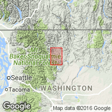
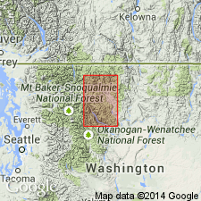
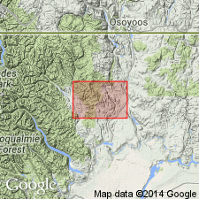
Type locality: along Lookout Ridge from forest lookout tower west to Black Pine Lake, [Twisp West and Hoodoo Peak 7.5-min quadrangles (2006 eds.), Okanogan Co., Okanogan National Forest], central northern WA.
Named from Newby Ridge [a few mi north-northwest of type locality, Hoodoo Peak 7.5-min quadrangle (2006 ed.), Okanogan Co., Okanogan National Forest, central northern WA], since name Lookout is previously used.
[Additional locality information from USGS historical topographic map collection TopoView; accessed July 29, 2016.]
Source: US geologic names lexicon (USGS Bull. 1200, p. 2717); GNU records (USGS DDS-6; Menlo GNULEX).
- Usage in publication:
-
- Newby Group
- Modifications:
-
- Revised
- Age modified
- AAPG geologic province:
-
- Okanogan province
Summary:
Newby Formation of Barksdale (1948) is raised in rank to Newby Group and is subdivided into two formal units in some areas but left undifferentiated in others. Includes (ascending): Twisp Formation and Buck Mountain Formation (both new). Underlies the Goat Creek Formation (new). Age is Early(?) or Middle(?) Jurassic to Early Cretaceous.
Source: GNU records (USGS DDS-6; Menlo GNULEX).
- Usage in publication:
-
- Newby Formation
- Modifications:
-
- Mapped
- AAPG geologic province:
-
- Okanogan province
Summary:
Newby Formation [Group] of Barksdale (1975) shown on bedrock geologic map of central Okanogan Range, WA. Intruded by Wolf Canyon Quartz Diorite (new). Several poor exposures of Newby rocks were found in northwestern part of area. Locally Newby rocks are so intensely fractured and altered, it is not clear whether they are sedimentary or volcanic. Age is Early Cretaceous.
Source: GNU records (USGS DDS-6; Menlo GNULEX).
For more information, please contact Nancy Stamm, Geologic Names Committee Secretary.
Asterisk (*) indicates published by U.S. Geological Survey authors.
"No current usage" (†) implies that a name has been abandoned or has fallen into disuse. Former usage and, if known, replacement name given in parentheses ( ).
Slash (/) indicates name conflicts with nomenclatural guidelines (CSN, 1933; ACSN, 1961, 1970; NACSN, 1983, 2005, 2021). May be explained within brackets ([ ]).