

- Usage in publication:
-
- Newark group
- Modifications:
-
- Named
- Dominant lithology:
-
- Sandstone
- AAPG geologic province:
-
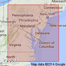
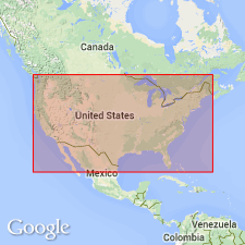
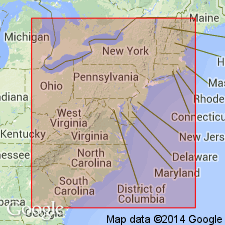
- Piedmont-Blue Ridge province
- New England province
Summary:
The designation Newark group is proposed as a convenient name for the New Red Sandstone, including the New Jersey sandstones and those of the Connecticut Valley, with which they are thoroughly identified by footprints and other fossils, and the contemporary sandstones of VA and NC. "In 1854, Prof. W. B. Rogers recognized the general equivalency of the eastern and middle belts of Virginia, and the eastern Deep River coal belt of North Carolina, all of which are in the Jurassic series, not far above its base; and disconnected tracts of the western belt in North Carolina, Virginia, and the prolonged area of the so-called New Red Sandstone of Maryland, Pennsylvania, and New Jersey, of Jurassic date, but little anterior to the coal rocks of Eastern Virginia."
Source: GNU records (USGS DDS-6; Reston GNULEX).
- Usage in publication:
-
- Newark system*
- Modifications:
-
- Overview
- AAPG geologic province:
-
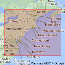
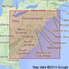
- New England province
- Piedmont-Blue Ridge province
Summary:
Newark System is used because it conforms with usage of the International Congress of Geologists. This review contains data on the basins, lithology, stratigraphy, theories of origin, age, correlations, and index of literature through 1890.
Source: GNU records (USGS DDS-6; Reston GNULEX).
- Usage in publication:
-
- Newark group*
- Modifications:
-
- Revised
- AAPG geologic province:
-
- New England province
Summary:
The Newark is here redefined as Newark group, for use by the USGS, to cover both sedimentary rocks and igneous flows, but not diabase dikes and intrusives. It should not be used for any subdivision, nor for the sedimentary rocks as a whole, exclusive of the contemporaneous igneous rocks, in areas where such occur.
Source: GNU records (USGS DDS-6; Reston GNULEX).
- Usage in publication:
-
- Newark group*
- Modifications:
-
- Overview
- AAPG geologic province:
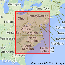
-
- Piedmont-Blue Ridge province
- New England province
Summary:
Correlation chart of Triassic formations including the Newark group.
Source: GNU records (USGS DDS-6; Reston GNULEX).
- Usage in publication:
-
- Newark group*
- Modifications:
-
- Overview
- AAPG geologic province:
-
- New England province
- Piedmont-Blue Ridge province
Summary:
Contains correlation chart of the Newark group.
Source: GNU records (USGS DDS-6; Reston GNULEX).
- Usage in publication:
-
- Newark Group
- Modifications:
-
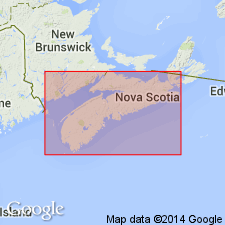
- Areal extent
- Not Used
Summary:
Mesozoic rocks of the Fundy basin are assigned to Fundy Group, because the name Newark Group is believed to have been originally applied in a time-stratigraphic sense.
Source: GNU records (USGS DDS-6; Reston GNULEX).
- Usage in publication:
-
- Newark Group
- Modifications:
-
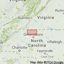
- Areal extent
- Not used
- AAPG geologic province:
-
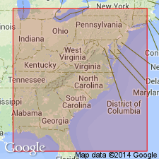
- Piedmont-Blue Ridge province
Summary:
Dan River Group is named in Dan River basin for Mesozoic rocks elsewhere assigned to the Newark, because it was originally applied in a time-stratigraphic sense.
Source: GNU records (USGS DDS-6; Reston GNULEX).
- Usage in publication:
-
- Newark Group
- Modifications:
-
- Biostratigraphic dating
- Age modified
- AAPG geologic province:
-
- Piedmont-Blue Ridge province
- New England province
Summary:
Palynological data show that the Newark Group has a time-stratigraphic range from Late Triassic in NC, VA, and PA, to Rhaetto-Liassic (Early Jurassic) in NJ, CT, and MA.
Source: GNU records (USGS DDS-6; Reston GNULEX).

- Usage in publication:
-
- Newark Supergroup
- Modifications:
-
- Revised
- AAPG geologic province:
-
- Piedmont-Blue Ridge province
- New England province
Summary:
The rank of the Newark is here raised to Supergroup. It includes continental clastic rocks and interbedded basalts of Late Triassic and Early Jurassic age which crop out in discrete elongate basins in the Piedmont, New England, and Maritime provinces and beneath the Atlantic Coastal Plain of eastern North America. The original meaning of Redfield's (1856) definition is preserved, and it allows the formations of individual basins to be included in specific groups while remaining in a strictly rock-stratigraphic hierarchy.
Source: GNU records (USGS DDS-6; Reston GNULEX).
- Usage in publication:
-
- Newark Supergroup*
- Modifications:
-
- Revised
- AAPG geologic province:
-
- Piedmont-Blue Ridge province
- New England province
Summary:
The Newark Supergroup, redefined by Olsen (1978), is revised to include continental clastic rocks and interbedded basalts of Late Triassic and Early Jurassic age that crop out in discrete elongate basins parallel to the Appalachian orogen in eastern North America, but it does not include subsurface rocks beneath the Atlantic Coastal Plain and Continental Shelf because these rocks are poorly understood and are apparently of diverse age, lithology, and origin.
Source: GNU records (USGS DDS-6; Reston GNULEX).

- Usage in publication:
-
- Newark Supergroup*
- Modifications:
-
- Overview
- AAPG geologic province:
-
- New England province
- Piedmont-Blue Ridge province
Summary:
An annotated list of 1462 references on the early Mesozoic basins indexed by author, topic, and geographic area.
Source: GNU records (USGS DDS-6; Reston GNULEX).
- Usage in publication:
-
- Newark Supergroup*
- Modifications:
-
- Overview
- AAPG geologic province:
-
- New England province
- Piedmont-Blue Ridge province
Summary:
Newark Supergroup units listed by basin: Deep River basin: Chatham Group (Gp): Pekin, Cumnock, Sanford Formations (Fms) Dan River-Danville basin: Dan River Gp: Dry Fork, Pine Hall, Cow Branch, Stoneville Fms. Richmond basin: Tuckahoe Gp: Boscabel boulder beds, lower barren beds, productive coal measures; Chesterfield Gp: Vinita beds, Otterdale Sandstone. Taylorsville basin: Doswell Fm: Stagg Creek, Falling Creek, Newfound Members (Mbrs). Culpeper and Barboursville basins: Culpeper Gp: Manassas Sandstone: Rapidan, Reston, Tuscarora Creek, Poolesville Mbrs; Balls Bluff Siltstone: Leesburg Mbr; Tibbstown Fm: Haudricks Mountain, Mountain Run Mbrs; Catharpin Creek Fm: Goose Creek Mbr; Mount Zion Church Basalt; Midland Fm; Hickory Grove Basalt; Turkey Run Fm; Sander Basalt; Waterfall Fm: Millbrook Quarry Mbr. Gettysburg basin: New Oxford Fm; Gettysburg Fm: Conewago Conglomerate, Heidlersburg Sandstone, Arendtsville Fanglomerate Mbrs; basalt at Aspers; Hammer Creek Fm. Newark basin: Stockton Fm; Lockatong Fm; Brunswick Gp: Passaic Fm: Graters, Perkasie Mbrs; Jacksonwald Basalt; Orange Mountain Basalt; Feltville Fm; Preakness Basalt; Towaco Fm; Hook Mountain Basalt; Boonton Fm. Hartford basin: New Haven Arkose; Talcott Basalt; Hitchcock Volcanics; Shuttle Meadow Fm; Holyoke Basalt; East Berlin Fm; Hampden Basalt; Granby Basaltic Tuff; Portland Fm. Deerfield-Northfield basins: Sugarloaf Fm; Deerfield Basalt; Turners Falls Sandstone; Mount Toby Fm. Fundy basin: Fundy Group: Lepreau Fm; Honeycomb Point Fm: Browns Beach, McCumber Point Mbrs; Quaco Fm; Echo Cove Fm: Berry Beach, Fownes Head, Melvin Beach, Stony Brook Mbrs; Wolfville Fm; Blomidon Fm; North Mountain Basalt; Scots Bay Fm; McCoy Brook Fm; Chedabucto Fm.
Source: GNU records (USGS DDS-6; Reston GNULEX).
- Usage in publication:
-
- Newark Supergroup
- Modifications:
-
- Revised
- AAPG geologic province:
-
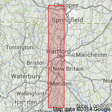
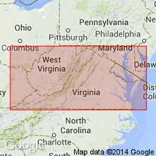
- Richmond basin
- Piedmont-Blue Ridge province
Summary:
Nomenclature in this report follows Ediger and others (in prep). Richmond basin sequence is divided into three formations (ascending): Tuckahoe, Turkey Branch, a newly recognized sequence of rocks, and Otterdale Formations of Newark Supergroup. Contacts are unconformable. Tuckahoe Formation is divided into (ascending) Lower Barren Beds Member, Productive Coal Measures Member, and Vinita Beds Member. Turkey Branch Formation is divided into the lower Hidden Member and the upper Tomahawk Creek Member (both first used). Chesterfield Group is not used. The Turkey Branch Formation correlates with the upper part of the Doswell Formation of the Taylorsville basin, which includes the upper part of the Stagg Creek Member, the upper part of the Falling Creek Member, and the Newfound Member. . [Several member names as used in this report are in violation of the NACSN and though presented as formal, should be considered informal.]
Source: GNU records (USGS DDS-6; Reston GNULEX).
- Usage in publication:
-
- Newark Supergroup*
- Modifications:
-
- Biostratigraphic dating
- AAPG geologic province:
-
- Piedmont-Blue Ridge province
Summary:
A new palynomorph species, FROELICHSPORITES TRAVERSEI, occurs throughout Newark Supergroup of eastern United States and Canada, Dockum Group of TX and NM, and Chinle Formation of NM, AZ, and UT. It is restricted geologically to strata deposited during upper Carnian and Norian Stages of the Upper Triassic. It occurs in the following formations of the Newark Supergroup: Passaic Formation (NJ), Gettysburg Formation (PA and MD), Manassas Sandstone (MD), Balls Bluff Siltstone (VA), Cow Branch Formation (NC), and Stoneville Formation (NC).
Source: GNU records (USGS DDS-6; Reston GNULEX).
For more information, please contact Nancy Stamm, Geologic Names Committee Secretary.
Asterisk (*) indicates published by U.S. Geological Survey authors.
"No current usage" (†) implies that a name has been abandoned or has fallen into disuse. Former usage and, if known, replacement name given in parentheses ( ).
Slash (/) indicates name conflicts with nomenclatural guidelines (CSN, 1933; ACSN, 1961, 1970; NACSN, 1983, 2005, 2021). May be explained within brackets ([ ]).