

- Usage in publication:
-
- New Hampshire petrogenic cycle
- Modifications:
-
- Original reference
- Dominant lithology:
-
- Diorite
- Granodiorite
- Trondhjemite
- Granite
- AAPG geologic province:
-
- New England province
Summary:
Four major periods of intrusive igneous activity have been recognized in central New Hampshire: The Highlandcroft, Oliverian, New Hampshire, and White Mountain petrogenic cycles.
The Highlandcroft cycle includes diorite, quartz diorite, granodiorite, and granite. They are younger than Partridge slate and older than Clough conglomerate; are definitely pre-Silurian, and probably late Ordovician.
The Oliverian rocks are largely biotite granite; younger than [Early] Devonian but older than major period of orogeny.
The New Hampshire magma series consists of diorite, quartz diorite, granodiorite, trondhjemite, and granite, younger than [Early] Devonian and essentially contemporaneous with the great period of folding.
Youngest of all is White Mountain ("alkaline") magma series, which is younger than [Early] Devonian, and later than the period of orogeny.
Thus 3 of the igneous series are younger than [Early] Devonian, and to them belong 90 percent of the igneous rocks of central New Hampshire. The other 10 percent (the Highlandcroft group) is pre-Silurian, probably late Ordovician but possibly older. On 1932 geologic map of US only the White Mountain magma series is shown as Paleozoic; all others being included in pre-Cambrian. In other words, Paleozoic intrusives are much more abundant than map shows. [Billings mapped New Hampshire magma series and Highland Croft magma series over parts of Littleton and Moosilauke quadrangles in Amer. Jour. Sci., 5th ser., v. 28, Dec. 1934, p. 414.]
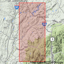
M. Billings (letter dated July 19, 1935) stated If there must be a type locality for New Hampshire magma series it is the Littleton and Moosilauke 15-min quadrangles, northwestern NH.
Source: US geologic names lexicon (USGS Bull. 896, p. 1485, Highland Croft entry p. 955).

- Usage in publication:
-
- New Hampshire plutonic series
- Modifications:
-
- Overview
- AAPG geologic province:
-
- New England province
Summary:
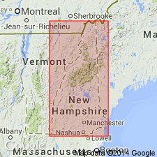
Found in central and southwestern parts of the state, but Hillsboro plutonic series in the southeast part probably belongs to the series, too. Subdivided into Concord, Fitzwilliam, and Bickford granites (all probably just Concord granite); French Pond granite; granite of Hedge Hog Hill; Spaulding quartz diorite; Remick tonalite; quartz monzonite of Norway Rapids; Kinsman quartz monzonite (also called the Meredith granite); and Bethlehem gneiss. Can be distinguished from other plutonic series in various ways. The abundance of biotite is characteristic. The presence of muscovite distinguishes it from younger rocks of the White Mountain Plutonic-Volcanic Suite. The New Hampshire rocks are generally gray whereas those of Oliverian plutonic series are pink. Pegmatites of the New Hampshire are white whereas those of the Oliverian are pink; pegmatites are rare in White Mountain rocks.
Source: GNU records (USGS DDS-6; Reston GNULEX).
- Usage in publication:
-
- New Hampshire Plutonic Series*
- Modifications:
-
- Age modified
- Geochronologic dating
- AAPG geologic province:
-
- New England province
Summary:
Rb-Sr whole-rock isochrons for the four main subdivisions of the Series yield the following ages: Concord Granite, 359+/-11 m.y. (or 330+/-3 m.y.?); Spaulding Quartz Diorite, 402+/-5 m.y.; Bethlehem Gneiss, 405+/-78 m.y.; Kinsman Quartz Monzonite, 411+/-19 m.y. Concord Granite is at least 40 m.y. younger than other members of the New Hampshire Plutonic Series, making its time of emplacement Late Devonian(?) or Mississippian(?). However, there is enough doubt as to the absolute time scale for the Devonian that the use of Early, Middle, or Late Devonian is not yet warranted.
Source: GNU records (USGS DDS-6; Reston GNULEX).
- Usage in publication:
-
- New Hampshire Plutonic Suite*
- Modifications:
-
- Revised
- AAPG geologic province:
-
- New England province
Summary:
Name changed from New Hampshire Plutonic Series to New Hampshire Plutonic Suite.
Source: GNU records (USGS DDS-6; Reston GNULEX).
- Usage in publication:
-
- New Hampshire Plutonic Suite
- Modifications:
-
- Not used
- AAPG geologic province:
-
- New England province
Summary:
Suggested [but did not implement] abandonment of the name New Hampshire Plutonic Suite because the entire suite is not a differentiation suite, is not geochemically consanguineous, and is not made up of coeval components.
Source: GNU records (USGS DDS-6; Reston GNULEX).

- Usage in publication:
-
- New Hampshire Plutonic Series*
- Modifications:
-
- Age modified
- Areal extent
- Geochronologic dating
- AAPG geologic province:
-
- New England province
Summary:
Rocks in Merrimack terrane at eastern edge of Glens Falls quad include Bethlehem Gneiss and Kinsman Quartz Monzonite which occupy much of the area. These and other related rock types constitute New Hampshire Plutonic Series of Billings (1956). Radiometric studies indicate 413 Ma age for foliated Kinsman (Barreiro and Aleinikoff, 1985, Geological Society of America, Abstracts with Programs, v. 17, no. 1, p. 3). U-Pb zircon dates from Sunapee pluton yield an age of 366 Ma (J.N. Aleinikoff, 1989, oral commun.). [Name used incorrectly here; should have been New Hampshire Plutonic Suite.]
Source: GNU records (USGS DDS-6; Reston GNULEX).

- Usage in publication:
-
- New Hampshire Plutonic Suite*
- Modifications:
-
- Age modified
- Geochronologic dating
- Overview
- AAPG geologic province:
-
- New England province
Summary:
Consists of weakly unmetamorphosed or weakly metamorphosed, massive to weakly foliated, felsic, intermediate, and mafic rocks of Devonian age in discordant, predominantly mesozonal plutons throughout the map area. Also consists of strongly metamorphosed, moderately to strongly foliated felsic rocks of Devonian age in semiconcordant plutons near the southwest corner of the map. Five assemblages are designated here. Assemblage I is probable youngest Devonian peraluminous biotite granite. Assemblage II is two-mica granite and related rocks. Assemblage III is biotite or hornblende-biotite granite to quartz diorite with no muscovite. Assemblage IV is muscovite-bearing granodiorite to granite and tonalite (including Bethlehem and Kinsman Granodiorites, names revised). Assemblage V is massive and layered gabbro, diorite, and associated ultramafic and hybrid rocks. Isotopic ages range from 365 Ma to 410 Ma; oldest ages obtained from plutons that intrude known Early Devonian strata.
Source: GNU records (USGS DDS-6; Reston GNULEX).

- Usage in publication:
-
- New Hampshire Plutonic Suite*
- Modifications:
-
- Overview
- Revised
- Age modified
- Geochronologic dating
- AAPG geologic province:
-
- New England province
Summary:
Includes syn- and post-kinematic granitoids related to Acadian orogeny ranging in age from Early to Late Devonian. Subdivided into 15 mappable units. Formally named units have been revised from previous usages in accordance with rock classification scheme of Streckeisen (1973) and include Early Devonian Kinsman Granodiorite, Bethlehem Granodiorite, Winnipesaukee Tonalite, and Spaulding Tonalite, and Late Devonian Concord Granite. Accompanying 1:500,000-scale map showing individual plutons and sample localities for age dating gives the following isotopic age data (in Ma):
1. Long Mountain pluton: 350 (approx) U/Pb (Harrison and others, 1987).
2. Fairlee pluton: 411 +-4 U/Pb zircon, 400 +-5 U/Pb monazite (Moench and Aleinikoff, 1987).
3. Lincoln pluton: <422 and >400 U/Pb monazite and zircon (J.N. Aleinikoff, oral commun., 1990).
4. Mount Clough pluton: 410 +-5 U/Pb (J.N. Aleinikoff, oral commun., 1989).
5. Cardigan pluton: 411 +-19 Rb/Sr (Lyons and Livingston, 1977); 413 +-5 Nd/Sm (Barreiro and Aleinikoff, 1985).
6. Newfound Lake pluton: 373 (concordant) U/Pb monazite (J.N. Aleinikoff, oral commun., 1984).
7. Winnipesaukee Tonalite: 400 +-2 U/Pb (J.N. Aleinikoff, oral commun., 1990).
8. Sunapee pluton: 349 +-? Rb/Sr (Hayward, 1983); 366 +-8 (recalculation by J.N. Aleinikoff (oral commun. 1990) of combined Rb/Sr data of Lyons and Livingston, 1977, and Hayward, 1983); 364 +-2 U/Pb (Harrison and others. 1987; J.N. Aleinikoff, oral commun., 1990).
9. Kearsarge pluton: 393 +-5 Rb/Sr (Lyons and Livingston, 1977).
10. Blackwater pluton: 398 +-? U/Pb monazite (Eusden and Barreiro, 1988).
11. Concord Granite: 365 +-20 U/Pb (J.N. Aleinikoff, oral commun., 1986); 375 +-? monazite, pegmatite in Concord Granite (Eusden and Barreiro, 1988).
12. New Durham pluton: 377 +-? U/Pb monazite (Eusden and Barreiro, 1988).
13. Bellows Falls pluton: 410-405 U/Pb (T.M. Harrison, quoted by Spear, 1989).
14. Hooksett pluton: 402 +-? Rb/Sr (Hayward, 1983); 365 +-20 U/Pb (J.N. Aleinikoff, oral commun., 1986).
15. Barrington pluton: 363 +-? U/Pb monazite (Eusden and Barreiro, 1988).
16. Fitzwilliam Granite: 383 +-? Rb/Sr (Hayward, 1983, 1987).
Other formal bodies shown on 1:500,000-scale plutonic map are Meredith Granite, Hardwick Tonalite, and Chelmsford Granite [for various reasons, these were unable to be shown on 1:250,000-scale map]. Other informal pluton names shown on 1:500,000-scale plutonic map are (all carry informal rank term of pluton): Greenough Pond, Bretton Woods, Peabody River, Indian Pond, Rumney, Thornton, Campton, Sandwich Mountain, Jewell Hill, Grafton, Massasecum, Weare, Shaker Village, Gilmanton, Antrim, Deering, West Hopkinton, Clinton Grove, Lyndeborough, Rochester, Ashuelot, Babbidge Reservoir, Marlborough, Spaulding Hill, Troy Quarry, Gap Mountain, Cummings Pond, Peterborough, Whitcomb Peak, Pratt Pond, Hudson, and Scobie Pond.
Source: GNU records (USGS DDS-6; Reston GNULEX).
For more information, please contact Nancy Stamm, Geologic Names Committee Secretary.
Asterisk (*) indicates published by U.S. Geological Survey authors.
"No current usage" (†) implies that a name has been abandoned or has fallen into disuse. Former usage and, if known, replacement name given in parentheses ( ).
Slash (/) indicates name conflicts with nomenclatural guidelines (CSN, 1933; ACSN, 1961, 1970; NACSN, 1983, 2005, 2021). May be explained within brackets ([ ]).