

- Usage in publication:
-
- [New Burnside coal member]
- Modifications:
-
- [Original reference]
- Dominant lithology:
-
- Coal
- AAPG geologic province:
-
- Illinois basin
Summary:
Pg. 42. [New Burnside coal member of Tradewater formation.] Named from New Burnside, Johnson Co., southern IL.
Source: Handbook of Illinois stratigraphy (Illinois Geol. Survey Bull. 95, p. 185, 1975).

- Usage in publication:
-
- New Burnside coal member
- Modifications:
-
- Principal reference
- Revised
- Dominant lithology:
-
- Coal
- AAPG geologic province:
-
- Illinois basin
Summary:
Pg. 32, 45 (table 1), 65, pl. 1. New Burnside coal member of Spoon formation (new) of Kewanee group (new). Name applied to member in lower part of Spoon formation in southeastern Illinois. Overlies Bidwell coal member (new); stratigraphically below Curlew limestone member. Thickness 3 feet. Age is Pennsylvanian. Presentation of new rock-stratigraphic classification of Pennsylvanian strata in Illinois. Cyclical classification retained but is entirely independent of rock-stratigraphic classification.
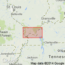
Type locality: in SE/4 SE/4 SW/4 sec. 5, T. 11 S., R. 4 E., Marion quadrangle [Creal Springs quadrangle], Johnson Co., southeastern IL. Upper of two coals mined in vicinity of village of New Burnside.
Source: US geologic names lexicon (USGS Bull. 1200, p. 2716); supplemental information from GNU records (USGS DDS-6; Reston GNULEX).

- Usage in publication:
-
- New Burnside Coal Bed
- Modifications:
-
- Revised
- AAPG geologic province:
-
- Illinois basin
Summary:
The New Burnside is here reduced in rank to Bed as it is neither widespread nor continuous. Restricted to the northeastern part of the Creal Springs quad. Varies in thickness from a few inches to about 54 in. Underlies variable strata ranging from conglomerates to sandstone, siltstone, and silty shale. Overlies shale, siltstone, and sandstone above the Delwood Coal Bed.
Source: GNU records (USGS DDS-6; Reston GNULEX).
For more information, please contact Nancy Stamm, Geologic Names Committee Secretary.
Asterisk (*) indicates published by U.S. Geological Survey authors.
"No current usage" (†) implies that a name has been abandoned or has fallen into disuse. Former usage and, if known, replacement name given in parentheses ( ).
Slash (/) indicates name conflicts with nomenclatural guidelines (CSN, 1933; ACSN, 1961, 1970; NACSN, 1983, 2005, 2021). May be explained within brackets ([ ]).