


- Usage in publication:
-
- New Berlin Formation
- Modifications:
-
- Original reference
- Dominant lithology:
-
- Till
- Sand
- Gravel
- AAPG geologic province:
-
- Wisconsin arch
Summary:
Pg. 4 (table 1); App., p. A7-1 to A7-4. New Berlin Formation. Occurs in the Lake Michigan Lobe, southeastern Wisconsin. Consists of brown to yellowish-brown, sandy, pebbly, calcareous till. Thickness at least 22 m. Divided into an informal lower sand and gravel member and an upper till member. At several places the till splits into two units, informally designated 1A and 1B by Mickelson and others (Wisconsin Coast Mgmt., Off. State Planning and Energy Shore Erosion Study Tech. Rpt., 1977), separated by outwash sand and gravel deposits. Overlies Tiskilwa Member of Zenda Formation (new) [=Tiskilwa Formation of Wedron Group in Illinois], contact is sharp to gradational. Underlies Oak Creek Formation (new) or various members of the Kewaunee Formation (new), contact is sharp or unconformable. Is the surface unit in much of Waukesha and Walworth Counties. Correlates with Horicon Formation (new) of the Green Bay Lobe. Age is late Pleistocene (late Wisconsinan).
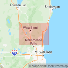
Type section: exposures in gravel pit complex operated by Kohler Pit, Inc., and New Berlin Redi-Mix, Inc., on north side of County Trunk Highway I (Lawnsdale Road), 0.5 to 1 mi (0.8 to 1.6 km) west of County Trunk Highway Y (Racine Ave.), in SE/4 sec. 19 and SW/4 sec. 20, T. 6 N., R. 20 E., [in vicinity of Lat. 42 deg. 57 min. 42 sec. N., Long. 88 deg. 10 min. 18 sec. W.], Muskego 7.5-min quadrangle, Waukesha Co., southeastern WI.
Named from the city of New Berlin, southwest of Milwaukee, in southeastern Waukesha Co., southeastern WI; name credited to Allan F. Schneider.
Reference sections:
(1) gravel pit operated by Robert Stewart, in village of Fontana, in SE/4 NW/4 NE/4 sec. 15, T. 1 N., R. 16 E., [approx. Lat. 42 deg. 32 min. 58 sec. N., Long. 88 deg. 35 min. 09 sec. W.], Walworth 7.5-min quadrangle, Walworth Co., southeastern WI;
(2) gravel pit operated by R.W. Miller and Sons, Inc., 1 mi (1.6 km) northeast of city of Lake Geneva, on northwest side of Highway 36, in W/2 SW/4 sec. 19, T. 2 N., R. 18 E., [approx. Lat. 42 deg. 36 min. 54 sec. N., Long. 88 deg. 25 min. 21 sec. W.], Lake Geneva 7.5-min quadrangle, Walworth Co., southeastern WI;
(3) gravel pit operated by Valley Sand and Gravel Company, south of Highway 15 on west side of County Trunk Highway Y (Racine Ave.), in NW/4 sec. 5, T. 5 N., R. 20 E., [approx. Lat. 42 deg. 55 min. 43 sec. N., Long. 88 deg. 09 min. 53 sec. W.], Muskego 7.5-min quadrangle, Waukesha Co., southeastern WI.
[Additional locality information from Syverson and others, 2011, Wisconsin lexicon of Pleistocene units, Wisconsin Geol. Nat. Hist. Survey Tech. Rpt., no. 1; supplemented from USGS historical topographic map collection TopoView and Wisconsin Highways www.wisconsinhighways.org, accessed on June 9, 2018.]
Source: Publication; US geologic names lexicon (USGS Bull. 1565, p. 218-219).
- Usage in publication:
-
- New Berlin Member
- Modifications:
-
- Revised
- Dominant lithology:
-
- Till
- Sand
- Gravel
- AAPG geologic province:
-
- Wisconsin arch
Summary:
Pg. 5 (fig. 3), 8 (fig. 5), 12; App., p. 51, 52 (fig. A2). New Berlin Member of Holy Hill Formation. Previously defined as New Berlin Formation (Mickelson and others, 1984). Occurs in the Lake Michigan Lobe, east of Kettle Moraine, southeastern Wisconsin. Is age equivalent and lithologically similar to Horicon Member (previously Horicon Formation) of the Holy Hill Formation in the Green Bay Lobe, west of Kettle Moraine. [Age of Holy Hill Formation is Pleistocene (late Wisconsinan, approximately 18,000 to 13,000 yr B.P.), based on stratigraphic relations.]
Source: Publication.
For more information, please contact Nancy Stamm, Geologic Names Committee Secretary.
Asterisk (*) indicates published by U.S. Geological Survey authors.
"No current usage" (†) implies that a name has been abandoned or has fallen into disuse. Former usage and, if known, replacement name given in parentheses ( ).
Slash (/) indicates name conflicts with nomenclatural guidelines (CSN, 1933; ACSN, 1961, 1970; NACSN, 1983, 2005, 2021). May be explained within brackets ([ ]).