The National Geologic Map Database is migrating to a new infrastructure. We apologize for any service disruptions during this process.
|
|---|


- Usage in publication:
-
- New Albany slate
- Modifications:
-
- Named
- Dominant lithology:
-
- Slate
- Shale
- AAPG geologic province:
-
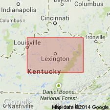
- Cincinnati arch
Summary:
Named for New Albany, Floyd Co., southern IN. Applied to rocks previously called Devonian black slate or Devonian black shale. Consists of jet black, thick-bedded rock that weathers pink, drab, or mottled and exhibits thin laminations after exposure. Thickness 50 to 120 ft. Overlain by ferruginous limestone; underlain by blue crinoidal limestone.
Source: GNU records (USGS DDS-6; Reston GNULEX).
- Usage in publication:
-
- New Albany shale
- Modifications:
-
- Revised
- AAPG geologic province:
-
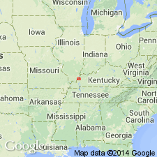
- Illinois basin
Summary:
Revised as New Albany shale. Is overlain by Rockford limestone and underlain by 25 to 47 ft of brown shale. In other reports, this brown shale has been included in New Albany shale that overlies Sellersburg limestone.
Source: GNU records (USGS DDS-6; Reston GNULEX).
- Usage in publication:
-
- New Albany Shale Group
- Modifications:
-
- Overview
- AAPG geologic province:
-
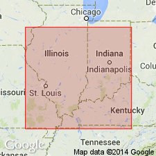
- Illinois basin
Summary:
New Albany Shale Group [name used incorrectly, should be New Albany Group] is a continuous body of black, gray, and greenish-gray shales found throughout Illinois basin portions of IL, IN, and western KY. Used as a group only in IL. Ranges in age from Middle Devonian to Lower Mississippian (Kinderhookian); most of the body is Late Devonian. Divided into nine formations (in ascending order: Blocher Shale, Sylamore Sandstone, Sweetland Creek Shale, Grassy Creek Shale, Saverton Shale, Louisiana Limestone, Horton Creek Formation and Hannibal Shale. At no single location are all nine formations present; some formations grade into each other. Report contains appendix describing type sections for each of the formations.
Source: GNU records (USGS DDS-6; Reston GNULEX).
- Usage in publication:
-
- New Albany Shale
- Modifications:
-
- Revised
- AAPG geologic province:
-
- Cincinnati arch
Summary:
Campbell's (1946) definition of Portwood Member of New Albany Shale is inadequate, hence term has been seldom used. Portwood is potentially usable and easily defined. It here replaces Duffin, Harg, and Ravenna facies. Portwood is here defined as basal-most unit of the black-shale sequence characterized by substantial amount of limestone and dolomite. Top and bottom defined by sandy lag horizon. Unit is up to 4 m thick. Consists of four lithofacies and is in large part coeval with Blocher Member.
Source: GNU records (USGS DDS-6; Reston GNULEX).
- Usage in publication:
-
- New Albany Shale
- Modifications:
-
- Areal extent
- AAPG geologic province:
-
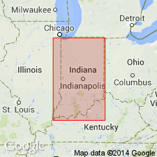
- Illinois basin
Summary:
Authors follow de Witt (1981) in restricting the New Albany Shale to the Illinois basin and the Ohio Shale to the Appalachian basin. Ohio Shale terminology used wherever Three Lick Bed is recognizable in cores. Unlike de Witt (1981), authors do not use Chattanooga Shale in Knobs outcrop area of south-central KY. Most of New Albany correlates with Huron Member of Ohio Shale. Upper 1 to 2 m correlates with Cleveland Member. New Albany subdivided into (ascending) Blocher, Morgan Trail, Camp Run, and Clegg Creek Members.
Source: GNU records (USGS DDS-6; Reston GNULEX).
- Usage in publication:
-
- New Albany Group*
- Modifications:
-
- Revised
- Overview
- AAPG geologic province:
-
- Illinois basin
Summary:
Report discusses the New Albany Group of Late Devonian and Early Mississippian age, on the east side of the Hicks dome, Hardin Co., southern IL. Report used terminology of Cluff and others (1981) with the exception that their New Albany Shale Group is revised to New Albany Group. The New Albany Group in this area includes the Grassy Creek Shale, which in turn includes the Henryville and Falling Run Beds.
Source: GNU records (USGS DDS-6; Reston GNULEX).
- Usage in publication:
-
- New Albany Shale, Group
- Modifications:
-
- Overview
- Areal extent
- AAPG geologic province:
-
- Illinois basin
Summary:
The Middle Devonian to Early Mississippian New Albany occurs in the Illinois basin of IL, IN, and western KY. Consists predominantly of brownish-black and greenish-gray shales. Brownish-black shales contain high concentrations of organic material. Attains a maximum thickness of more than 460 ft in the southern part of the basin. Unit is assigned group status in IL only where it is divided into (ascending) Blocher Shale, Sylamore Sandstone, Selmier Shale, Sweetland Creek Shale, Grassy Creek Shale, Saverton Shale, Louisiana Limestone, Horton Creek Formation, and Hannibal Shale. In southeastern IN and west-central KY, the New Albany Shale is divided into ascending Blocher, Selmier, Morgan Trail, Camp Run, and Clegg Creek Members. In west-central IN, a sixth member, the Ellsworth, is recognized. In western KY, unit is divided into only three members: Blocher, Selmier and Grassy Creek. [This list does not agree completely with GNU records, but author states this report summarizes the work of the Illinois, Indiana, and Kentucky Geological Surveys for the Eastern Gas Shales Project.] In southeastern IL, southwestern IN, and western KY, unit conformably overlies Middle Devonian carbonate rocks. Westward in IL, the Blocher at the base grades into the Lingle and Alto Formations. Where the Blocher is absent, the Sylamore unconformably overlaps Middle Devonian to Late Ordovician strata. Eastward and northward in IN, the New Albany overlies the Muscatatuck Group. In west-central KY, it unconformably overlies strata ranging from Middle Devonian to Late Ordovician. Throughout most of the area, unit is overlain conformably by Mississippian strata, the Chouteau Limestone of Kinderhookian age, or the Rockford Limestone of Kinderhookian and Valmeyeran age in the subsurface. Where the Rockford is absent, the New Albany is overlain in the subsurface by the Springville Shale (IL) or the New Providence Shale (IN,KY). In extreme western IL, it is conformably overlain by the McCraney Limestone and in limited areas of northwestern KY by the Saverton and Hannibal Shales.
Source: GNU records (USGS DDS-6; Reston GNULEX).
- Usage in publication:
-
- New Albany Shale*
- Modifications:
-
- Age modified
- Biostratigraphic dating
- AAPG geologic province:
-
- Illinois basin
- Cincinnati arch
Summary:
Conodont biostratigraphy of the lower part of the New Albany Shale (Blocher, Selmier, Morgan Trail, and Camp Run Members) indicate that the base of the formation is of Late Devonian (Frasnian) age as evidenced by the TRANSITANS Zone. Therefore, the New Albany Shale ranges in age from Late Devonian (Frasnian) to Early Mississippian (Kinderhookian).
Source: GNU records (USGS DDS-6; Reston GNULEX).
For more information, please contact Nancy Stamm, Geologic Names Committee Secretary.
Asterisk (*) indicates published by U.S. Geological Survey authors.
"No current usage" (†) implies that a name has been abandoned or has fallen into disuse. Former usage and, if known, replacement name given in parentheses ( ).
Slash (/) indicates name conflicts with nomenclatural guidelines (CSN, 1933; ACSN, 1961, 1970; NACSN, 1983, 2005, 2021). May be explained within brackets ([ ]).