The National Geologic Map Database is migrating to a new infrastructure. We apologize for any service disruptions during this process.
|
|---|


- Usage in publication:
-
- Nevidiskov Formation*
- Modifications:
-
- Named
- Reference
- Dominant lithology:
-
- Graywacke
- Conglomerate
- AAPG geologic province:
-
- Aleutian Islands province
- Alaska Southwestern region
Summary:
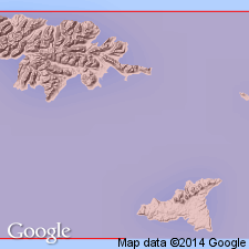
Named for exposures at type locality on west side of Nevidiskov Creek valley, south central Attu Island, Near Islands AK. Reference sections are on west side of Nevidiskov Creek 2.5 mi north of creek mouth, and 1.5 mi north of creek mouth. Composed of coarse graywacke and conglomerate with clasts of fragments of basement rocks. Is 300 m thick. Conformably and gradationally underlies Chuniksak Formation (new). Assigned middle Tertiary age, possibly late Oligocene and early Miocene.
Source: GNU records (USGS DDS-6; Menlo GNULEX).
For more information, please contact Nancy Stamm, Geologic Names Committee Secretary.
Asterisk (*) indicates published by U.S. Geological Survey authors.
"No current usage" (†) implies that a name has been abandoned or has fallen into disuse. Former usage and, if known, replacement name given in parentheses ( ).
Slash (/) indicates name conflicts with nomenclatural guidelines (CSN, 1933; ACSN, 1961, 1970; NACSN, 1983, 2005, 2021). May be explained within brackets ([ ]).