

- Usage in publication:
-
- Neihart quartzite and sandstone*
- Modifications:
-
- Original reference
- Dominant lithology:
-
- Quartzite
- Sandstone
- AAPG geologic province:
-
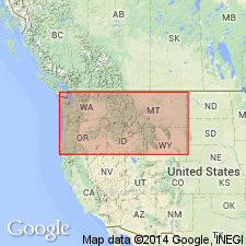
- Northern Rocky Mountain region
Summary:
Pg. 199-215. Neihart quartzite and sandstone. Coarse reddish sandstones, with interbedded dark-greenish layers of fine-grained sandstone and shale, 300 feet; underlain by 400 feet of pinkish-gray massive, sometimes cross-bedded quartzite, in some parts a compact hard sandstone. Basal formation of Belt series. Underlies Chamberlain shales. Named by W.H. Weed [reference not stated], for its occurrence on Neihart Mountain where the quartzites and sandstones are in contact with the gneiss. Thickness measured by Weed 700 feet. Age is pre-Cambrian (Belt).
[The compiler (M.G. Wilmarth, ca. 1938) has been unable to find any Neihart Mountain, and assumes that Walcott referred to mountain slightly northeast of Neihart, which is called Long Mountain on Little Belt Mountains topographic map, as in Little Belt Mountains folio (No. 56) Neihart quartzite is mapped over southern part of Long Mountain and over large area to south and east of village of Neihart.]
Source: US geologic names lexicon (USGS Bull. 896, p. 1473-1474).
- Usage in publication:
-
- Neihart Quartzite
- Modifications:
-
- Overview
- AAPG geologic province:
-
- Northern Rocky Mountain region
Summary:
Coarse-grained arkose and conglomerate of the LaHood Formation crop out in a narrow zone from the northern half of the Bridger Range to and across the Highland Mountains, in Northern Rocky Mountain region, Jefferson Co, MT. These rocks grade northward into fine-grained carbonate, argillite, siltite, and quartzite of Belt Series of the Northern Rocky Mountain region. Belt rocks included are Neihart Quartzite (of the Northern Rocky Mountain region), Chamberlain Shale, Prichard Formation, Newland Limestone, and lower part of Greyson Shale. Neihart is of Precambrian age.
Source: GNU records (USGS DDS-6; Denver GNULEX).

- Usage in publication:
-
- Neihart Quartzite*
- Modifications:
-
- Overview
- AAPG geologic province:
-
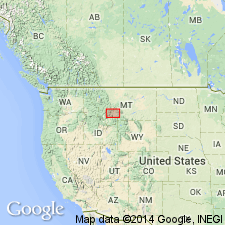
- Northern Rocky Mountain region
Summary:
Is the basal Belt unit in the Neihart area, in the Northern Rocky Mountain region. Stratigraphic position and correlation with other Precambrian formations of the Belt Supergroup of the U.S., Northern Rocky Mountain region, and of the Purcell Supergroup of Alberta and British Columbia, Canada shown on figs 4, 5, and 8.
Source: GNU records (USGS DDS-6; Denver GNULEX).
For more information, please contact Nancy Stamm, Geologic Names Committee Secretary.
Asterisk (*) indicates published by U.S. Geological Survey authors.
"No current usage" (†) implies that a name has been abandoned or has fallen into disuse. Former usage and, if known, replacement name given in parentheses ( ).
Slash (/) indicates name conflicts with nomenclatural guidelines (CSN, 1933; ACSN, 1961, 1970; NACSN, 1983, 2005, 2021). May be explained within brackets ([ ]).