

- Usage in publication:
-
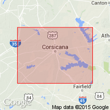
- Navarro beds
- Modifications:
-
- Original reference
- Dominant lithology:
-
- Clay
- AAPG geologic province:
-
- East Texas basin
Summary:
Pg. 189. Navarro beds. Fossiliferous blue and gray arenaceous clays in Navarro County, not hitherto recognized in Texas but believed to occupy stratigraphic position above Austin limestone. [Age is Late Cretaceous (Gulf).]
[Named from development in Navarro Co., eastern TX.]
Source: US geologic names lexicon (USGS Bull. 896, p. 1467-1468).
- Usage in publication:
-
- Navarro beds*
- Modifications:
-
- Revised
- AAPG geologic province:
-
- East Texas basin
Summary:
Pg. 298. Navarro beds (EXOGYRA PONDEROSA marl). Marls, clays, and limestones of varying hardness and in beds of limited extent. Overlie Dallas limestone and underlie basal Tertiaries. [Age is Late Cretaceous (Gulf).]
[As thus defined included Taylor marl.]
Source: US geologic names lexicon (USGS Bull. 896, p. 1467-1468).
- Usage in publication:
-
- Navarro beds*
- Modifications:
-
- Revised
- AAPG geologic province:
-
- East Texas basin
Summary:
Pg. 290. Navarro beds. Calcareous sands overlying EXOGYRA PONDEROSA [Taylor] marls. Top formation of Upper Cretaceous in Texas.
Source: US geologic names lexicon (USGS Bull. 896, p. 1467-1468).

- Usage in publication:
-
- Navarro group*
- Modifications:
-
- Overview
- AAPG geologic province:
-
- East Texas basin
- Ouachita folded belt
Summary:
Navarro group. Adopted in well-established sense, for arenaceous glauconitic deposits overlying nonglauconitic Taylor marl and underlying Eocene. (See also Taylor marl.) The Navarro deposits of northeastern Texas are now treated by the USGS as a group, divided into (descending) Kemp clay (restricted), Corsicana sand (restricted), Nacatoch sand, and Neylandville marl. See USGS 1937 geol. map of Texas and Univ. Texas Bull., no. 3232, 1933. In Medina River region Navarro group is now divided by L.W. Stephenson into (descending) Escondido formation and Corsicana marl. In Rio Grande region it is now divided into (descending) Escondido formation and Olmos formation. Age is Late Cretaceous (Gulf).
Named from development in Navarro Co., eastern TX.
Source: US geologic names lexicon (USGS Bull. 896, p. 1467-1468).
- Usage in publication:
-
- Navarro group*
- Modifications:
-
- Biostratigraphic dating
- AAPG geologic province:
-
- East Texas basin
- Ouachita folded belt
Summary:
Navarro group comprises (ascending) Neylandville marl, Nacatoch sand, Corsicana marl, Kemp clay, and Escondido formation. Overlies Taylor marl; underlies Midway group. Discussion of larger invertebrate fossils of Navarro group. Age is Late Cretaceous (Gulf).
Source: US geologic names lexicon (USGS Bull. 1200, p. 2692-2693).
- Usage in publication:
-
- Navarro group
- Modifications:
-
- Revised
- Biostratigraphic dating
- AAPG geologic province:
-
- East Texas basin
- Ouachita folded belt
Summary:
Pg. 49-53. Navarro group. Restricted to exclude Neylandville marl which is reallocated to Taylor group. As restricted group comprises (ascending) Nacatoch sand, Corscicana marl, Kemp clay, and Escondido clay. Foraminifera described. Age is Late Cretaceous (Gulf).
Source: US geologic names lexicon (USGS Bull. 1200, p. 2692-2693).

- Usage in publication:
-
- Navarro Group, undivided
- Modifications:
-
- Mapped 1:250k
- Dominant lithology:
-
- Clay
- Sand
- AAPG geologic province:
-
- East Texas basin
- Ouachita folded belt
Summary:
Navarro Group, undivided. Upper part mostly clay, silty, in part sandy, sand increases downward, calcareous, glauconitic, calcareous concretions common, some cone-in-cone, medium-gray to bluish-gray; weathers light yellowish-gray and medium greenish-gray; marine megafossils scarce. Lower part mostly sand, fine-grained, silty, clayey, weakly coherent, light- to medium-gray; weathers light yellowish-gray; marine megafossils abundant locally. Indistinctly to thinly bedded. Thickness 500 to 775 feet. Lies above Neylandville Formation and below Paleocene Midway Group. Age is Late Cretaceous.
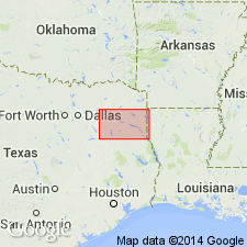
[Mapped in mostly continuous belt, in Bowie, Delta, Franklin, Hopkins, Hunt, Lamar, and Red River Cos., northeastern TX.]
Source: Publication.

- Usage in publication:
-
- Navarro Group
- Modifications:
-
- Areal extent
- AAPG geologic province:
-
- Gulf Coast basin
- Ouachita folded belt
Summary:
Navarro Group. Clay, calcareous, locally silty, massive, thinly laminated, conchoidal fracture, medium dark gray; weathers medium gray. [Thickness not stated.] Overlies Marlbrook Marl ("upper Taylor marl"; Upper Cretaceous); underlies Midway Group (Eocene). Age is Late Cretaceous.
Not separately mapped. (Mapped with Marlbrook Marl in Guadalupe, Caldwell, and Hays Cos., southeastern TX.)
Source: Modified from GNU records (USGS DDS-6; Denver GNULEX).
- Usage in publication:
-
- Navarro Group
- Modifications:
-
- Areal extent
- AAPG geologic province:
-
- East Texas basin
Summary:
Navarro Group. Age is Late Cretaceous.
Not separately mapped. [Includes Kemp Clay (mapped in Hunt and Rains Cos., eastern TX).]
Source: Publication; supplemental information from GNU records (USGS DDS-6; Denver GNULEX).

- Usage in publication:
-
- Navarro Group, undivided
- Modifications:
-
- Areal extent
- AAPG geologic province:
-
- Gulf Coast basin
- Ouachita folded belt
Summary:
Pamphlet [p. 4]. Navarro Group, undivided. Not separately mapped. Mapped with [underlying] Marlbrook Marl ("upper Taylor marl") in Bexar and Guadalupe Counties, southern Texas.
Upper part [interpreted to be Navarro Group]: marl, clay, sandstone, and siltstone; marl and clay, glauconitic, contain concretions of limonite and siderite; sandstone, fine-grained, and siltstone, yellow brown, contain concretions of hard bluish-gray siliceous limestone 2 to 10 feet in diameter; sandstone beds have little lateral continuity and become more abundant westward; thickness up to 580 feet. Correlative with [upper part of] Escondido Formation (mapped west of Bexar County). Age is Late Cretaceous.
Source: Publication.

- Usage in publication:
-
- Navarro Group
- Modifications:
-
- Mapped 1:250k
- Dominant lithology:
-
- Clay
- Sand
- AAPG geologic province:
-
- East Texas basin
Summary:
Pamphlet [p. 1]. Navarro Group. Subdivided into (descending) Kemp Clay and Nacatoch Sand; separately mapped. [Composite thickness about 450 feet.] Lies below Paleocene Kincaid Formation [of Midway Group] and above Neylandville Marl. Age is Late Cretaceous.
Mapped undivided east of Sabine River [in Hunt Co., northeastern TX].
Source: Publication.
For more information, please contact Nancy Stamm, Geologic Names Committee Secretary.
Asterisk (*) indicates published by U.S. Geological Survey authors.
"No current usage" (†) implies that a name has been abandoned or has fallen into disuse. Former usage and, if known, replacement name given in parentheses ( ).
Slash (/) indicates name conflicts with nomenclatural guidelines (CSN, 1933; ACSN, 1961, 1970; NACSN, 1983, 2005, 2021). May be explained within brackets ([ ]).