


- Usage in publication:
-
- Nashua marl
- Modifications:
-
- Named
- Dominant lithology:
-
- Marl
- Sand
- AAPG geologic province:
-
- Florida platform
Summary:
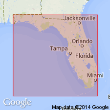
Nashua marl named for town of Nashua on St. Johns River in Putnam Co., northeastern FL. Consists light-colored marine sand beds alternating with shell marl. Although matrix is usually calcareous, it is always more or less sandy and sometimes consists of nearly pure sand. Bears strong lithologic resemblance to Caloosahatchee marl. Thickness ranges 6 to 32 ft. Is thought to rest unconformably on Miocene and is unconformably overlain by Pleistocene sand. Occupies St. Johns Valley, where it underlies a broad terrace bordering the stream. It probably occurs beneath the plain east of St. Johns River.
Source: GNU records (USGS DDS-6; Reston GNULEX).
- Usage in publication:
-
- Nashua marl†
- Modifications:
-
- Abandoned
- AAPG geologic province:
-
- Florida platform
Summary:
"Nashua" marl abandoned for Caloosahatchee marl, which is so nearly of same age that two names are not needed.
Source: GNU records (USGS DDS-6; Reston GNULEX).
- Usage in publication:
-
- Nashua Formation
- Modifications:
-
- Reinstated
- Dominant lithology:
-
- Marl
- Sand
Summary:
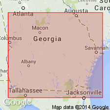
Nashua Marl of Matson and Clapp (1909) is here reintroduced as Nashua Formation. Caloosahatchee, the name favored by Cooke and Mossom (1929) when they abandoned the Nashua, is not used in this report. Unit is described as variably calcareous, shelly sand and finely sandy shell coquina. Deposited in open-marine, shallow-water on an inner neritic continental shelf. Underlies the St. Johns River area at least as far south as Deland, Volusia Co., FL. Its northern limit is the vicinity of the St. Marys River and therefore it probably occurs in GA. Grades westward and northward into the correlative Cypresshead Formation (new name). Disconformably overlies the Coosawhatchie Formation and underlies only undifferentiated surficial sand deposits in northeast FL. In the coastal area it may be overlain by the Satilla Formation. There is virtually no information on thickness distribution. Matson and Clapp reported 15 ft (4.5 m) at the type locality. Unit has been measured in a well at Deland at 32 ft (10 m), and based on its similarities to the Cypresshead in stratigraphic position and elevation, the expected thickness ranges from 40 to 60 ft (12 to 18 m). The Nashua is probably a multideposit formation. On the basis of Foraminifera, the unit is assigned an age range of late Pliocene to early Pleistocene (Piacenzian to Calabrian).
Source: GNU records (USGS DDS-6; Reston GNULEX).

- Usage in publication:
-
- Nashua Formation
- Modifications:
-
- Revised
- Overview
- AAPG geologic province:
-
- Florida platform
Summary:
Port Charlotte Group (of DuBar, in press) is composed of the early Pleistocene Caloosahatchee and Nashua Formations (correlatives) and the middle Pleistocene Bermont Formation. Group overlies Pliocene Tamiami Group and underlies late Pleistocene Hialeah Group. Nearshore marine Nashua Formation occurs in band 40 to 70 km wide along the Atlantic Coast of FL. Differs lithologically from Caloosahatchee Formation. Typical Nashua consists of fine to coarse quartz sands, fossiliferous quartz sands, and dark clays containing wood and brackish-water fossils. Closely related faunally to the Waccamaw Formation of the Carolinas. Maximum known thickness of 27 m recorded in drillhole in Osceola Co. Thickness averages 9 m or less. Early Pleistocene age based on unit's stratigraphic position and correlation with Caloosahatchee.
Source: GNU records (USGS DDS-6; Reston GNULEX).
- Usage in publication:
-
- Nashua Formation*
- Modifications:
-
- Biostratigraphic dating
- Age modified
- Overview
- AAPG geologic province:
-
- Florida platform
Summary:
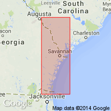
Bear Bluff Formation of southeastern NC and northeastern SC lies above Duplin Formation and is equivalent to Cypresshead Formation of GA. Cypresshead lies above Raysor Formation. Bear Bluff is equivalent to Nashua Formation of northeastern FL. Bear Bluff, Cypresshead, and Nashua are equivalent to Zone PL5 of Berggren (1973) and are assigned a late Pliocene age. Other than limited microfossil data, there is no age control for Cypresshead. Huddlestun (1988) reports juvenile planktic Foraminifera in Cypresshead from core in Wayne Co., GA, that suggest an age no younger than Pliocene based on GLOBOGERINOIDES OBLIQUS. Benthic Foraminifera VIRGULINELLA GUNTERI from core in Chatham Co., GA, also indicate Pliocene age. Diatom assemblage from core in Byram Co., GA, suggests probable latest Pliocene to early Pleistocene age, including the possible Pliocene forms in genus RAPHONEIS. Assuming all three samples represent same unit, age of Cypresshead ranges from late Pliocene to early Pleistocene. However, authors consider age of Nashua to be latest late Pliocene and wholly or partially equivalent in age to Bear Bluff Formation of northeastern SC.
Source: GNU records (USGS DDS-6; Reston GNULEX).
For more information, please contact Nancy Stamm, Geologic Names Committee Secretary.
Asterisk (*) indicates published by U.S. Geological Survey authors.
"No current usage" (†) implies that a name has been abandoned or has fallen into disuse. Former usage and, if known, replacement name given in parentheses ( ).
Slash (/) indicates name conflicts with nomenclatural guidelines (CSN, 1933; ACSN, 1961, 1970; NACSN, 1983, 2005, 2021). May be explained within brackets ([ ]).