- Usage in publication:
-
- Nantahala slate*
- Modifications:
-
- Named
- Dominant lithology:
-
- Slate
- Schist
- AAPG geologic province:
-
- Piedmont-Blue Ridge province
Summary:
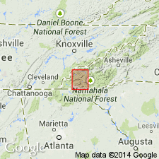
Nantahala slate named. Consists predominantly of black and gray banded slates and schists distinguished by mica, garnet, staurolite, or ottrelite. Most of the schists are near the base of formation and strongly resemble the slate and schist beds in Great Smoky conglomerate. The slates and ottrelite schists are as a rule somewhat darker than the other beds, the color being due to very minute grains of iron oxide. The slates are banded light and dark gray and bluish gray and cannot be distinguished from the slates in other formations. In northern half of quad, slate makes up nearly all of the formation, but forms only the upper beds in the southern half. Many sandstones and conglomerate beds are interstratified with the slate near its base and form a transition into underlying Great Smoky conglomerate. Unimportant layers of graywacke or conglomerate are also found higher up in the slate. Thickness 1,400 to 1,800 ft. Overlain by Tusquitee quartzite.
Source: GNU records (USGS DDS-6; Reston GNULEX).
- Usage in publication:
-
- Nantahala slate*
- Modifications:
-
- Revised
- AAPG geologic province:
-
- Piedmont-Blue Ridge province
Summary:
Term Nantahala slate is used as defined by Keith (1907) but included in Ocoee series and age given as late Precambrian. Slate is present above Great Smoky quartzite in main syncline of Ocoee series in Bald Mountains, in Great Smoky Mountains in vicinity of Newfound Gap and southwestward, and on flanks of Murphy syncline from northeast corner of Nantahala quad southwestward into northern GA. In deeper parts of the syncline, as in Bald Mountains and Murphy syncline, slate is overlain by Big Butt (Tusquitee) quartzite. Northwest of main syncline, from Little Tennessee River southward across southern TN and NC, slate is enclosed in minor synclines in Great Smoky quartzite.
Source: GNU records (USGS DDS-6; Reston GNULEX).
- Usage in publication:
-
- Nantahala Formation
- Modifications:
-
- Overview
- Redescribed
- Dominant lithology:
-
- Siltstone
- Sandstone
- AAPG geologic province:
-
- Piedmont-Blue Ridge province
Summary:
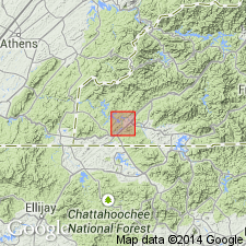
Best exposed section of the Nantahala and Brasstown Formations of Hiwassee River Group is found on both banks of the Hiwassee River west of Murphy, NC. In reference section H, Nantahala Formation measures 1550 m and Brasstown Formation measures 1319 m. Murphy Marble here is 167 m. Nantahala here is composed of siltstone and sandstone. Though Keith (1904 and 1907) described the Nantahala as containing slates, Nantahala of this study more accurately described as containing siltstones, as mica content is low and slaty cleavage is not well developed. The Brasstown Formation is mostly light gray to dark gray siltstones and schists. Entire Chilhowee Group is thought to be correlative to the siliciclastic portion of the Hiwassee River Group. "If the Cochran Formation rocks are facies-transition equivalents to the sandstones and siltstones of the Nantahala Formation, then the Brasstown Formation may be equivalent in time to the transgressive sequences of the Nichols/Nebo and Murray/Hesse Formations. Shady Dolomite and Murphy Marble would be carbonate "platform" equivalents." According to Walker and Driese (1991), the Late Proterozoic-Early Cambrian boundary is located somewhere in the upper Cochran Formation.
Source: GNU records (USGS DDS-6; Reston GNULEX).
- Usage in publication:
-
- Nantahala Formation
- Modifications:
-
- Revised
- Overview
- AAPG geologic province:
-
- Piedmont-Blue Ridge province
Summary:
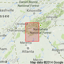
Nantahala Formation is here assigned to the base of the newly named Hiwassee River Group. New group encompasses strata lying between Great Smoky Group and Mineral Bluff Group (rank raised) in the Murphy belt of NC and GA. Slates at the base of the Nantahala are conformable and gradational with the schists at the top of the Dean Formation of the Great Smoky Group. The Nantahala includes all black slate, schist, and arkosic quartzite above the Dean and below the Brasstown Formation. Tusquitee Quartzite recognized by previous workers above the Nantahala is here abandoned and the strata assigned to the Nantahala. Bedding throughout is typically thin to laminated and is defined by graphite-rich pelitic layers interbedded with lighter colored metasiltstone and metasandstone.
Source: GNU records (USGS DDS-6; Reston GNULEX).
- Usage in publication:
-
- Nantahala Formation*
- Modifications:
-
- Overview
- AAPG geologic province:
-
- Piedmont-Blue Ridge province
Summary:
Nantahala Formation used on map. Name follows usage of Brown and others (1985) on NC State geologic map. Age is Cambrian(?) [differs from State geologic map].
Source: GNU records (USGS DDS-6; Reston GNULEX).
- Usage in publication:
-
- Nantahala Formation*
- Modifications:
-
- Age modified
- Revised
- Overview
- AAPG geologic province:
-
- Piedmont-Blue Ridge province
- Appalachian basin
Summary:
Nantahala Formation, from its type locality along Nantahala River in NC to southeast of Tate, GA, is mostly at staurolite metamorphic grade and is mostly a (+/-staurolite)-(+/-garnet)-pyrite-graphite-muscovite-quartz-feldspar schist interbedded with thin feldspathic quartzites and commonly containing thin lenses of orthoclase and blue quartz granulite/pebble metaconglomerate. Nantahala has been mapped from Carterville quad through Dalton quad into type locality in Fontana Lake quad, so there is no question that the Nantahala in GA is the same as that in NC. Southeast of Tate, undergoes a facies change; graphite content increases and thin beds of feldspathic quartzite disappear over a strike distance of a few tens of kilometers until Nantahala becomes a graphitic schist with quartzite and metaconglomerate lenses. This graphitic phase is named Laffingal Member. Maximum outcrop width is about 300 m; thicknesses shown in measured sections by Aylor (1991) or Tull and others (1991) should be discounted because they did not take into consideration faulting or folding. Contact between Nantahala and Corbin metagranite is nearly everywhere a thrust fault. Paraconformably overlies Pinelog Formation. Presence of metaconglomerates and blue quartz and feldspar derived from Corbin in both Nantahala and Pinelog indicates that Nantahala generally overlies, but may be partly a distal, finer grained facies of Pinelog. Cambrian age assigned by Keith (1907) doesn't have any evidence to support it. Nantahala must be younger than Corbin Gneiss and is probably older than Middle Ordovician Rockmart Slate because it is thrust over Rockmart in places. Therefore, an age of Late Proterozoic to Middle Ordovician is tentatively assigned to Nantahala. Report includes geologic map and correlation chart.
Source: GNU records (USGS DDS-6; Reston GNULEX).
For more information, please contact Nancy Stamm, Geologic Names Committee Secretary.
Asterisk (*) indicates published by U.S. Geological Survey authors.
"No current usage" (†) implies that a name has been abandoned or has fallen into disuse. Former usage and, if known, replacement name given in parentheses ( ).
Slash (/) indicates name conflicts with nomenclatural guidelines (CSN, 1933; ACSN, 1961, 1970; NACSN, 1983, 2005, 2021). May be explained within brackets ([ ]).

