The National Geologic Map Database is migrating to a new infrastructure. We apologize for any service disruptions during this process.
|
|---|


- Usage in publication:
-
- Nankoweap group
- Modifications:
-
- Overview
- Dominant lithology:
-
- Sandstone
- Shale
- Limestone
- AAPG geologic province:
-
- Southern Rocky Mountain region
Summary:
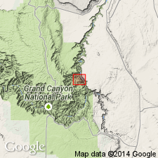
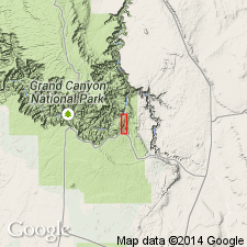
Author gives more complete description of Nankoweap group than previous reports. Type section in Basalt Canyon, north side of Colorado River south of its intersection with Little Colorado River, where 330 ft of Nankoweap exposed. Is separated at type from underlying Unkar group and overlying Chuar group by disconformities. In Basalt Canyon consists of (ascending): 1) white, brown, purple siliceous sandstone; 2) white, purple, brown thin-bedded sandstone with ripple marks and some mudcracks; 3) white, brown, purple thin-bedded sandstone with thin-bedded purple and red shale, some beds ripple marked, some cross-bedded; 4) gray sandy limestone with laminae of green shale. Locally conglomerate at base contains well rounded cobbles and pebbles up to 8 in across imbedded in matrix of sand grains of quartz, feldspar, basaltic debris. Material in conglomerate larger than half a cm in diameter amygdules from lava, 85 percent; red or pink siliceous sandstone, 15 percent. Mineral grains: quartz 91-96 percent; remainder feldspar. Silica predominant cementing material. Nankoweap sediments resemble Unkar and were mapped as upper Unkar and lower Chuar by Walcott (1895); considered by author as transitional between Unkar and Chuar. Impression of jellyfish medusa found 150 ft above base. Thought to have been deposited in ocean, bay, or estuary in Algonkian time. Geologic map. Confined to eastern Grand Canyon, AZ, Southern Rocky Mountain region.
Source: GNU records (USGS DDS-6; Denver GNULEX).
- Usage in publication:
-
- Nankoweap Formation*
- Modifications:
-
- Revised
- AAPG geologic province:
-
- Southern Rocky Mountain region
Summary:
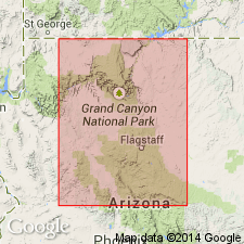
Nankoweap Formation assigned as a formation to the Grand Canyon Supergroup (rank term changed from "Series") and as the formation unconformably above the Cardenas Lavas of the Unkar Group and unconformably beneath the Chuar Group of the Grand Canyon Supergroup. Geologic maps. Report area covers the Grand Canyon area of northern AZ in the Southern Rocky Mountain region. Nankoweap divided into a ferruginous member, which is restricted to the graben at Tanner Canyon rapids and a disconformably overlying upper member. The ferruginous member, 3 to 13 m thick, consists of finely laminated, very fine grained, light red-brown sandstone; the lower two-thirds of this member is well cemented by hematite making it resistant to erosion; the upper one-third is less well cemented and forms a bench. The ferruginous member was deposited in quiet standing water. Upper member, 100 m thick, is the same as the Nankoweap Formation of Van Gundy (1934, 1951) and the Nankoweap Formation of Maxon (1961, 1967). Of Precambrian age.
Source: GNU records (USGS DDS-6; Denver GNULEX).
- Usage in publication:
-
- Nankoweap Formation*
- Modifications:
-
- Age modified
- AAPG geologic province:
-
- Southern Rocky Mountain region
Summary:
Is a formation in Grand Canyon Supergroup. Unconformably overlies Cardenas Basalt of Unkar Group. Unconformably underlies Galeros Formation of Chuar Group. Is 113 to 250+ m thick. Designation of age as Proterozoic Y changed to Middle Proterozoic, the age term applied to rocks older than 900 Ma and younger than 1,600 Ma. Two members recognized. Only remnants of the basal ferruginous member preserved. Upper member was deposited in sand and mud flats and as a beach sand. Upper member thought to be slightly younger than the Chequamegon Sandstone of Lake Superior region. Used in the Southern Rocky Mountain region of northern AZ. Columnar section.
Source: GNU records (USGS DDS-6; Denver GNULEX).
- Usage in publication:
-
- Nankoweap Formation*
- Modifications:
-
- Overview
- AAPG geologic province:
-
- Southern Rocky Mountain region
Summary:
In northern AZ, Southern Rocky Mountain region, Middle-Late Proterozoic boundary is at unconformity between Nankoweap and overlying Chuar Group, both of Grand Canyon Supergroup. Although boundary is placed at unconformity, no appreciable structural disturbance is recognized in Grand Canyon rocks. Nominal age of boundary is 900 Ma. Boundary separates Middle Proterozoic redbed rocks from overlying early Late Proterozoic rocks that record a time of flourishing of plankters and a general suppression of redbeds. Middle-Late Proterozoic boundary previously (Elston, 1979, USGS Prof. Paper 1092; Elston, McKee, 1982, GSA Bull., v. 93, p. 681-699) drawn to correspond with Grand Canyon-Mackenzie Mountains orogeny at top of Grand Canyon Supergroup to which nominal age of 800 Ma was assigned. Middle Proterozoic age.
Source: GNU records (USGS DDS-6; Denver GNULEX).
For more information, please contact Nancy Stamm, Geologic Names Committee Secretary.
Asterisk (*) indicates published by U.S. Geological Survey authors.
"No current usage" (†) implies that a name has been abandoned or has fallen into disuse. Former usage and, if known, replacement name given in parentheses ( ).
Slash (/) indicates name conflicts with nomenclatural guidelines (CSN, 1933; ACSN, 1961, 1970; NACSN, 1983, 2005, 2021). May be explained within brackets ([ ]).