

- Usage in publication:
-
- Nacatoch (Washington) sand
- Modifications:
-
- Original reference
- Dominant lithology:
-
- Sand
- AAPG geologic province:
-
- Ouachita folded belt
Summary:
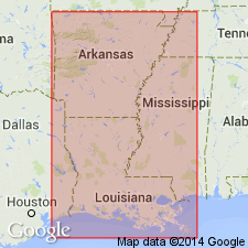
Pg. 84, 85, 87-88, and USGS Water-Supply Paper 114, p. 180, 183. Nacatoch (Washington) sand. Name taken from typical exposures at Nacatoch Bluff, on Little Missouri River in Clark County, southwestern Arkansas, and includes the sandy beds between the Marlbrook below and the Arkadelphia above. Called Washington Greensands by Hill, which name is preoccupied. Thickness 150 to 200 feet. [Age is Late Cretaceous.]
[Nacatoch Bluff, local name, possibly located in sec. 1, T. 10 S., R. 22 W., Okolono South 7.5-min quadrangle. See also W.D. Hanson and others, 2000, Arkansas Geol. Comm., Digital Geol. Quad. Map, no. DGM-AR-00648, scale 1:24,000; Nacatoch Sand mapped in unnamed bluffs along Little Missouri River in Clark Co.]
Source: US geologic names lexicon (USGS Bull. 896, p. 1455-1456).
- Usage in publication:
-
- Nacatoch sand
- Modifications:
-
- Areal extent
- AAPG geologic province:
-
- Arkla basin
Summary:
Pg. 26-27. Nacatoch sand. A series of sandy beds overlying Marlbrook marl and underlying Arkadelphia clay. Outcrop at Nacatoch Bluff, on Little Missouri River, Clark County, southwestern Arkansas, measures 64 feet in thickness, and includes a minor amount of sandy limestone and calcareous sandstone. In western part of region the sands are of rather light color. About Hope [Hempstead County, Arkansas] they are 100 to 160 feet thick in wells. Toward Arkadelphia the sand grows darker and thinner. In well of Arkadelphia Ice and Fuel Company it appears to extend from 100 to 160 feet, and is therefore about 60 feet thick. Nearly = "Washington greensand" or "Washington or High Bluff greensand" of Hill. [Age is Late Cretaceous.]
Source: US geologic names lexicon (USGS Bull. 896, p. 1455-1456).
- Usage in publication:
-
- Nacatoch sand
- Modifications:
-
- Revised
Summary:
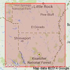
Nacatoch sand as now interpreted is a complex unit of cross-bedded yellowish and gray fine-grained unconsolidated quartz sand, hard crystalline fossiliferous sandy limestone, coarse, richly glauconitic sand, fine argillaceous dark blue-black sand, and pure light-gray clay and marl, resting unconformably on Saratoga chalk, also on the older Marlbrook marl restricted and the still older Ozan formation. There is no doubt that most of the beds included by Hill in "Washington or High Bluff greensand beds" as well as the underlying "Blue sands of High Bluff and of Pate's Creek" were included by Veatch in upper part of his Marlbrook formation. From point west of Washington, Hempstead County, Arkansas, east to Dobyville, Clark County, the Nacatoch is divisible into three gradational lithologic units (descending): (1) Unconsolidated gray fine-grained quartz sand which weathers yellowish and reddish. (2) Dark-greenish sand containing 20 to 80 percent of coarse glauconite grains and weathering to lighter shades of green; generally fossiliferous where strongly glauconitic; contains hard irregular concretionary beds cemented with calcite and subordinate beds of dark blue-gray argillaceous massive fine-grained sand. Most extensive exposures in vicinity of Washington, where 30 feet is shown. (3) Bedded gray clay, sandy clay, and marl; dark clayey, very fine-grained sand and harder irregular concretionary beds; contains lenses of calcareous fossiliferous, slightly glauconitic sand. Nacatoch Bluff exposes about 50 feet of upper part of formation. Thickness 150 to 400 feet; in vicinity of Arkadelphia not much over 150 feet. [Age is Late Cretaceous.]
Source: US geologic names lexicon (USGS Bull. 896, p. 1455-1456).

- Usage in publication:
-
- Nacatoch sand*
- Modifications:
-
- Overview
Summary:
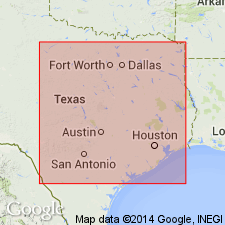
Nacatoch sand (southwestern Arkansas, northwestern Louisiana); Nacatoch sand of Navarro group (northeastern Texas). The Navarro deposits of northeastern Texas are now called a group, divided into (descending) Kemp clay (restricted), Corsicana marl (restricted), Nacatoch sand, and Neylandville marl. (See Univ. Texas Bull., no. 3232, 1933, L.W. Stephenson and W.S. Adkins, and USGS geol. map of Texas, 1937.)
Source: US geologic names lexicon (USGS Bull. 896, p. 1455-1456).
- Usage in publication:
-
- Nacatoch sand*
Summary:
Pg. 20-22. Nacatoch sand of Navarro group. In Texas. consists mainly of gray massive more or less calcareous marine sand, subordinate parts of which are indurated to hard calcareous concretionary masses of various sizes as much as several feet in longest dimension. Thickness 100 to 200 feet. Narrow belt of outcrop lies immediately to east of, and parallel to, that of Neylandville marl and has been traced southward through Texas as far as northern Falls County, where it passes under transgressing Corsicana marl. [Age is Late Cretaceous.]
Source: US geologic names lexicon (USGS Bull. 1200, p. 2668).
- Usage in publication:
-
- Nacatoch sand
- Modifications:
-
- Revised
- AAPG geologic province:
-
- Arkla basin
- Ouachita folded belt
Drouant, R.G., 1960, Stratigraphy and Ostracoda of the Exogyra costata zone in southwestern Arkansas: Dissertation Abstracts, v. 20, no. 11, p. 4367-4368., Louisiana State University, PhD dissert., 158 p., 1959
Summary:
Nacatoch sand of Navarro group. Discussion of stratigraphy and Ostracoda of EMOGYRA COSTATA zone which embraces Saratoga, Nacatoch, and Arkadelphia formations of southwestern Arkansas. Units were traced on surface from Little River in Hempstead County to Arkadelphia in Clark County. Nacatoch formation is restricted to include upper arenaceous member and lower glauconitic member. Glauconitic member is a concentrate above an angular unconformity developed upon the chalk and argillaceous-arenaceous member of the Saratoga. Argillaceous-arenaceous member of Saratoga formerly included in Nacatoch. Age is Late Cretaceous.
(See also Kennedy and Cobban, 1993, Jour. Paleo, v. 67, no. 3, p. 404-434, and references therein.)
Source: US geologic names lexicon (USGS Bull. 1200, p. 2668).

- Usage in publication:
-
- Nacatoch Sand
- Modifications:
-
- Mapped 1:250k
- Dominant lithology:
-
- Sand
- Clay
- Sandstone
- AAPG geologic province:
-
- East Texas basin
- Gulf Coast basin
Summary:
Nacatoch Sand. Quartz, fine- to medium-grained, glauconitic, poorly sorted, friable, greenish gray; local lenses of silty clay; calcite-cemented sandstone in thin hard beds in lower and upper parts. Thickness up to 180 feet, feathers out southward near Rosebud. Lies above Neylandville Formation and below Kemp Clay. Age is Late Cretaceous.
Mapped in Falls, Limestone, Milam, and Navarro Cos., eastern TX.
[Corsicana Marl, which overlies the Nacatoch on the Dallas Sheet to the north, is not mapped or discussed on this map sheet.]
Source: Publication; supplemental information from GNU records (USGS DDS-6; Denver GNULEX).
- Usage in publication:
-
- Nacatoch Sand*
- Modifications:
-
- Paleomagnetics
- AAPG geologic province:
-
- Arkla basin
Summary:
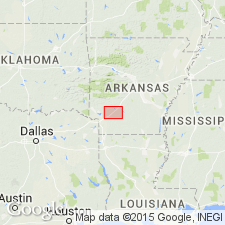
Paleomagnetic (a.f. demagnetized) data indicates the Upper Cretaceous Nacatoch Sand in the Arkla basin in southwest AR possesses a remanent magnetization of reversed magnetic polarity. The deposit is correlated with the Gubbio (Italy) reversed polarity zone E (middle Maestrichtian).
Source: GNU records (USGS DDS-6; Denver GNULEX).

- Usage in publication:
-
- Nacatoch Sand
- Modifications:
-
- Mapped 1:250k
- Dominant lithology:
-
- Sand
- Clay
- Sandstone
- AAPG geologic province:
-
- East Texas basin
Summary:
Nacatoch Sand. Quartz sand, fine-grained, poorly sorted, friable, silty, glauconitic, local lenses of silty clay, compact, light gray to greenish gray; thin calcareous sandstone beds in upper and lower parts. Thickness 250+/- feet. Lies above Neylandville Formation and below Corsicana Marl. Marine megafossils. Age is Late Cretaceous.
[Mapped in Hunt, Kaufman, Navarro, and Rockwall Cos., eastern TX.]
Source: Publication.

- Usage in publication:
-
- Nacatoch Sand
- Modifications:
-
- Mapped 1:250k
- Dominant lithology:
-
- Sand
- AAPG geologic province:
-
- East Texas basin
Summary:
Pamphlet [p. 1]. Nacatoch Sand of Navarro Group. Quartz sand, light- to medium-gray, fine-grained, silty, locally calcareous concretions in discontinuous beds, marine megafossils. Thickness approximately 200 feet. [Overlies Neylandville Marl; underlies Nacatoch Sand of Navarro Group.] Age is Late Cretaceous.
[Mapped south of Greenville in extreme southeast corner of map sheet, in Hunt Co., northeastern TX.]
Source: Publication.
- Usage in publication:
-
- Nacatoch Sand*
- Modifications:
-
- Age modified
- Biostratigraphic dating
- AAPG geologic province:
-
- Arkla basin
Summary:
An ammonite assemblage of the NOSTOCERAS (NOSTOCERAS) RUGOSUM zone has been found in concretions from the middle glauconite member of the Nacatoch Sand in NE1/4 sec 14, T11S, R25W, Hempstead Co, AR in the Arkla basin. The middle member is dated thus on the basis of the ammonite as late Campanian. However, authors note that those working on nannofossils and planktonic forams consider Nacatoch Maastrichtian because it overlies Saratoga Marl of the GLOBOTRUNCANITA FORNICATA-STUARTIFORMIS assemblage zone. Ammonites of the N. (N.) RUGOSUM zone are regarded as late Campanian because they have affinities with ammonites considered unequivocally Campanian.
Source: GNU records (USGS DDS-6; Denver GNULEX).
For more information, please contact Nancy Stamm, Geologic Names Committee Secretary.
Asterisk (*) indicates published by U.S. Geological Survey authors.
"No current usage" (†) implies that a name has been abandoned or has fallen into disuse. Former usage and, if known, replacement name given in parentheses ( ).
Slash (/) indicates name conflicts with nomenclatural guidelines (CSN, 1933; ACSN, 1961, 1970; NACSN, 1983, 2005, 2021). May be explained within brackets ([ ]).