

- Usage in publication:
-
- Murfreesboro limestone
- Modifications:
-
- Named
- Dominant lithology:
-
- Limestone
- AAPG geologic province:
-
- Appalachian basin
Summary:
Named Murfreesboro limestone of Stones River group for Murfreesboro, Rutherford Co., TN (also known as the Central limestone). Consists of light-blue heavy-bedded and often cherty limestone. It is the lowest limestone of the Central Basin and is 70 feet thick. Unit is considered the basal formation of the Stones River Group (Chazy) and is of Early Ordovician age.
Source: GNU records (USGS DDS-6; Reston GNULEX).

- Usage in publication:
-
- Murfreesboro Limestone*
- Modifications:
-
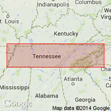
- Areal extent
- AAPG geologic province:
-
- Appalachian basin
Summary:
The Murfreesboro Limestone of the Stones River Group, as used by Milici and Smith (1969), is here used in the Chickamauga terrane in GA. Age is Middle Ordovician.
Source: GNU records (USGS DDS-6; Reston GNULEX).

- Usage in publication:
-
- Murfreesboro Limestone*
- Modifications:
-
- Overview
- AAPG geologic province:
-
- Cincinnati arch
Summary:
The Murfreesboro Limestone of the Stones River Group in central Tennessee consists of mainly dark gray, very fine grained, massively bedded limestone that locally contains laminations, mud cracks, intraformational conglomerate, chert, and dolomitized burrows. Unit is the oldest formation exposed in the Central Basin of Tennessee (70 feet exposed thickness) and underlies the Pierce Limestone of the Stones River Group. The Murfreesboro was deposited in a shallow, probably restricted marine environment like an inner shelf lagoon and tidal flat.
Source: GNU records (USGS DDS-6; Reston GNULEX).
For more information, please contact Nancy Stamm, Geologic Names Committee Secretary.
Asterisk (*) indicates published by U.S. Geological Survey authors.
"No current usage" (†) implies that a name has been abandoned or has fallen into disuse. Former usage and, if known, replacement name given in parentheses ( ).
Slash (/) indicates name conflicts with nomenclatural guidelines (CSN, 1933; ACSN, 1961, 1970; NACSN, 1983, 2005, 2021). May be explained within brackets ([ ]).