


- Usage in publication:
-
- Muldoon Canyon Formation
- Modifications:
-
- Named
- Dominant lithology:
-
- Argillite
- Conglomerate
- Quartzite
- Limestone
- AAPG geologic province:
-
- Idaho Mountains province
- Snake River basin
Summary:
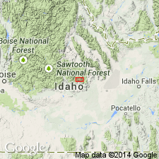
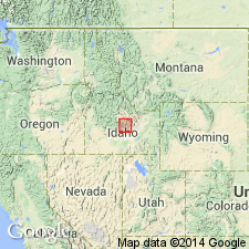
Named 1 of 6 formations of Copper Basin Group (rank raised) for Muldoon Canyon at south end of Copper Basin. Type section designated, measured at W1/2 sec 19, T4N, R22E (basal 1,100 ft) and E1/2 NE1/4 sec 7 to center of NE1/4 SW1/4 NE1/4 sec 8, T4N, R22E (remaining 3,050 ft), Custer Co, ID, Idaho Mountains province. Gradationally overlies Scorpion Mountain Formation (new) of Copper Basin; contact placed where non-resistant thin-bedded quartzite and argillite predominate. Conformably underlies Brockie Lake Conglomerate (new) of Copper Basin; contact placed at base first light-gray quartzite cobble conglomerate or light-gray quartzite. Exposed along discontinuity from north edge Snake River plain to T8N, R20E, Snake River basin. Thins north and south of type to about 500 ft. At type consists of basal 1,600 ft of dark- to medium-gray (weathers light gray), silty, thin- to medium-bedded argillite (about 70%) interbedded with medium-gray quartzite and dark-gray quartzite-chert-argillite granule to pebble conglomerate, and very minor amount dark-gray to black micaceous mudstone, and of upper 1,600-2,100 ft of dark-gray silty argillite (90%) interbedded with quartzite and conglomerate. Newly named Green Lake Limestone Member occurs about 100 ft below formation top. Poorly preserved brachiopods, ammonites, gastropods, corals, cephalopods, pelecypods. Tentatively assigned to Late Mississippian?, late "Chesteran"? to Early Pennsylvanian?
Source: GNU records (USGS DDS-6; Denver GNULEX).
- Usage in publication:
-
- Muldoon Canyon Formation
- Modifications:
-
- Age modified
- AAPG geologic province:
-
- Idaho Mountains province
Summary:
Recognized (stratigraphic chart) as one of six formations of Copper Basin Group in central Pioneer Mountains, Custer Co, ID, Idaho Mountains province, where it intertongues with the older Scorpion Mountain Formation of the Copper Basin and also intertongues with the younger Brockie Lake Conglomerate of the Copper Basin. Age modified from Late Mississippian? to Early Pennsylvanian? to Early and Late Mississippian [specific reason not stated]. Green Lake Limestone Member shown on chart as Late Mississippian age.
Source: GNU records (USGS DDS-6; Denver GNULEX).
- Usage in publication:
-
- Muldoon Canyon Member*
- Modifications:
-
- Revised
- AAPG geologic province:
-
- Snake River basin
Summary:
Rank reduced and assigned as one of four members of newly named Argosy Creek Formation of Copper Basin Group (revised). Argosy Creek includes all units within Copper Basin Group above Drummond Mine Limestone: Scorpion Mountain, Muldoon Canyon, Brockie Lake Conglomerate, and Iron Bog Creek Members, all reduced from formation rank. Argosy Creek defined because upper part of Copper Basin Group is poorly exposed and abrupt facies changes make previous formation-rank units difficult to map. Occurs in area of Pioneer Mountains, Blaine Co, ID (Snake River basin) west of Copper Basin thrust fault. Contains primarily fine-grained turbidite lithofacies with rare lime mudstone intervals, including Green Lake Limestone Bed (rank reduced). Muldoon Canyon thins southward and Scorpion Mountain thins to north. Measured section; geologic map (fig 4); correlation charts. Basal contact with Scorpion Mountain Member cuts stratigraphically upward to south; underlies Brockie Lake Conglomerate Member with angular unconformity; disconformity thought to span much of Osagean time. Assigned Early Mississippian age, as Kinderhookian conodonts have been identified from several limestone lenses.
Source: GNU records (USGS DDS-6; Denver GNULEX).
For more information, please contact Nancy Stamm, Geologic Names Committee Secretary.
Asterisk (*) indicates published by U.S. Geological Survey authors.
"No current usage" (†) implies that a name has been abandoned or has fallen into disuse. Former usage and, if known, replacement name given in parentheses ( ).
Slash (/) indicates name conflicts with nomenclatural guidelines (CSN, 1933; ACSN, 1961, 1970; NACSN, 1983, 2005, 2021). May be explained within brackets ([ ]).