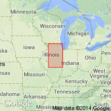
- Usage in publication:
-
- Mulberry Grove Silt Member
- Modifications:
-
- Named
- Dominant lithology:
-
- Silt
- AAPG geologic province:
-
- Illinois basin
Summary:
Informal Mulberry Grove silt of Jacobs and Lineback (1969) is here formally proposed as Mulberry Grove Silt Member of Glasford Formation. It is a thin, lenticular unit generally less than 1.5 ft thick and consists mostly of calcareous silt, and locally contains a few fossil snail shells and lenses of sand and gravel. Underlies the Vandalia Till Member and overlies the Smithboro Till Member, both of the Glasford Formation. Occurs at approximately the same stratigraphic position as the Duncan Mills Member of central western IL. Unit is probably within the early part of the Monican Substage of the Illinoian.
Source: GNU records (USGS DDS-6; Reston GNULEX).

- Usage in publication:
-
- Mulberry Grove Member
- Modifications:
-
- Revised
- Overview
- AAPG geologic province:
-
- Illinois basin
Summary:
In the study area, the Mulberry Grove Silt Member of the Glasford Formation is as much as 58 ft thick and comprises three distinguishable facies composed of sand and gravel, diamicton, and silt loam. Because the sand and gravel facies is dominant in the area, silt is dropped from the name in this report. Regional distribution is not well known. Sediments equivalent to the sand and gravel facies and the silt facies have been described in the type area near Vandalia, IL, and in Coles Co., IL. Unit is 31 ft in thickness under the Martinsville alternative site and reaches 58 ft in the North Fork Embarras River valley. Thickness in the area averages 17.8 ft. A persistent layer of the diamicton facies is sandwiched by the sand and gravel facies along the North Fork Embarras River buried valley, where they occupy a paleochannel eroded in the Smithboro Till Member. The sand and gravel facies, alone, reaches 35 ft in thickness. The diamicton facies, composed of beds of gray loam to clay loam diamicton is less than 12 ft, though it is persistent. The silt facies consists of silty sediment that is gray, yellowish brown, or locally black, organic rich, and leached or weakly calcareous. The clay mineralogy is nearly identical to that of the underlying Smithboro Till Member. and is generally less than 1 ft thick at the Martinsville site but reaches 10 ft nearby. The Mulberry Grove is a moderate yielding aquifer. Underlies the Vandalia Till Member. Age is Pleistocene (Illinoian).
Source: GNU records (USGS DDS-6; Reston GNULEX).
For more information, please contact Nancy Stamm, Geologic Names Committee Secretary.
Asterisk (*) indicates published by U.S. Geological Survey authors.
"No current usage" (†) implies that a name has been abandoned or has fallen into disuse. Former usage and, if known, replacement name given in parentheses ( ).
Slash (/) indicates name conflicts with nomenclatural guidelines (CSN, 1933; ACSN, 1961, 1970; NACSN, 1983, 2005, 2021). May be explained within brackets ([ ]).

