The National Geologic Map Database is migrating to a new infrastructure. We apologize for any service disruptions during this process.
|
|---|


- Usage in publication:
-
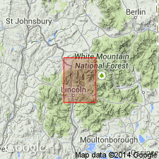
- Mount Osceola granite
- Modifications:
-
- Named
- Dominant lithology:
-
- Granite
- AAPG geologic province:
-
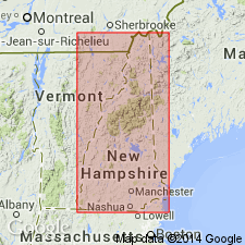
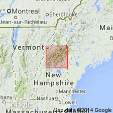
- New England province
Summary:
Named for Mount Osceola, Franconia 15-min quad, northern NH. Assigned to White Mountain magma series. Exposed on Mount Osceola and Scar Ridge. Consists of a group of granites, typically coarse to medium grained, weathering white to gray. Older than Conway granite, either late Devonian or late Carboniferous.
Source: GNU records (USGS DDS-6; Reston GNULEX).
- Usage in publication:
-
- Mount Osceola Granite*
- Modifications:
-
- Age modified
- Geochronologic dating
- AAPG geologic province:
-
- New England province
Summary:
Page F2 states that the White Mountain Plutonic-Volcanic Series has an age of Late Triassic or Early Jurassic. Isotope age determination by Tilton and others (1957) and Hurley and others (1960) yields an age of 180 m.y. [It is unclear how 180 m.y. translates into Late Triassic or Early Jurassic. The ages of the Conway Granite, Mount Osceola Granite, Mount Lafayette Granite Porphyry, Mount Garfield Porphyritic Quartz Syenite, and the Albany Quartz Syenite are inferred to be Late Triassic or Early Jurassic.]
Source: GNU records (USGS DDS-6; Reston GNULEX).
- Usage in publication:
-
- Mount Osceola Granite*
- Modifications:
-
- Age modified
- AAPG geologic province:
-
- New England province
Summary:
Although ages as old as Late Triassic have been reported from rocks of the White Mountain Plutonic-Volcanic Suite from southernmost ME, no ages older than Early Jurassic have been reported from the present map area.
Source: GNU records (USGS DDS-6; Reston GNULEX).

- Usage in publication:
-
- Mount Osceola Granite*
- Modifications:
-
- Age modified
- AAPG geologic province:
-
- New England province
Summary:
White Mountain batholith and outlying bodies, including Mount Osceola Granite, are Jurassic in age.
Source: GNU records (USGS DDS-6; Reston GNULEX).
- Usage in publication:
-
- Mount Osceola Granite
- Modifications:
-
- Geochronologic dating
- AAPG geologic province:
-
- New England province
Summary:
Radiometric age of 186.8 +/-1.2 Ma obtained by Rb/Sr whole-rock methods (table 2). Mount Osceola granite has second greatest areal extent of units of White Mountain batholith. Field relations indicate that it is younger than Mount Lafayette granite porphyry and Mount Garfield porphyritic quartz syenite, but older than Conway granite.
Source: GNU records (USGS DDS-6; Reston GNULEX).

- Usage in publication:
-
- Mount Osceola Granite*
- Modifications:
-
- Areal extent
- Geochronologic dating
- Age modified
- Overview
- AAPG geologic province:
-
- New England province
Summary:
Mapped in the White Mountain batholith in the North and South Doublehead [mountains] and Redstone areas, Carroll Co., NH, and west of the Saco River in Grafton Co., as well as in its type area on the southern edge of the Lewiston 15-min quad. Included with similar Jurassic rocks exposed outside of White Mountain batholith. Mapped as part of the White Mountain Plutonic-Volcanic Suite. Described as hornblende-biotite-mesoperthite granite, typically green, medium- to coarse-grained, commonly containing hastingsite, ferrohedenbergite; or fayalite; locally pink. Locally interlayered with and not easily distinguished from Conway Granite or Conway-type granite. Age is Jurassic based on Rb/Sr whole-rock isochron of 187 +/-1 Ma (Eby and others, 1992) and using time scale of Harland and others (1989). Report includes geologic map, cross sections, and correlation chart.
Source: GNU records (USGS DDS-6; Reston GNULEX).

- Usage in publication:
-
- Mount Osceola Granite*
- Modifications:
-
- Overview
- Age modified
- Geochronologic dating
- AAPG geologic province:
-
- New England province
Summary:
Used as Mount Osceola Granite of White Mountain Plutonic-Volcanic Suite. Mapped as two units, one consisting of green biotite mesoperthitic granite, the other as granite containing hornblende, and locally hastingsite, ferrohedenbergite, or fayalite. Age changed from Early Jurassic of previous workers to Early and Middle Jurassic based on Rb/Sr isotopic age of 187 +/-1 Ma (Eby and others, 1992). Report includes geologic map and correlation chart, and 1:500,000-scale map showing plutons and sample localities for age dating.
Source: GNU records (USGS DDS-6; Reston GNULEX).
For more information, please contact Nancy Stamm, Geologic Names Committee Secretary.
Asterisk (*) indicates published by U.S. Geological Survey authors.
"No current usage" (†) implies that a name has been abandoned or has fallen into disuse. Former usage and, if known, replacement name given in parentheses ( ).
Slash (/) indicates name conflicts with nomenclatural guidelines (CSN, 1933; ACSN, 1961, 1970; NACSN, 1983, 2005, 2021). May be explained within brackets ([ ]).