

- Usage in publication:
-
- Mount Laurel sands
- Modifications:
-
- Named
- Dominant lithology:
-
- Sand
- AAPG geologic province:
-
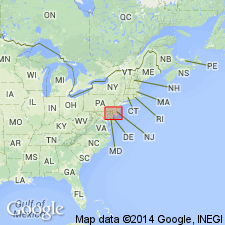
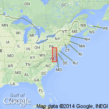
- Atlantic Coast basin
Summary:
Mount Laurel sands, named for town in Burlington Co., described as coarse red sands, often indurated by iron content. More or less glauconitic, especially to south. Thickness ranges 5 to 80 ft. Underlies Navesink marls and overlies Matawan formation. Constitutes basal division of Monmouth formation.
Source: GNU records (USGS DDS-6; Reston GNULEX).
- Usage in publication:
-
- Mount Laurel sand*
- Modifications:
-
- Areal extent
- AAPG geologic province:
-
- Atlantic Coast basin
Summary:
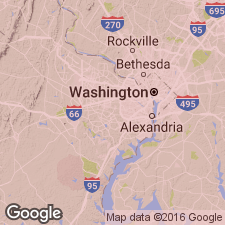
Mount Laurel is geographically extended into DE where it is present along Chesapeake and Delaware Canal for a distance of almost 2 mi at its eastern end. At St. Georges Bridge, 8.5 ft of formation is exposed above water level, full thickness probably not cut by canal. Only representative of group in immediate canal area. Unconformably overlies Marshalltown formation; unconformably overlain by Wicomico and Talbot formations (Pleistocene).
Source: GNU records (USGS DDS-6; Reston GNULEX).
- Usage in publication:
-
- Mount Laurel member
- Modifications:
-
- Revised
- AAPG geologic province:
-
- Atlantic Coast basin
Summary:
Rank reduced to member status in Matawan formation. Uppermost member of formation; overlies Wenonah member; underlies Navesink member of Monmouth formation.
Source: GNU records (USGS DDS-6; Reston GNULEX).
- Usage in publication:
-
- Mount Laurel Snad*
- Modifications:
-
- Areal extent
- AAPG geologic province:
-
- Atlantic Coast basin
Summary:
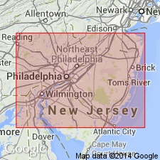
In northeastern MD and northern DE of northernmost Delmarva Peninsula, the Upper Cretaceous terms Matawan and Monmouth Formation or Groups are not useful, and they should be restricted from the area in favor of other formations geographically extended from NJ. The Matawan Formation of northeastern MD (Kent and Cecil Cos.) is replaced by (ascending) Merchantville, Englishtown, and Marshalltown Formations, and the Monmouth Formation is replaced by the Mount Laurel Sand.
Source: GNU records (USGS DDS-6; Reston GNULEX).
- Usage in publication:
-
- Mount Laurel Sand*
- Modifications:
-
- Revised
- AAPG geologic province:
-
- Atlantic Coast basin
Summary:
Mount Laurel Sand is stratigraphically restricted in MD and DE to its lower part. Its rocks in upper part now included in Severn Formation (here reinstated in northeastern MD and northern DE where Monmouth no longer used). Mount Laurel Sand still remains in use as lowermost formation of Monmouth Group in NJ and PA. Age is Late Cretaceous.
Source: GNU records (USGS DDS-6; Reston GNULEX).
- Usage in publication:
-
- Mount Laurel Sand*
- Modifications:
-
- Overview
- AAPG geologic province:
-
- Atlantic Coast basin
Summary:
It was assumed by Owens and Minard (1965) that of all the units in the Monmouth Group only the Mount Laurel is present in DE and MD. In Cecil Co., where the group is considerably thicker, some higher units of the Monmouth may exist. Therefore, in this report, unit is referred to as Monmouth Group in the belief that other members may overlie the Mount Laurel Sand. Abnormal thickness in western DE and in Cecil Co., MD, and presence of the ammonite SPHENODISCUS and other fossils in a dark-gray, very silty sand may indicate that the Red Bank Sand and Navesink Formation should be extended from NJ or that these previously unrecognized beds in MD and DE should be given new names. [This manuscript was reviewed by the GNU in 1973, but was not published until 1990. Field work for this study was done in the late 1960's. The nomenclature in this report may not reflect current USGS usage.]
Source: GNU records (USGS DDS-6; Reston GNULEX).
- Usage in publication:
-
- Mount Laurel Formation
- Modifications:
-
- Overview
- AAPG geologic province:
-
- Atlantic Coast basin
Summary:
Mount Laurel Formation of the Monmouth Group is a light gray to dark brown medium to coarse quartz sand with pebbles. Locally these sands may be intercalated with dark clays or may be indurated with iron compounds. Thickness ranges from 6 m in the northeast to 21 m in the southwest. Constitutes the northern extension of the EXOGYRA CANCELLATA zone. Characterized by an extensive marine invertebrate fauna, especially BELEMNITELLA AMERICANA (Morton). Similar lithologically and faunally to the overlying Navesink Formation but in DE has yielded a unique fauna. Unit extends from Monmouth Co., NJ, to the eastern shore of Chesapeake Bay in MD. Exposed along Rte 34 in Holmdel, and in streambanks along Hop Brook, Big Brook, and Crosswicks Creek, Monmouth Co.; at Irish Hill, Camden Co.; along the banks of Chestnut Branch in Sewell, and at Mullica Hill, Gloucester Co. Overlies the Wenonah Formation of the Matawan Group. Downdip, the two units cannot be distinguished. Age is late Campanian according to some authors, and early Maastrichtian according to others.
Source: GNU records (USGS DDS-6; Reston GNULEX).
- Usage in publication:
-
- Mount Laurel Sand*
- Modifications:
-
- Biostratigraphic dating
- AAPG geologic province:
-
- Atlantic Coast basin
Summary:
Mount Laurel Sand is shown as Late Cretaceous (early and middle Maastrichtian) on fig. 1. Early and middle Maastrichtian age based on CRASSATELLA VADOSA collected in Burlington Co., central NJ.
Source: GNU records (USGS DDS-6; Reston GNULEX).
- Usage in publication:
-
- Mount Laurel Formation
- Modifications:
-
- Overview
- AAPG geologic province:
-
- Atlantic Coast basin
Summary:
Two formations of Upper Cretaceous Monmouth Group occur in Ken-Bf 180: the Mount Laurel Formation and the Severn Formation. The Mount Laurel occupies the interval from 295 ft to 217.9 ft, while the Severn ranges from 217.9 to 204.2 ft. In Kent Co. the Mount Laurel ranges in thickness from about 25 ft to 80 ft, but unit is absent at Annapolis. Biostratigraphic information from the core suggests that the Mount Laurel is Maastrichtian. Ostracode species recovered within the Severn at 210 ft range from late Campanian to Maastrichtian. Maastrichtian foraminiferal and palynomorph species are found at 214 ft. The Mount Laurel gradationally overlies the undivided Matawan Group and the Severn underlies the Hornerstown Formation.
Source: GNU records (USGS DDS-6; Reston GNULEX).
- Usage in publication:
-
- Mount Laurel Sand*
- Modifications:
-
- Age modified
- Biostratigraphic dating
- AAPG geologic province:
-
- Atlantic Coast basin
Summary:
Ammonites from the Mount Laurel Sand of DE suggests that the age of the formation is late Campanian. Authors note that this age assignment is in conflict with age assignments based on microfossils (Maastrichtian) but only reflects the difference in placement of the Campanian-Maastrichtian boundary.
Source: GNU records (USGS DDS-6; Reston GNULEX).
- Usage in publication:
-
- Mount Laurel Sand*
- Modifications:
-
- Age modified
- Biostratigraphic dating
- AAPG geologic province:
-
- Atlantic Coast basin
Summary:
Mount Laurel Sand is latest late Campanian based on calcareous nannofossils. Contains REINHARDTITES LEVIS, whose first appearance datum (FAD) defines base of Perch-Nielsen's (1985) Zone CC 22c, and REINHARDTITES ANTHOPHORUS, whose last appearance datum (LAD) defines top of Zone CC 22c. LAD of R. ANTHOPHORUS is considered to represent very top of Campanian Stage and is used by calcareous nannofossil workers to represent Campanian-Maastrichtian boundary; however, that boundary is currently in dispute and placement varies depending on micro- or macrofossil biostratigraphy used.
Source: GNU records (USGS DDS-6; Reston GNULEX).
- Usage in publication:
-
- Mount Laurel Formation
- Modifications:
-
- Overview
- AAPG geologic province:
-
- Atlantic Coast basin
Summary:
Uppermost Campanian unconformity-bounded sequence in the NJ coastal plain, informally termed the Marshalltown sequence in this report, includes the Marshalltown, Wenonah, and Mount Laurel Formations and ranges in age from 74.1 to 69.9 Ma based on Sr-isotope age estimates. Sequence boundaries of the Marshalltown match boundaries elsewhere in the Atlantic Coastal Plain and the inferred global sea-level record of Haq and others (1987). Eustatic changes determined to be the mechanism controlling deposition of this sequence. The Marshalltown Formation is a fine-grained, silty, quartzose, glauconite sand deposited in middle- to outer-shelf environments (30-200 m). The Wenonah and Mount Laurel Formations vary greatly in lithology and thickness. Finer grained Wenonah dominates the sequence in northern NJ, while the coarse, massive quartz sand of the Mount Laurel dominates in the south.
Source: GNU records (USGS DDS-6; Reston GNULEX).
- Usage in publication:
-
- Mount Laurel Formation*
- Modifications:
-
- Overview
- AAPG geologic province:
-
- Atlantic Coast basin
Summary:
The Mount Laurel Formation in New Jersey consists of medium-gray weathering, stained orange-brown, mostly medium-grained, loose, glauconite-quartz sand with interbedded thin clay beds. Thickness averages 10 meters. Contact with underlying Wenonah Formation is gradational over 1.5 meters and is accompanied by an increase in clay, silt, and mica. Underlies the Navesink Formation. The Mount Laurel is of Late Cretaceous (late Campanian) age.
Source: GNU records (USGS DDS-6; Reston GNULEX).
For more information, please contact Nancy Stamm, Geologic Names Committee Secretary.
Asterisk (*) indicates published by U.S. Geological Survey authors.
"No current usage" (†) implies that a name has been abandoned or has fallen into disuse. Former usage and, if known, replacement name given in parentheses ( ).
Slash (/) indicates name conflicts with nomenclatural guidelines (CSN, 1933; ACSN, 1961, 1970; NACSN, 1983, 2005, 2021). May be explained within brackets ([ ]).