- Usage in publication:
-
- Mt. Evans quartz monzonite batholith
- Modifications:
-
- First used
- Dominant lithology:
-
- Quartz monzonite
- AAPG geologic province:
-
- Southern Rocky Mountain region
Summary:
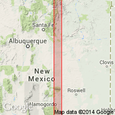
First published use as Mt. Evans quartz monzonite and as Mt. Evans quartz monzonite batholith. The locality Mt. Evans lies in Clear Creek Co, CO in the Southern Rocky Mountain region. Intent to name and designation of a type not stated. Is coarsely crystalline. A long tongue of Indian Creek granite (new) was intruded between the roof schist (Idaho Springs formation) and Mt. Evans quartz monzonite. Mapped on west side of geologic map where it is in contact with Idaho Springs formation on the north, Yankee Creek pluton of the Indian Creek granite (new) on the central- and northeast, and the Pikes Peak granite on the southeast and in the central part of the map.
Source: GNU records (USGS DDS-6; Denver GNULEX).

- Usage in publication:
-
- Mount Evans Granodiorite
- Modifications:
-
- Overview
- AAPG geologic province:
-
- Southern Rocky Mountain region
Summary:
Also known as Mount Evans Quartz Monzonite and Mount Evans Gneiss. Name abandoned by Boos (1954) in favor of Boulder Creek Granite, but some recent use (Gobel and Hutchinson, 1971; Puffer, 1972). Known in central Front Range, CO in the Southern Rocky Mountain region. Listed with granitic rocks of circa 1,700 m.y. age (Precambrian X) age group.
Source: GNU records (USGS DDS-6; Denver GNULEX).

- Usage in publication:
-
- Mount Evans batholith*
- Modifications:
-
- Age modified
- Geochronologic dating
- Overview
- AAPG geologic province:
-
- Southern Rocky Mountain region
Summary:
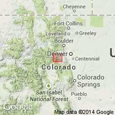
New U-Pb zircon ages on four samples yield dates of 1442 +/-2 Ma putting batholith in Berthoud Plutonic Suite rather than in Routt Plutonic Suite as previously thought. Batholith is exposed over an area of about 225 sq km in Front Range west-southwest of Denver, CO, Southern Rocky Mountain region. Mount Evans is composed primarily of weakly to strongly foliated coarse-grained monzogranite and granodiorite, as well as several small plutons of weakly foliated monzogranite called granite of Rosalie Peak.
Source: GNU records (USGS DDS-6; Denver GNULEX).
For more information, please contact Nancy Stamm, Geologic Names Committee Secretary.
Asterisk (*) indicates published by U.S. Geological Survey authors.
"No current usage" (†) implies that a name has been abandoned or has fallen into disuse. Former usage and, if known, replacement name given in parentheses ( ).
Slash (/) indicates name conflicts with nomenclatural guidelines (CSN, 1933; ACSN, 1961, 1970; NACSN, 1983, 2005, 2021). May be explained within brackets ([ ]).

