

- Usage in publication:
-
- Mount Dutton Formation*
- Modifications:
-
- Named
- Dominant lithology:
-
- Lava
- Breccia
- Tuff
- Sandstone
- AAPG geologic province:
-
- Paradox basin
- Great Basin province
- Wasatch uplift
Summary:
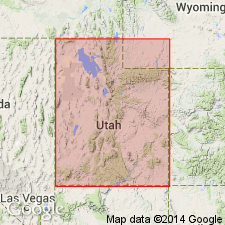
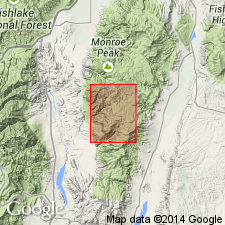
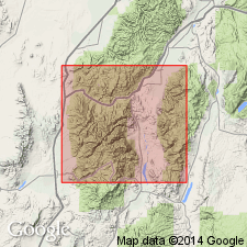
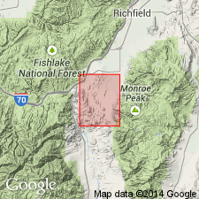
Named. Is 1,000 m thick at type section at Mount Dutton, NE1/4 NE1/4 sec 9 to center sec 15, T32S, R4W, Garfield Co, UT, Paradox basin. Reference section in SW1/4 SE1/4 sec 31, T29S, R3W to NE1/4 NE1/4 sec 1, T30S, R4W, Piute Co, UT, Wasatch uplift. Exposed in southern Tushar Mountains, Wasatch uplift; southern Sevier Plateau, Paradox basin; northern Markagunt Plateau and Black Mountains, Great Basin province. Locally base not exposed; rests on Baldhills Tuff Member (new) of Isom Formation or on Needles Range Formation on Sevier Plateau. Locally overlain by Horse Valley Formation (new) or by Dry Hollow Formation (restricted). Correlation chart; fence diagram; measured sections. Includes most rocks on south flank Marysvale volcanic pile--lava flows and autoclastic flow breccia in center, mudflow breccia on flanks of pile. Vent facies exposed only in Tushars is thick lava flows, flow breccia, volcanic mudflow breccia and tuff. Alluvial facies lying radially outward from vent facies is moderately indurated tan and gray volcanic mudflow breccia and scattered dacitic, doreitic, and andesitic lava flows, flow breccia, fluvial and windblown sandstone, tuff, and near distal edges conglomerate. Locally includes Beaver (new), Kingston Canyon, Antimony Tuff Members. Pinches out rapidly away from pile. Assigned late Oligocene and early Miocene age; flows in lower part 26.0 +/-0.8 m.y. date; dike in vent facies in upper part 22.9 +/-0.4 m.y.
Source: GNU records (USGS DDS-6; Denver GNULEX).
- Usage in publication:
-
- Mount Dutton Formation*
- Modifications:
-
- Age modified
- AAPG geologic province:
-
- Wasatch uplift
Summary:
Age of Antimony and Kingston Canyon Tuff Members, the only members of the Mount Dutton Formation mapped in this quad, changed from Miocene to Oligocene. Age modification based not on new information but on use of 24 m.y. as the Miocene-Oligocene boundary. The Kingston Canyon has a K-Ar age of 26-25 m.y. The map area is on the Wasatch uplift.
Source: GNU records (USGS DDS-6; Denver GNULEX).
- Usage in publication:
-
- Mount Dutton Formation*
- Modifications:
-
- Geochronologic dating
- AAPG geologic province:
-
- Wasatch uplift
Summary:
Antimony Tuff Member of Mount Dutton has a K-Ar age of 25.4 m.y. on the Wasatch uplift.
Source: GNU records (USGS DDS-6; Denver GNULEX).
- Usage in publication:
-
- Mount Dutton Formation*
- Modifications:
-
- Geochronologic dating
- AAPG geologic province:
-
- Wasatch uplift
Summary:
Antimony Tuff Member has a K-Ar age of 25.4 m.y., or Oligocene, on the Wasatch uplift.
Source: GNU records (USGS DDS-6; Denver GNULEX).
- Usage in publication:
-
- Mount Dutton Formation*
- Modifications:
-
- Mapped 1:24k
- Dominant lithology:
-
- Breccia
- Flows
- AAPG geologic province:
-
- Great Basin province
Summary:
Mapped in Iron Co, southwest UT, Great Basin province. Consists of moderately resistant volcanic mudflow breccia with angular to subrounded pebble- to cobble-size clasts, mostly of intermediate-composition volcanic rocks and lesser amounts of tuffaceous sandstone in a pale-red, light-gray, and dusky-brown matrix. Intermediate-composition aphanitic to porphyritic lava flow with phenocrysts of plagioclase, hornblende, and pyroxene is locally present. Lower part is age equivalent to upper part of Bear Valley Formation; younger than Leach Canyon Formation; is youngest Tertiary unit in study area. Exposed incomplete thickness is about 90 m. Exposed in northwest part of map area. [Mount Dutton is also mapped in adjacent quad to west (Parowan Gap, USGS GQ-1712).] Assigned age is Oligocene and Miocene based on K-Ar date of about 26-21 Ma (Anderson and Rowley, 1975).
Source: GNU records (USGS DDS-6; Denver GNULEX).
For more information, please contact Nancy Stamm, Geologic Names Committee Secretary.
Asterisk (*) indicates published by U.S. Geological Survey authors.
"No current usage" (†) implies that a name has been abandoned or has fallen into disuse. Former usage and, if known, replacement name given in parentheses ( ).
Slash (/) indicates name conflicts with nomenclatural guidelines (CSN, 1933; ACSN, 1961, 1970; NACSN, 1983, 2005, 2021). May be explained within brackets ([ ]).